


After a two-month drought from Severe Thunderstorm Warnings, some parts of the state had large hail on Friday. Now, another threat for severe weather is forecast to start our work week.
Be prepared for some strong thunderstorms moving from west to east across the state this afternoon and evening.
There is a level 1 to level 2 (out of 5) risk for severe weather across the state.
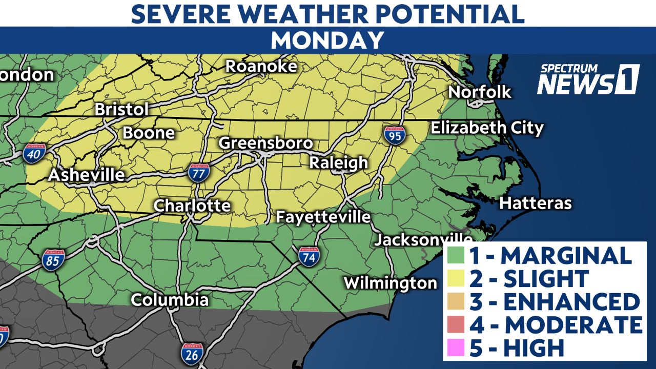
The greatest threat from the storms will be damaging straight-line wind gusts that could bring down a few trees and cause spotty power outages.
However, we cannot rule out a low risk for a brief tornado.

Everyone should have a way to receive weather alerts as the storms move across the state.
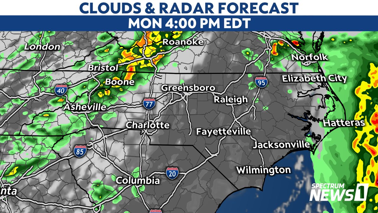
The day is starting with rain near the coast from an area of low pressure offshore. The severe weather threat will come later in the day as a cold front tracks across the state.
The storms should move across the mountains and foothills between 3 and 6 p.m.
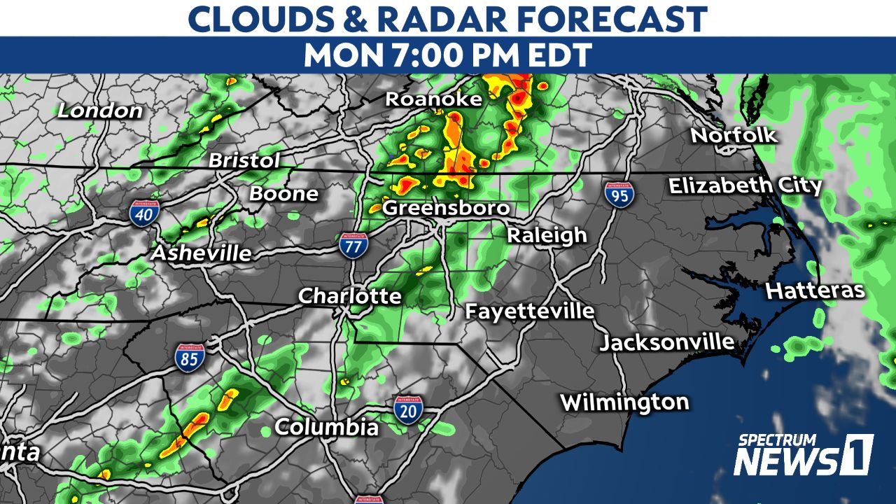
The Piedmont, including locations near Charlotte and the Triad, will need to be on guard for the storms between 5 and 9 p.m.
For the Triangle and Sandhills, the storm threat will be highest between 6 and 11 p.m.
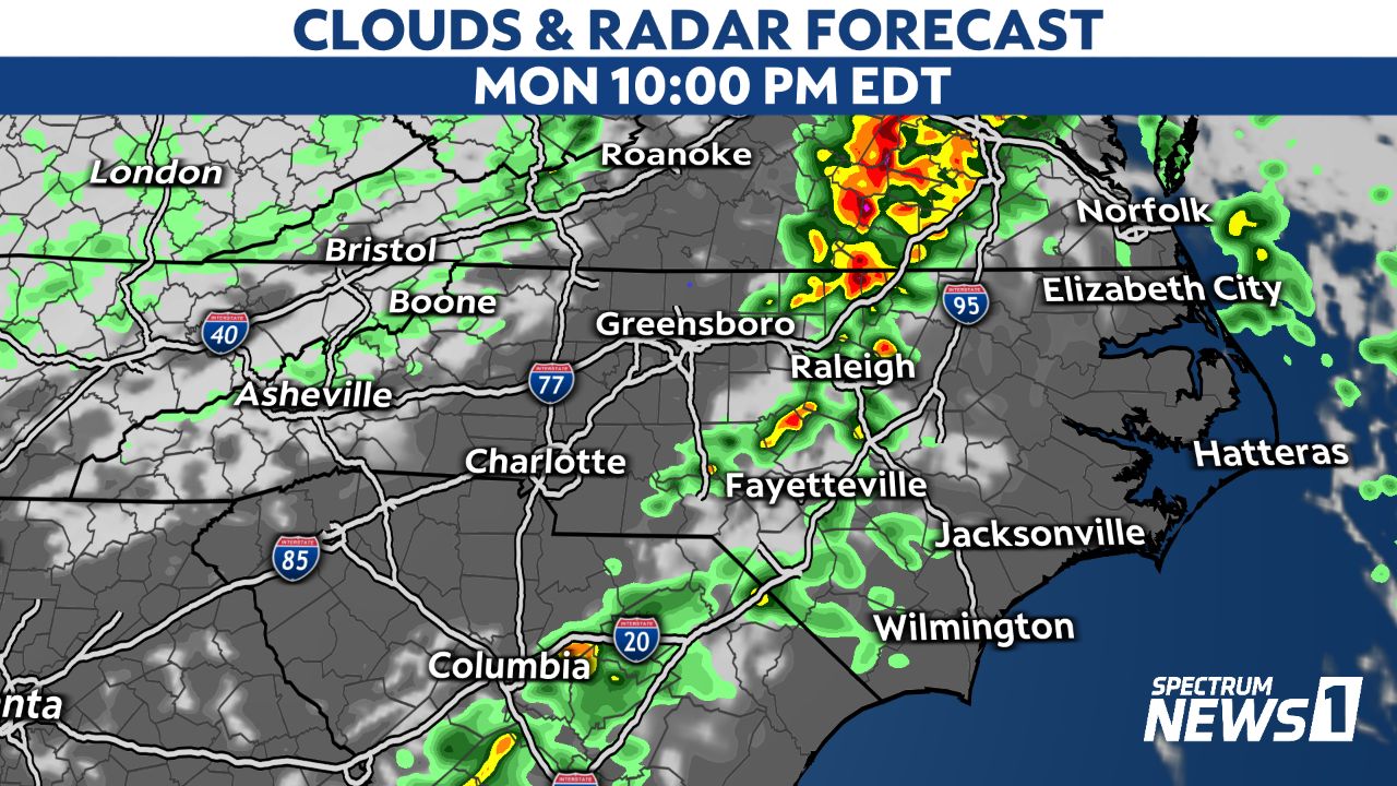
Many of the storms may break up and weaken by midnight, but a few overnight storms cannot be ruled out closer to the coast.

Stay with Spectrum News 1 and the Spectrum News app for updates.