Most of the state has experienced record dry and hot conditions this summer, but the three-month climate outlook shows a potential change for some by the fall.
For most of the Lone Star State, the hottest part of the summer is here, and it's been one for the record book. Will it be welcomed pattern change as fall arrives in September? According to the Climate Prediction Center (CPC), the answer is yes and no.
The three-month temperature and precipitation outlooks for August, September and October show continued warmer-than-average temperatures likely for a majority of the state, but there’s a change in potential precipitation.
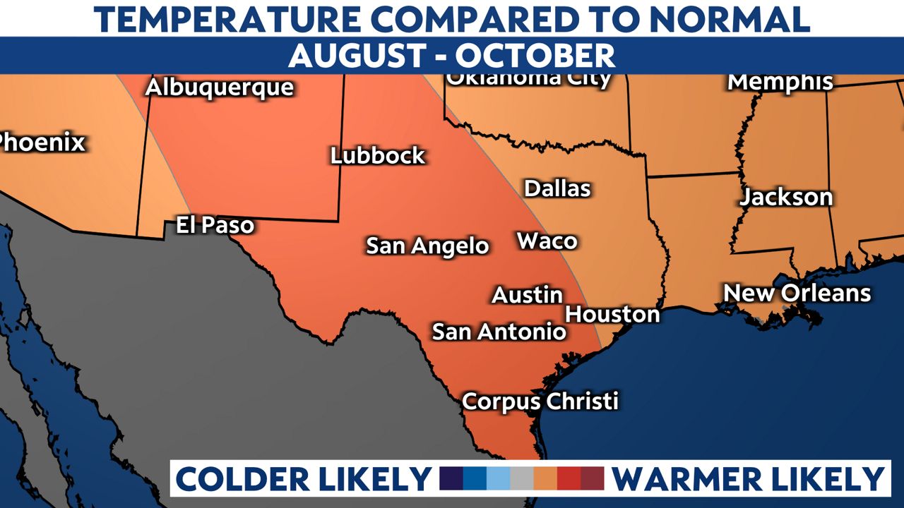
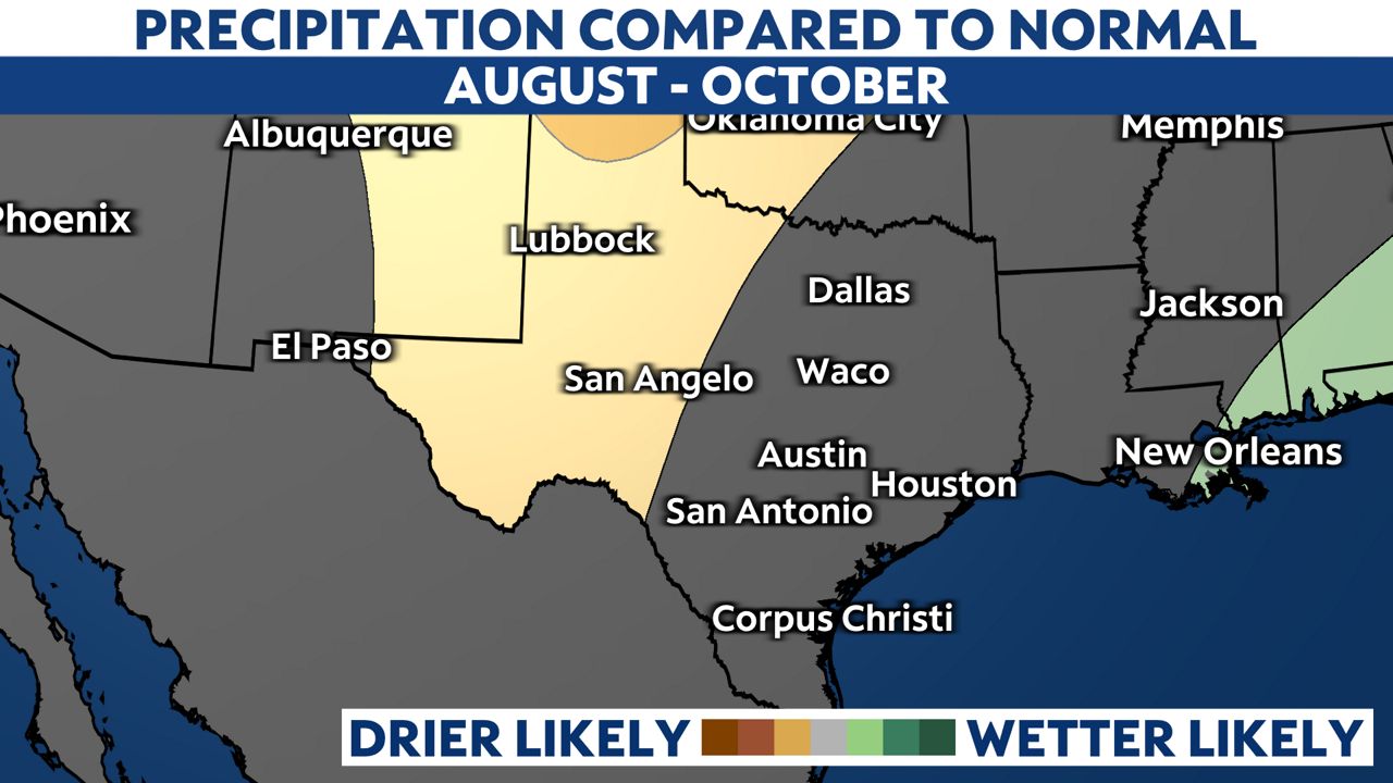
Notice the lack of color for most of Texas, including I-35 to the coast. This shows equal chances, or near seasonal accumulated precipitation amounts, are expected. Why could this part of the state find near-normal rainfall into October?
It’s a tropical connection. We are approaching the peak of the Atlantic Hurricane Season, which is on September 10. September is the single most active month of the season.
The monsoon pattern continues through the end of September in El Paso, so this part of West Texas is also likely to find equal chances near-normal precipitation.
So overall, the weather pattern is shifting for parts of the state as we head into fall. There will probably be a continued influence from the Gulf of Mexico, keeping a better chance for measurable and needed rainfall closer to the coast. So unfortunately, this is not good news for all.
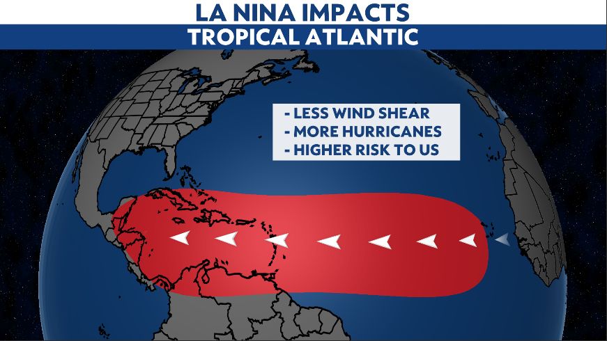
Another note to make. La Niña is expected to continue through the fall and winter. This could play a part in the Atlantic hurricane season, which runs through November.
Typically, La Niña can suppress tropical activity in the central and eastern Pacific, but enhances it in the Atlantic basin. This means there could be an connection between potential tropical development and rainfall along the Texas coast. .
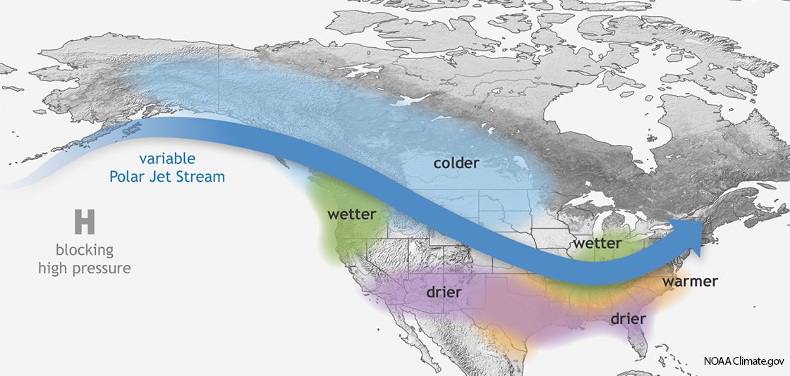
Another link to our fall to winter weather pattern and La Niña, aside from the potential tropical development, is that the drought will likely continue to worsen. During a La Niña winter, Texas usually experiences warmer and drier-than-average conditions.
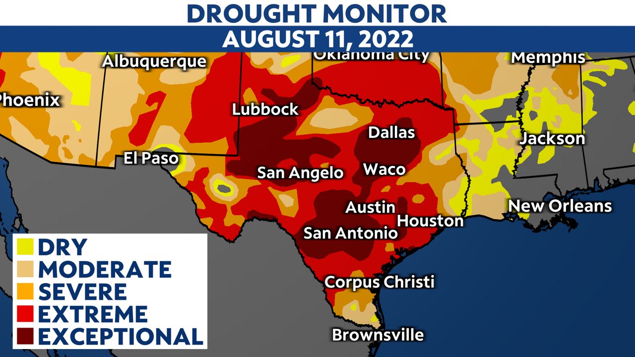
The latest U.S. Drought Monitor shows 96% of Texas under drought conditions. The worst drought conditions, extreme and exceptional, are continuing to expand.
 Our team of meteorologists dive deep into the science of weather and break down timely weather data and information. To view more weather and climate stories, check out our weather blogs section.


