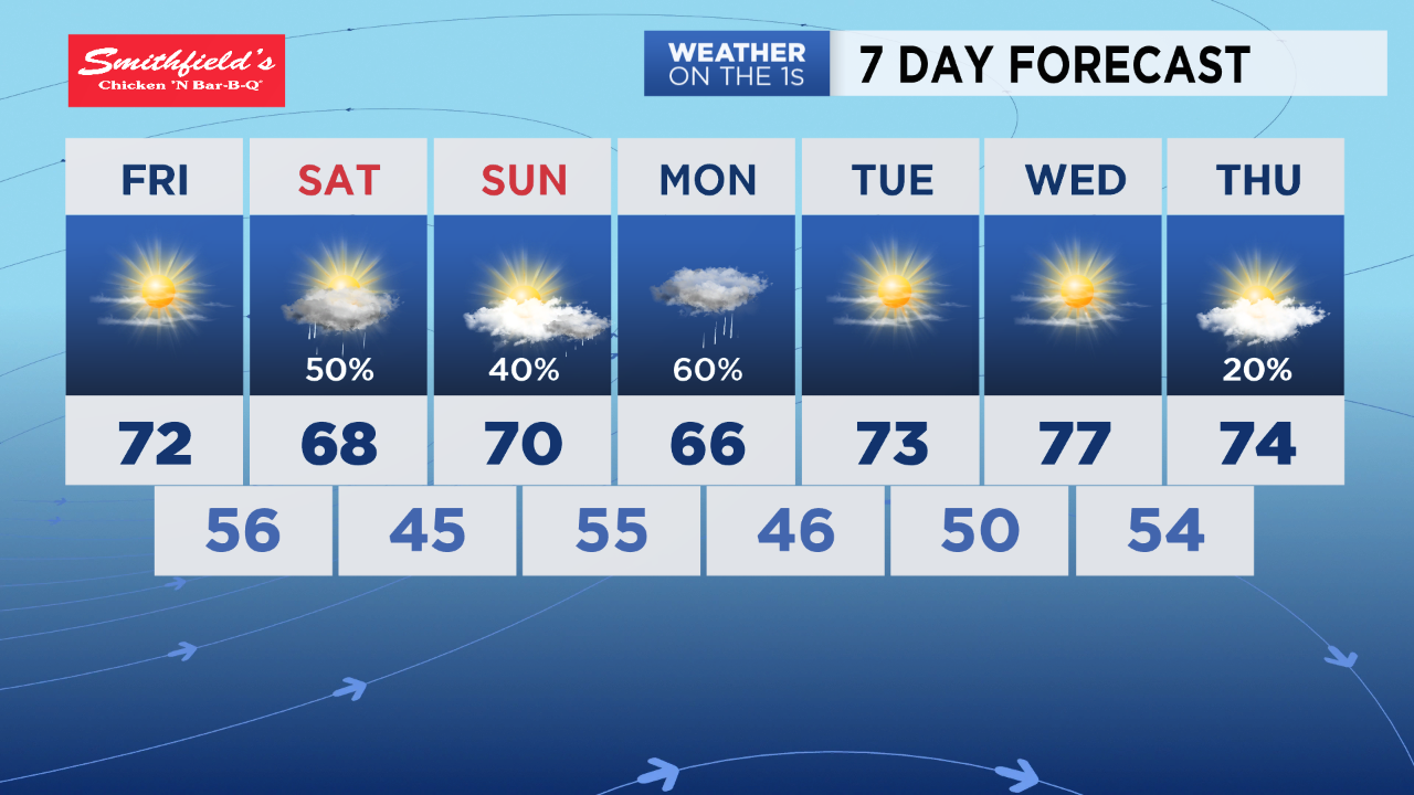
After a cold start in the 30s with patchy frost Thursday morning, a full day of sunshine will warm our highs to the mid 60s for the afternoon.
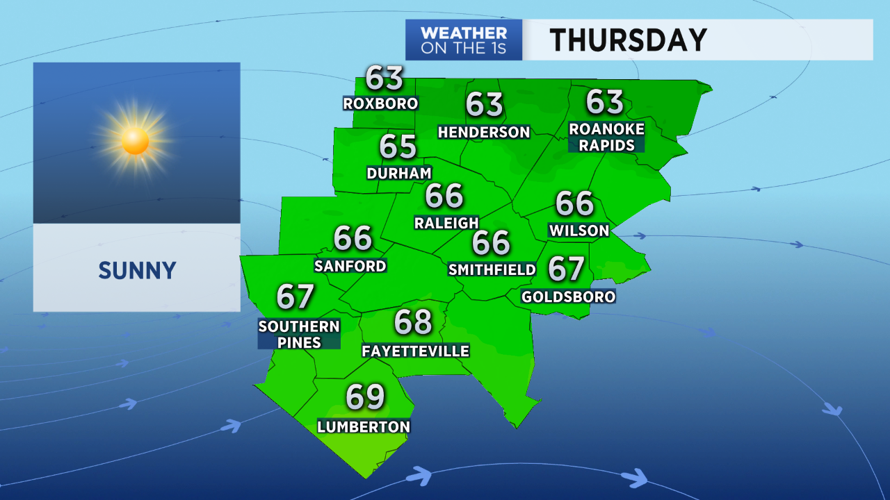
That's still a little below average for the middle of April, but not as cool as Wednesday afternoon when most of central North Carolina was in the 50s. Normal, or average highs, for this time of the year are in the low 70s.
- Nine Years Since Largest Tornado Outbreak in NC
- 12 Tornadoes Touch Down in North Carolina Monday
- Project Weather: Answering Your Weather Questions
Another chilly night is on the way. Lows will drop to the upper 30s and low 40s by sunrise Friday.
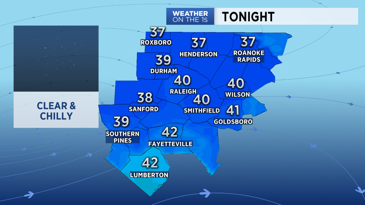
Patchy frost could develop again Friday morning especially for outlying locations on the north and west side of the Triangle.
Afternoon temperatures will return to near normal with mostly sunny conditions Friday.
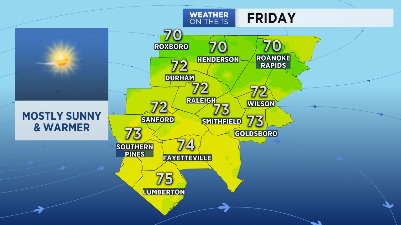
Dry weather is forecast through Friday night. Our next chance of rain should arrive Saturday morning when scattered showers and a few storms will be possible.
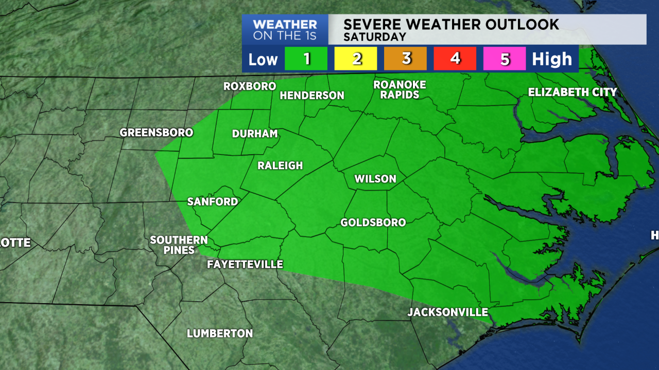
The threat for any severe weather Saturday appears low at this time. However, the Storm Prediction Center has placed parts of central and eastern North Carolina under a level 1 risk for a storm that could produce damaging wind gusts.
Saturday's scattered showers and storms should come to an end by mid to late afternoon. Up to a quarter of inch of rain is expected.
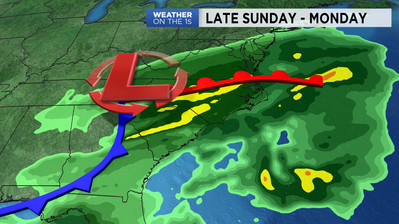
Heavier rain now appears likely at the end of the weekend into early next week. Another storm system will bring the chance for more widespread rain and possibly storms from late Sunday through Monday. Early forecast data suggest an inch or two of rain will be possible during that time.
Follow Meteorologist Lee Ringer on Facebook, Twitter, and Instagram.