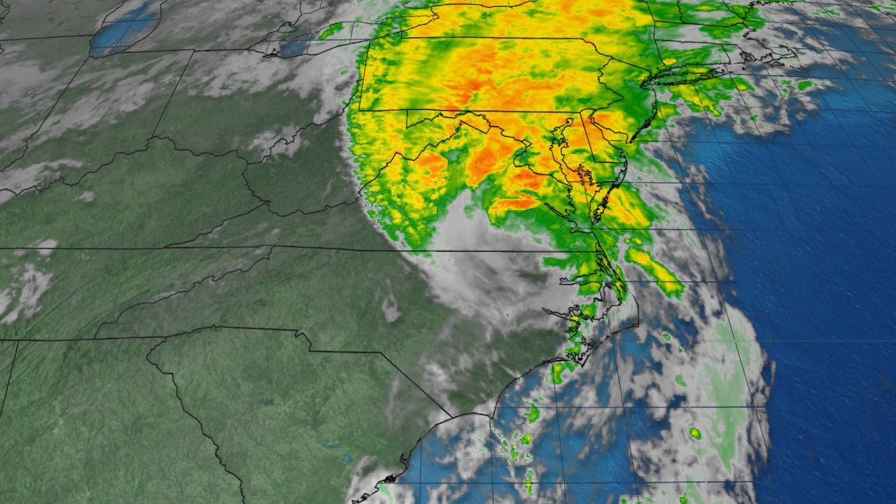
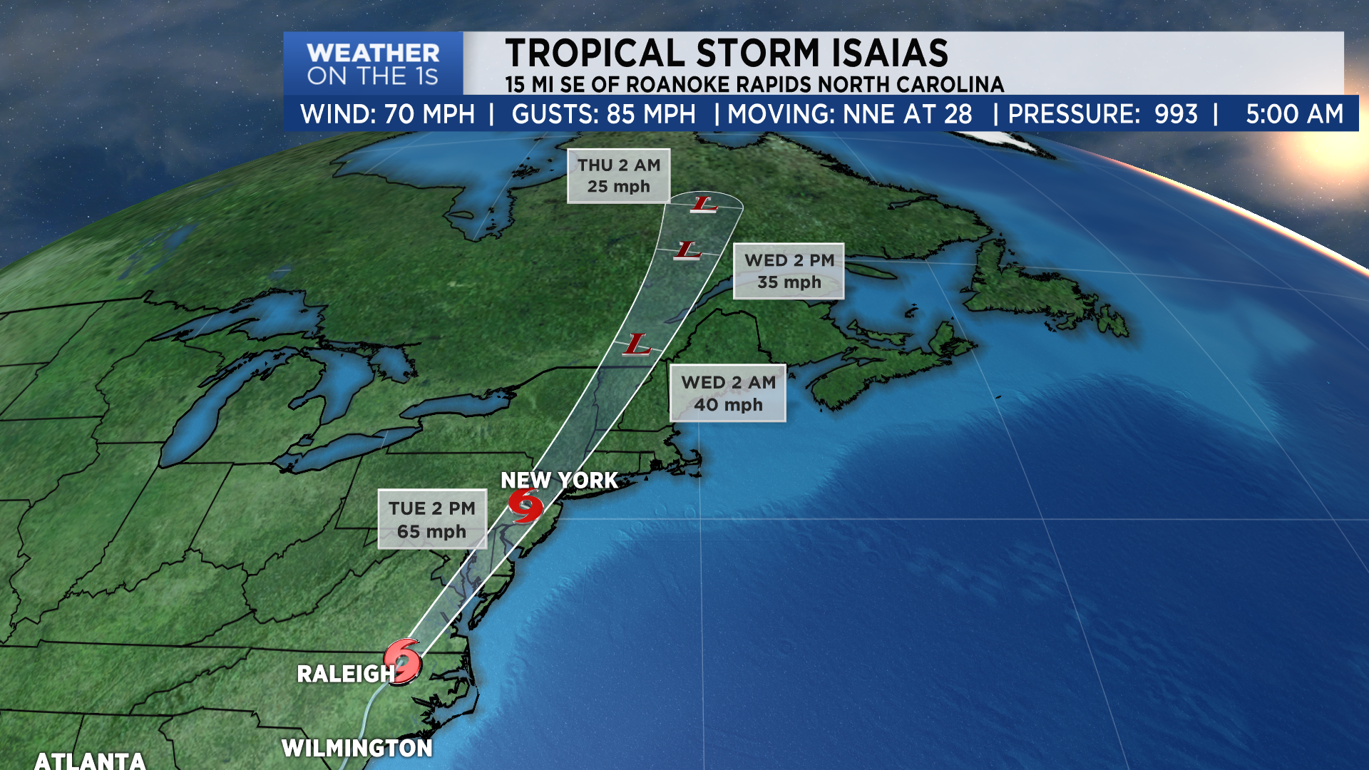
NORTH CAROLINA – Packing 85 mph winds, Isaias made landfall near Ocean Isle Beach at 11:10 p.m. Monday evening and is moving through the state.
Isaias quickly weakened to a tropical storm as it accelerated northward across eastern North Carolina. At least two tornadoes were spawned by the storm, one in Bald Head Island and one near Windsor.
A peak wind gust of 87 mph was reported at Bald Head Island just before landfall. Lockwoods Folly Inlet reported a peak gust of 77 mph and Wilmington 74mph.
Although the rain will quickly depart the state the flooding threat will continue into the next few days for rivers across the region.
The flooding won't be as bad as some of the previous storms that has hit North Carolina due to the speed of the storm limiting its time over the region.
Some sunshine can be expected Tuesday afternoon as clean begins and typical summer weather is in the forecast for the rest of the week and into the weekend.
Stay tuned to Weather on the 1s on Spectrum News 1 for the latest on the storm.
Did you know you can now watch, read and stay informed with Spectrum News 1 wherever and whenever you want? Get the new Spectrum News app here.