After a multi-year hiatus from winter seasonal forecasting, I am dipping my toe back in the water this year. Seasonal and long-lead forecasting is still very much a developing area within the field of meteorology, and that can create some big swings and misses in these types of forecasts at times. But there is some degree of skill in these forecasts, and it gets better each year.
What You Need To Know
- A La Niña should hold through this winter
- We have been in a La Niña for many months now
- The winters of 2011-2012 and 1999-2000 are reference points for this winter
Around the Carolinas, seasonal snowfall forecasting is especially tricky, largely because a single snowstorm can make many cities reach or exceed their average yearly snowfall totals.
With specific winter storms, the devil is always in the details. Those details mean the difference between a big snow event and a marginal mixed bag of sloppy precipitation. Those details are something you can't even attempt to nail down until you see the whites of an event's eyes, much less on the scale of a season.
On a broader scale, a lot of what gives us a perspective on whether a specific time period (normally a couple of weeks) is overall either conducive or not for winter weather threats are called teleconnections. That is the topic of another blog, but oftentimes, forecasting those teleconnections more than a few weeks in advance is a fool's errand.
One other major weather factor that drives our winter weather chances is the Madden-Julian Oscillation, or MJO. Some phases of the MJO are favorable to winter weather chances around here while phases are not. Again, forecasting that more than a few weeks in advance is difficult to impossible.
When we can get some of these factors turned in a favorable direction, that can lead to much better chances in what may be an overall unfavorable seasonal setup for snow fans.
And I think that will be the story this winter.
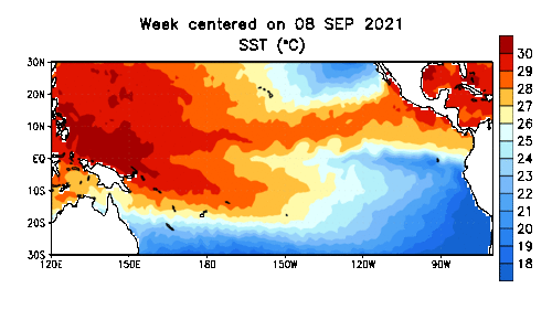
We are currently in a La Niña pattern (cooler-than-normal waters in the equatorial Pacific), and the La Niña conditions are expected to continue through the winter.
)
A couple of winter seasons I am looking at as analogs–past weather that could help in predicting the future–are the winters of 2011-2012 and 1999-2000. Both of those winters occurred during a La Niña, and importantly for this forecast, in a La Niña that had been occurring for at least a year. That is the general backdrop for this winter as well.
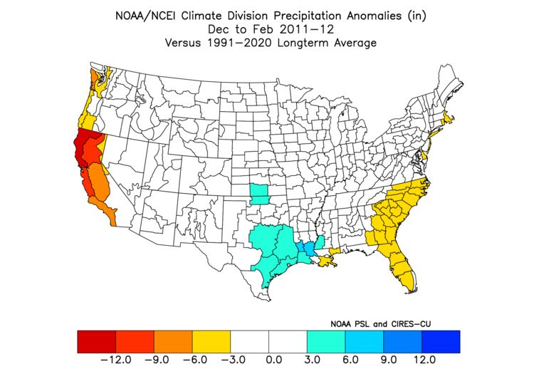
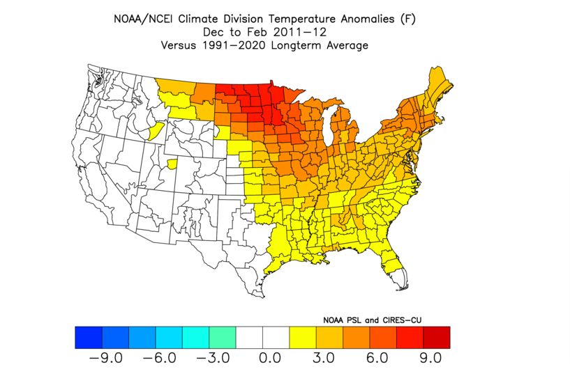
Let's look at the winter of 2011-2012. Below are the precipitation and temperature deviations from normal for December, January and February. Swipe through to see each image.
Below are the anomalies for the December through February period combined.
Next, we have the combined December-February anomalies for 1999-2000.
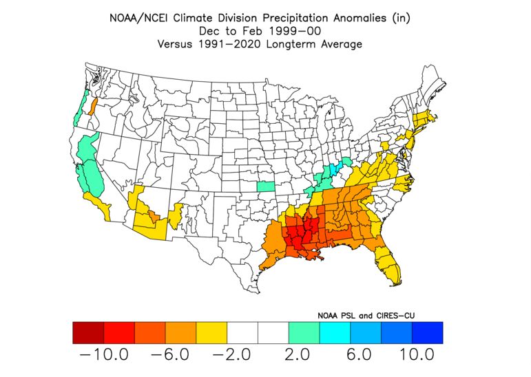
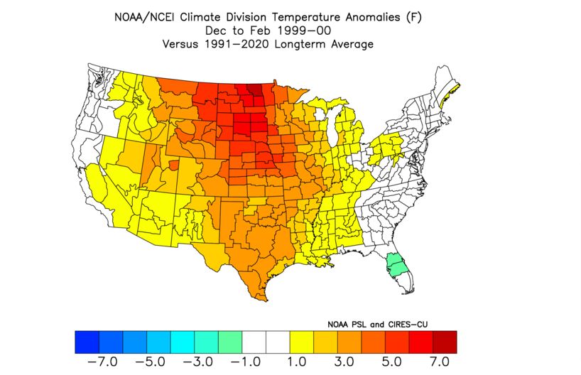
In Charlotte, for example, the winter of 1999-2000 had a snow total of 9.2 inches. This all occurred in the month of January in what is fondly remembered by snow fans as the Carolina Crusher snowstorm. Raleigh received 24 inches, while Wilmington collected 5 inches. It was an amazing system, indeed.
Asheville received 6.4 inches for the winter of 1999-2000... with 6.2 inches of that coming in January.
The 2011-2012 winter was a dagger to snow fans. Charlotte only received a trace of snow for the winter. Amazingly, Asheville also only received a trace for the winter.
For the Carolinas, I favor the idea of above-average temperatures for the December-February period as a whole. That does not mean there won't be cold and below-average intervals. There almost undoubtedly will. But looking at the winter as a whole, I anticipate above-average temperatures.
I will also go with the idea of below-average snowfall. Again, that doesn't mean we won't have wintry precipitation chances. And with the average snowfall in Charlotte sitting at 5 inches, it only takes one good event to exceed that (see January 2000), and that is certainly possible. But with these types of seasonal forecasts, you play the odds, and that that's the way I see the odds playing out at the moment.
As is the case in most winters, even "bad" ones, at least a couple of periods (one or two weeks each) usually happen when the overall weather pattern turns more favorable for wintry precipitation chances with the major weather players appearing on the field. This winter, snow fans in the Carolinas will need to hope for those players to come together at the right time, as chances might be limited for the winter as a whole.