


NORTH CAROLINA -- Isaias’s forecast path shows the storm making landfall somewhere near the North Carolina-South Carolina border Monday tracking across central North Carolina overnight, bringing inches of rain and the potential for tornadoes and flash flooding.
Officials in North Carolina issued evacuation orders for some areas along the coast. The state is also getting the National Guard ready to help out with the storm and moving swift water rescue crews into place in case of any severe flooding.
North Carolina Emergency Managment said people in central and eastern parts of the state should expect heavy rains and flash flooding Monday evening through Tuesday.
President Donald Trump approved the North Carolina's request for a disaster disclaration over the week, freeing up money from the Federal Emergency Managaement Agency to help respond to the storm. During a press conference Sunday, Gov. Roy Cooper said FEMA representatives were already working in the state emegency opertations center to help prepare for Isaias.
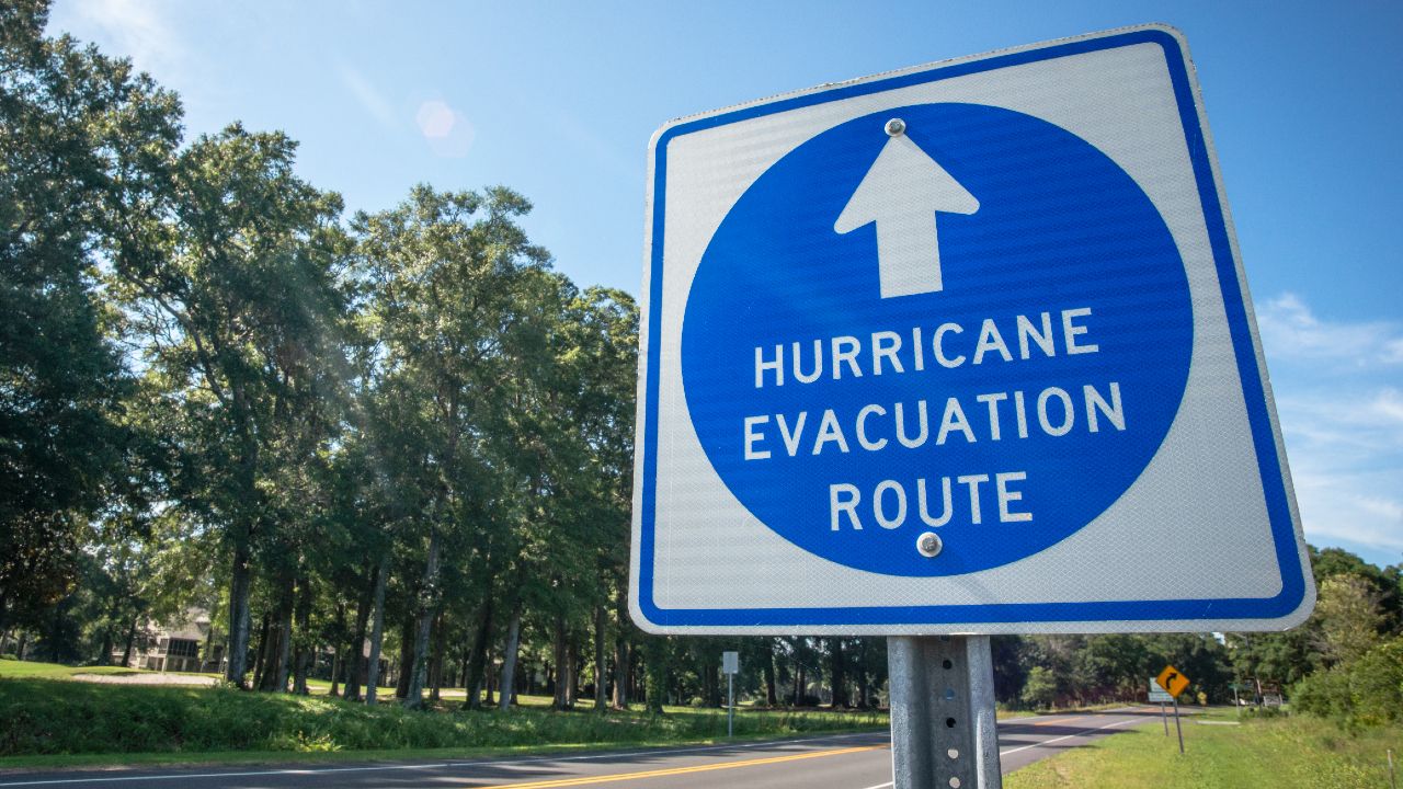
Evacuations
Several beach communities ordered evacuations from North Carolina’s barrier islands.
Brunswick County, in the southeastern corner of the state, ordered tourists to leave Holden Beach and Ocean Isle Beach. Officials also issued voluntary evacuations for visitors in Caswell Beach and Oak Island.
Dare County issued mandatory evacuation orders for residents and visitors on Hatteras Island.
Hyde County ordered residents and visitors to evacuate Ocracoke Island. The last ferry will leave Ocracoke at 10:30 a.m. Monday.
"North Carolina ferries have evacuated more than 3,300 passengers toll-free and more than 1,500 vehicles from Ocracoke Island through noon Sunday. Evacuations will continue through Monday mid-morning," the governor's office said Sunday.
Further inland, Sampson County issued a voluntary evacuation order for flood-prone Franklin Township.
Duplin County plans to open two evacuation shelters at 2 p.m. Monday. Those shelters will be at North Duplin Elementary School in Mt. Olive and James Kenan High School in Warsaw.
See details on North Carolina evacuation orders and shelter on the state's ReadyNC site.
Crowded shelters could become COVID-19 hotspots, officials have warned.
State officials say everyone seeking shelter will be screened for coronavirus symptoms, and people who are showing systems will be given options where they can isolate.
People in shelters will be required to bring their own bedding, wear face masks, and maintain physical distance from one another. Shelter staff will serve meals in sealed containers instead of using serving lines.
State Emercency Management director Mike Sprayberry said the Red Cross needs volunteers to help operate shelters. People interesting in helping out must be at least 18 years old and can sign up through the Red Cross.
Cooper declared a state of emergency ahead of Isaias Friday, and on Saturday he activated the National Guard to help with the hurricane response.
“Although the storm has been downgraded from a hurricane, Isaias still poses great threats to our state,” Cooper said Sunday. “North Carolinians should prepare for flooding, storm surge, power outages and the dangers associated with them.”
The governor said more than 1,800 state Department of Transportation workers are ready to keep the roads clear "with more than 1,500 pieces of equipment and more than 1,000 chainsaws. The department is preparing to respond to downed trees and localized flooding that may temporarily close roadways."
The heaviest rains will likely be along the Interstate 95 corridor, with three to six inches likely, and some areas could see up to seven inches. Eastern North Carolina could see one to four inches of rain, according to the National Weather Service.
Isaias could produce tornadoes, officials said. The biggest threat is along and east of the I-95 corridor.
New Hanover County officials warned that the Wilmington area could expect to see the worst impacts Monday night into Tuesday. “Right now, sustained winds are forecast around 44 mph, with wind gusts up to 58 when it arrives in our area,” officials said on Twitter Sunday.
"Residents and visitors should be in a safe location by 8 p.m. Monday," New Hanover County officials said Sunday evening. They said the county plans to declare a state of emergency starting at noon Monday.
In Dare County, emergency management officials warned that waves and storm surge could cover Highway 12 along Hatteras Island.
"As roads become covered with sand and water, it becomes difficult, sometimes impossible, for law enforcement, fire and emergency medical service personnel to respond to calls for assistance in a timely manner. In recent years, storms with forecasts similar to Isaias have caused road closures and the loss of personal property," officials warned Sunday.
"While many are disappointed that their vacation plans to Hatteras Island have been disrupted by Tropical Storm Isaias, it is important to understand that evacuation decisions are made in the interest of public health and safety," Dare County Emergency Management said.
"While there are no evacuation orders in effect for the northern beaches (Hurricane Evacuation Zone B), including the towns of Duck, Southern Shores, Kitty Hawk, Kill Devil Hills, Nags Head and Manteo, it is important for residents and visitors to closely watch updated forecasts and be prepared for impacts starting late Monday and into Tuesday," Dare County said. On the sound side of Dare County, people should prepare for flooding in low-lying areas.
In Cumberland County, residents should prepare for damaging winds and up to six inches of rain around the Fayetteville area.
“Residents should be prepared for flash flooding in the normal low-lying areas. We are anticipating street-level flooding, as well as power outages from downed trees with wind gusts in the 50 miles-per-hour range,” Cumberland County Emergency Services director Gene Booth said in a statement Sunday.