


There are signs of the current triple-dip La Niña pattern ending this spring. This could shift the weather pattern across Texas, but impacts from this pattern shift should be felt by next winter.
A La Niña pattern has been in place for the last three years (which is rare), and current signals are hinting at a shift this spring. We look at the sea surface temperatures in the central and eastern equatorial Pacific Ocean.
The current La Niña pattern means that cooler than average ocean temperatures are in the eastern equatorial Pacific. El Niño is characterized by abnormal warming of these same waters.
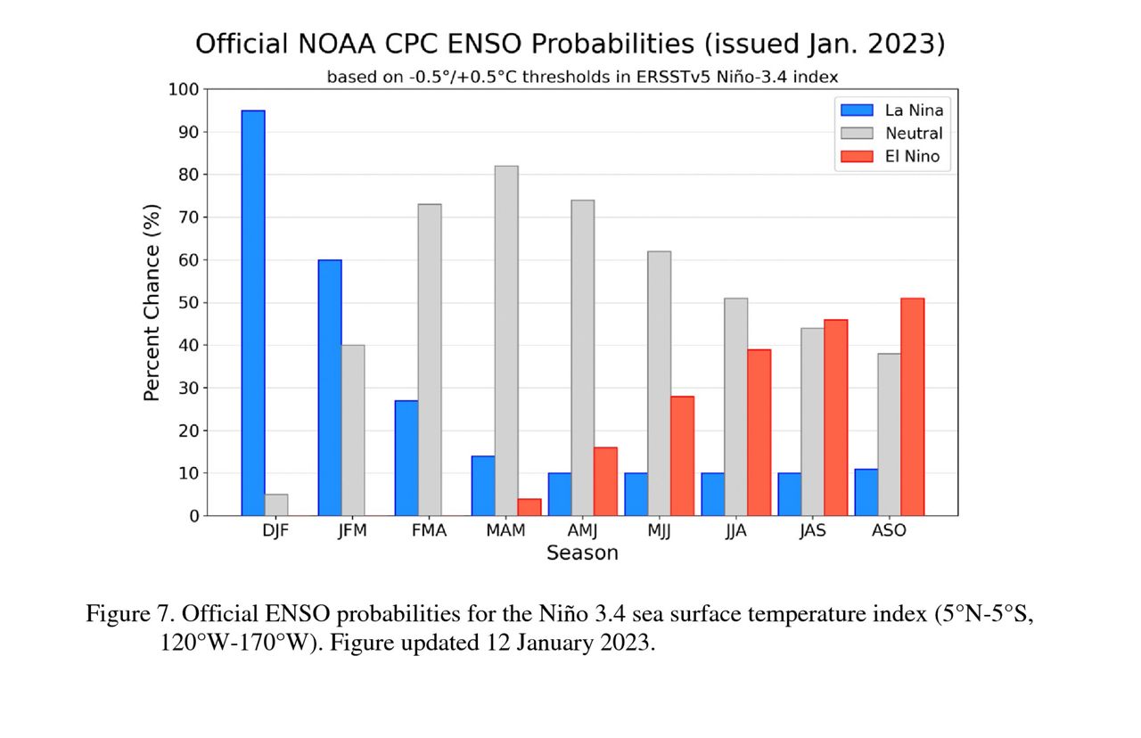
2022 ended with below-average ocean temperatures in the eastern equatorial Pacific, but signs of warming from the central to eastern Pacific may shift the current ENSO phase from La Niña to neutral this spring.
Looking even farther out, conditions may be in place for El Niño to develop by the end of the year.
A neutral state, between the cool phase (La Niña) and warm phase (El Niño), refers to normal sea surface temperatures, winds and rainfall across the eastern equatorial Pacific.
Forecasts are favoring a transition to ENSO-neutral from February to April. So there’s some slight disagreement, but signs of change are present, and there’s higher confidence that ENSO-neutral will emerge in the Northern Hemisphere spring.
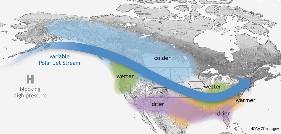
La Niña winters in Texas are typically warmer and drier than average, and this pattern usually has a larger impact overall during the winter months.
In a La Niña spring season, even with more likely drier and warmer weather, history shows a higher frequency of severe storms that produce hail and tornadoes, especially across the South.
Rich, available moisture combined with an active jet stream and a clash of air masses can lead to devastating tornado outbreaks.
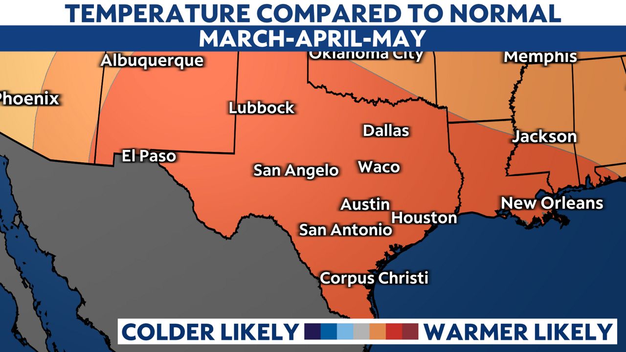
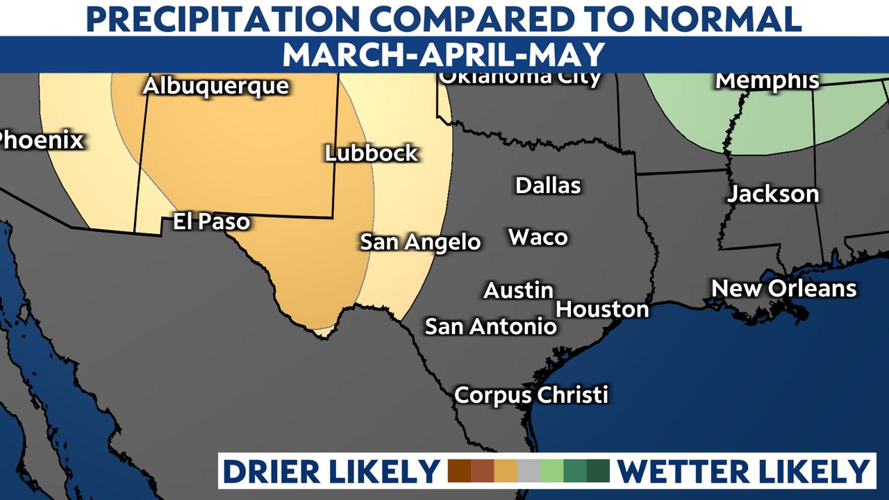
Would a shift to ENSO-neutral impact Texas weather this spring? Well according to the Climate Prediction Center (CPC), the three month outlook that includes March, April and May (meteorological spring), is hinting at above average temperatures for all the Lone Star State, but equal chances above or below average rainfall for most.
West Texas will likely experience drier than average rainfall during this time.
The impact from this pattern transition may be minimal across Texas this spring, but El Niño developing by the end of the year could be more impactful to the weather pattern next winter.
This could be good news for parts of the state still experiencing extreme to exception drought conditions. El Niño years are typically warmer than normal, but usually favor wetter and cooler than normal weather for parts of Central and South Texas. Unfortunately, history tells us that flood events also happen during El Niño.
Our team of meteorologists dives deep into the science of weather and breaks down timely weather data and information. To view more weather and climate stories, check out our weather blogs section.