For the third winter in a row, a La Niña ENSO pattern will control our weather pattern. This is extremely rare as this is the first “triple-dip” La Niña of the century according to the World Meteorological Organization and overall there is less than a 20% chance of it occurring.
So many meteorologists feel we are in uncharted territory.
To explain, the ENSO or El Niño-Southern Oscillation is an oceanic and atmospheric phenomenon that is either positive, indicating a warming of the ocean surface temperatures in the central and eastern tropical Pacific Ocean, or negative, indicating a cooling of the ocean surface temperatures sea surface temperature in that same region.
These warm sea surface temperatures of La Niña cause our equatorial easterly winds to strengthen, leading to increased or decreased precipitation and warmer or cooler regions around the world.
For us here in Texas, that means below normal precipitation and warmer conditions are possible from December through February.
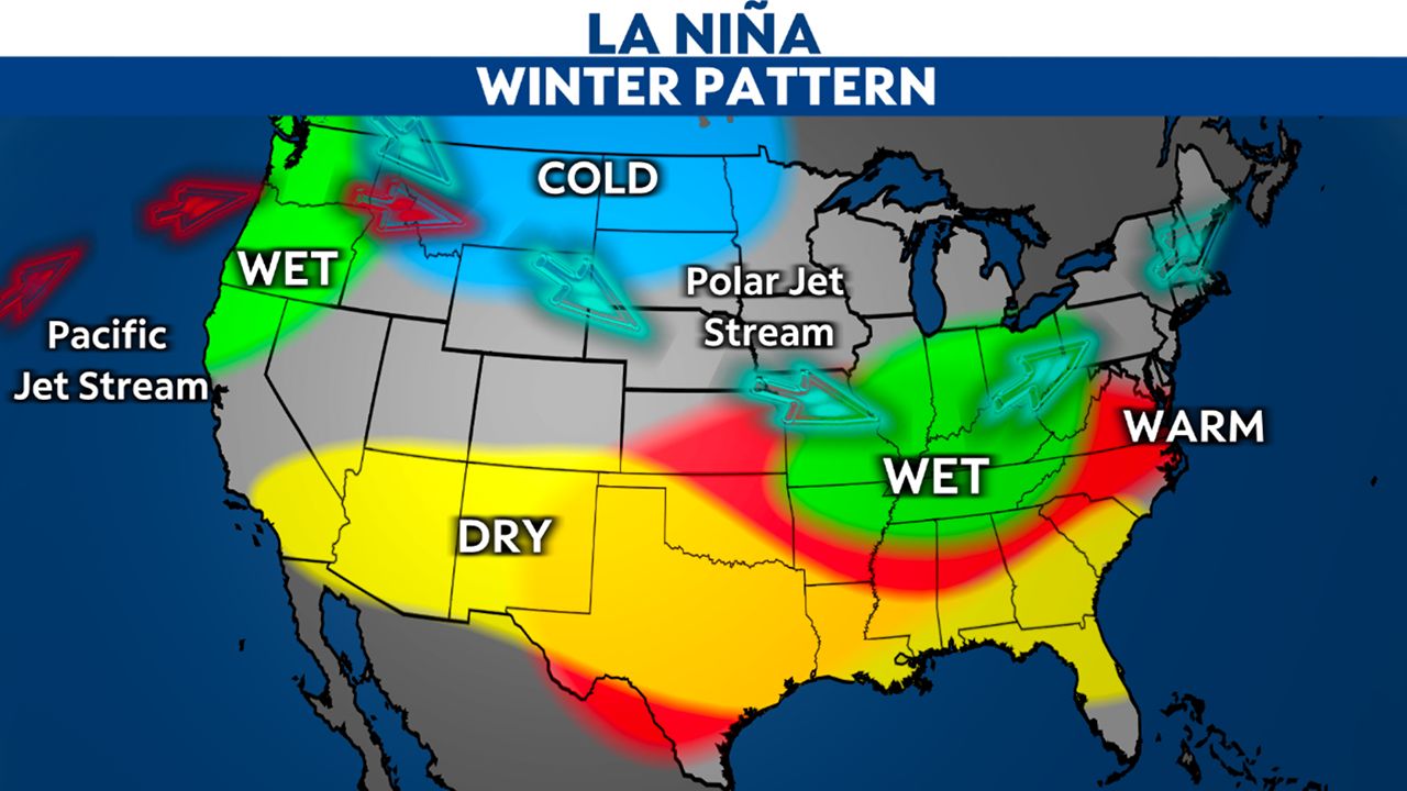
The Climate Prediction Center also confirmed that there is a 75% chance of La Niña persisting in the Northern Hemisphere for the winter months.
For the Lone Star state, our winters are relatively mild. Texas, of course, gets hit the hardest in the summer months when our climate is already at its most extreme. La Niña’s influence can make it downright unbearable.
If you’ll remember, 1998’s La Niña influence left DFW ranked as the No. 2 hottest season on record with 56 100-degree days as heat related emergencies soared that year.
The strong La Niña in 2000 caused the Barton Creek greenbelt to dry up completely and DFW saw its 5th hottest summer of all time.
2008 and 2011 were also La Niña years, that hammered the state of Texas.
Our current La Niña started in Sept. 2020 and has held since only seeing a temporary weakening of the oceanic components in January and Feb. 2022.
Scientists expect La Niña to persist through the winter and then transition to ENSO-neutral by March 2023. We’ll keep our fingers crossed as it continues to skew toward neutral or beyond before the hot temperatures return.
Our team of meteorologists dives deep into the science of weather and breaks down timely weather data and information. To view more weather and climate stories, check out our weather blogs section.