


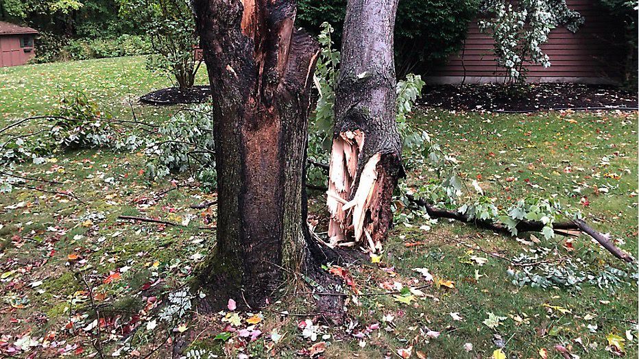
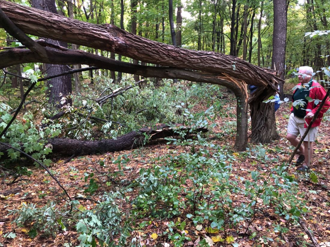
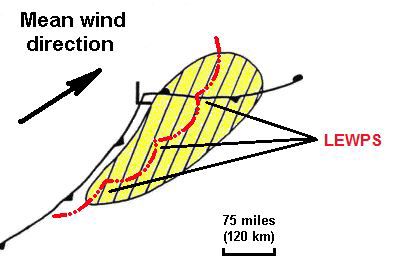
When a storm path is caused by a derecho, it is likely to leave an extensive area of wind damage in its wake.
That’s exactly what we saw on Wednesday, October 7 when severe storms came barreling through here like Godzilla on steroids.
Some Capital Region residents recalled the rapidly approaching storm as sounding like a freight train.
Here's what the October 7 storms led to in our area:
- 2 fatalities
- 1 tornado
- Nearly 300 wind damage reports in the Northeast, with half of those from the immediate Capital Region
- The upheaval left hundreds of thousands of residents without power, some for days
According to the National Oceanic and Atmospheric Association, in order for a line of storms to be defined as a derecho it needs travels at least 240 miles and move at a speed of at least 58 mph.
The Storm Prediction Center states that “by definition, a derecho must include wind gusts of at least 58 mph (50 knots or 93 km/h) or greater along most of its length. While derecho winds typically are less than 100 mph, gusts as high as 130 mph have been recorded - equivalent to those with strong EF2 tornadoes.”
Our storms on October 7 earned derecho status as they carved an extensive path of destruction that traveled over 300 miles at 50 to 60 mph with some wind gusts ranging as high as 80 to 100 mph. In meteorological terms, our scenario was coined a serial derecho.
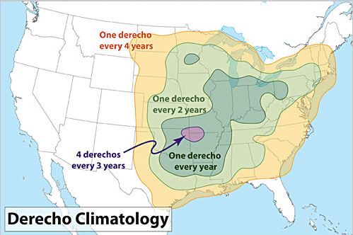
While more common in the Plains, in the South and in the warmer months, derechos are not a regular visitor for us here in the Northeast.
Derechos occur more regularly in the central and southern plains of the United States.
A widespread line of volatile wind and storms approached as did the busiest part of the day, the mid-afternoon on a Wednesday. Folks were on their way home from school and from work, leaving them fleeing for shelter to avoid a path of destruction that rapidly swept through.
The atmospheric variables in forecast data leading up to a severe weather event like this are quite intricate, and the ingredients came together quickly. The most intense part of the storm arrived in the Capital Region between 3 p.m. and 5 p.m. Massive leafy trees snapped and were strewn about neighbors' yards, on roofs, and across roadways. Unfortunately, this storm caused two deaths.
Relentless, intense bursts of wind ripped through buildings and knocked down hundreds of electricity poles. Power outages led to school closings as tens of thousands were left in the dark and food spoiled in warm refrigerators.
National Grid deployed an immediate massive crew response that worked around the clock for days in order to clear storm damage and reccover power. They also provided our community with bottled water and dry ice in the days that followed. Watch more post-storm coverage from Spectrum News’ Matt Hunter.
Recalling that Wednesday morning, the Storm Prediction Center made an upgrade to our severe storm risk, going up in risk category from marginal to slight. Damaging wind threat forecasts were elevated directly over the Capital Region, making the storm potential a bit more concerning leading up to the outbreak.
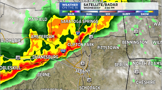
As the line of storms sliced across the state, damage reports to our west signaled what was on the way. In turn, a rather extensive coverage of severe thunderstorm warnings was issued by our local National Weather Service offices.
As a low pressure area swung in from Canada a positively-tilted trough became negatively tilted.
A negatively tilted trough looks horizontal (parallel to the surface) from northwest to the southeast, when normally it is the opposite. When this occurs, there will likely be a decent amount of vertical wind shear, or a significant increase of wind speed with height. This is important to note while forecasting because it can be a sign that the weather may become volatile.
Some rather benign weather occurred earlier that day as a warm front moved through.
A few showers developed by late morning and then some sun returned, warming us a bit through the early afternoon. The slight boost in surface temperature and dew point was followed by a surface trough and a cold front.
The atmosphere then processed a rapid decrease in temperature with height (lapse rate) and this created some instability. As the trough pivoted through, the jet stream introduced an area of rapidly moving mid-level winds.
These stronger jet streak winds were stronger than what's typical and gained momentum as they mixed down to the surface. Wind shear from the jet streak helped intensify the line of storms.
Since our area is not typically favored for this type of weather phenomenon, why did it occur here in upstate New York on October 7? They say timing is everything, and the atmospheric conditions came together at the right time, which led to the intense, rapidly moving weather outbreak.
It’s the strengthening line of storms that raced east at 50-to-60 miles per hour. The narrow storm band developed clusters of downbursts or microbursts forcing wind to the ground and then outward in all directions, resulting in incredible wind damage. Bow echoes were seen on radar and it's these parts of the storm that left the most intense damage.
The widespread winds were impressive, but they certainly weren’t the strongest. Other localized wind gust reports ranged between 70 and 100 mph in spots.
The wind gust of 67 mph at the Albany International Airport was the highest wind gust for the month of October.
There was also small hail, plenty of lightning as well as an EF-0 tornado in Canajoharie with winds of 85 mph, though it only lasted for one minute. The tornado nearly flattened a barn in the blink of an eye.
In 1995 our region had a similar storm outbreak called "The Ontario/Adirondacks Derecho." Here's more on what happened the last time we had a derecho blast through town.
Spectrum News' Mercedes Williams tells us about power outages that lingered into the weekend following the storm.
Due to power outages caused by the storm, traffic lights were rendered inoperable for days. Drivers were given reminders that when a traffic light is out, the intersection is treated as a four-way stop.
What was so remarkable about this serial derecho was not only how fierce it was, but how fast it came and went, leaving many residents in shock and awe of its power. With a year already full of uncertainty this storm dealt us yet another blow. The October 7 Derecho has been recorded as one of the worst severe weather outbreaks in our local history.
If you’d like to know more about this storm, here is the Storm Prediction Center’s summary.