It has been quite a while since any areas outside of the High County have seen snow in North Carolina.
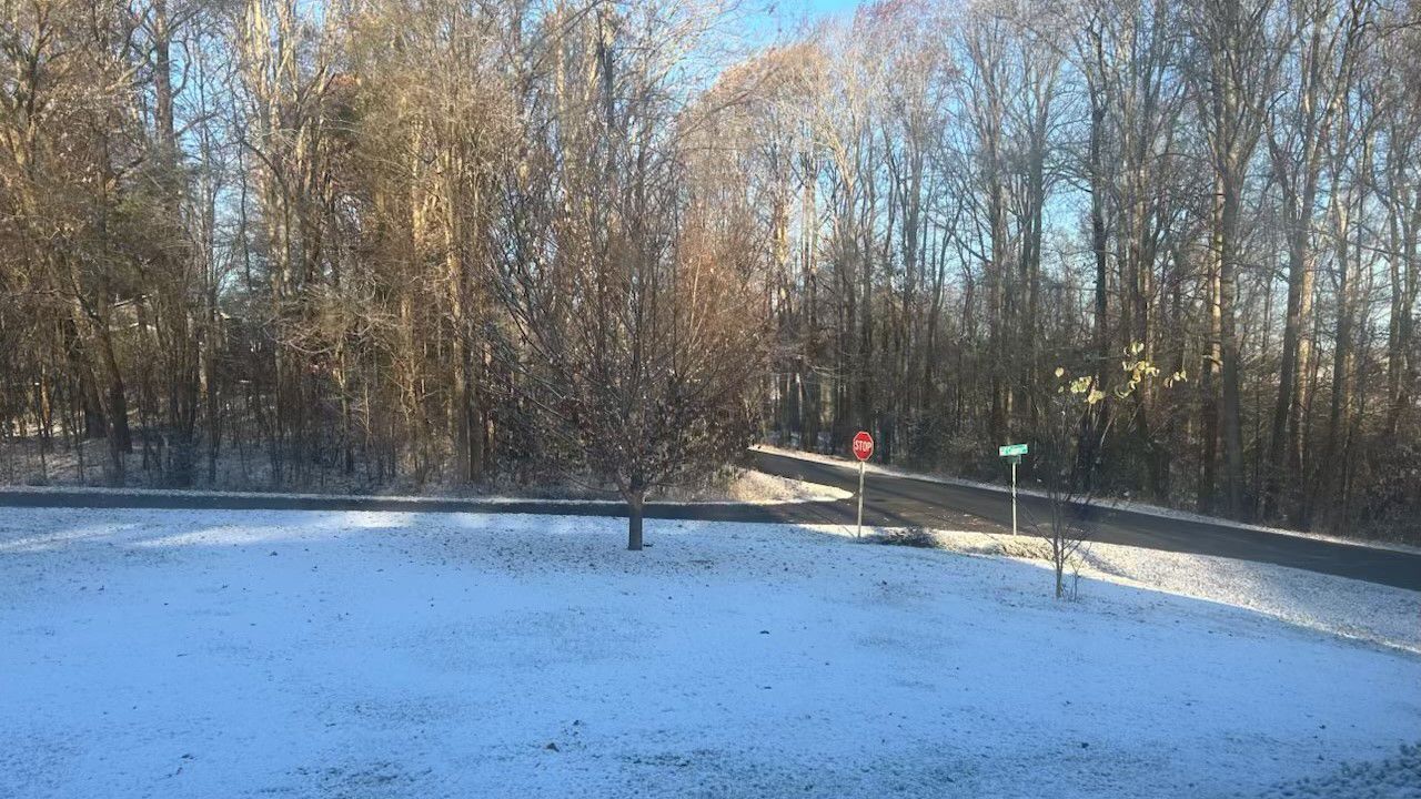
That did change for some parts of the Piedmont early Tuesday morning with light snow that fell before sunrise. Asheboro measured just over an inch on grassy and elevated surfaces.
It was just enough to create a number of accidents around the Triad, including on Interstate 40 and Interstate 85 during the morning commute.
Higher amounts fell around the mountains, especially for elevations over 3,000 feet.
For many other areas outside of the mountains, it has been over 1,000 days since measurable snow has fallen.
Charlotte has set a record for the length of time without measurable snow, and Raleigh is getting close to a similar record.
With those records, or near records, of snow-free conditions, odds would suggest North Carolina could see more snow this winter season.
However, the long range outlook over the next few months will be disappointing for snow lovers.
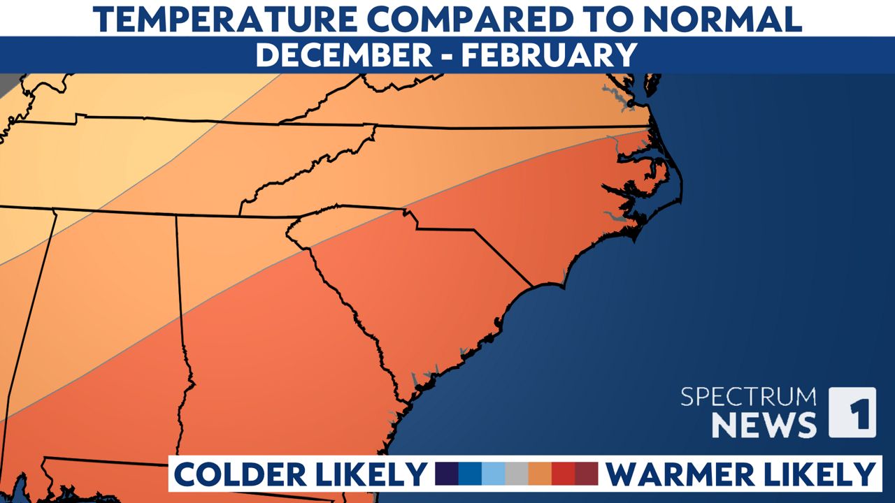
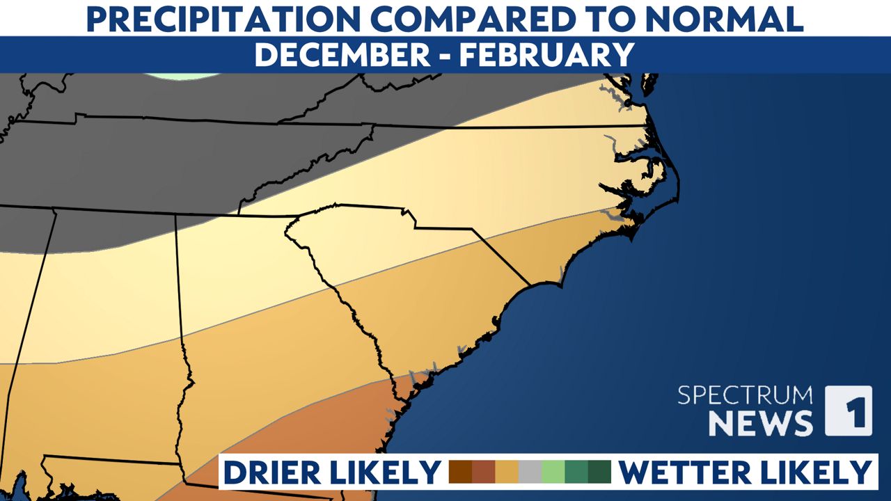
One of the main driving factors for weather patterns over the next few months around the globe is expected to be a weak La Niña. That typically leads to a warmer and drier than average winter in North Carolina with limited changes for wintry precipitation outside of our mountains.


In a winter that is warmer than average, we can still have periods of cold temperatures. We'll experience that as meteorological winter starts with colder than normal temperatures for much of the first week of December. That will come with dry conditions though for most of the state.
An analysis by the State Climate Office of previous winters with a weak La Niña did find there is often one month out of the winter that ends up a bit wetter than normal. That was the case in January 2022 with a weak La Niña. For many areas, that was also the last time for at least some measurable snow.
If you're a fan of snow, don't give up all hope. Over the next few months that will likely end up warmer and drier than average, we'll watch closely to see if a brief period of wetter weather can phase up with some colder air.
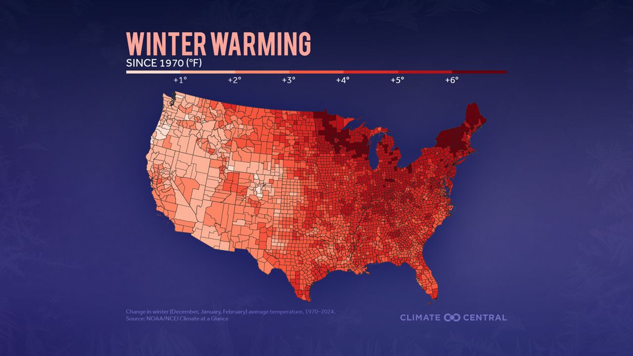
There's one other factor that will likely make this winter warmer than the 30-year average, and that factor is human caused.
As the planet gets warmer due to greenhouse gas emissions like carbon dioxide, every season is getting warmer in North Carolina and all across the country.

The North Carolina Science Report, released in 2020 and authored by some of the state's top climate scientists, serves as a scientific assessment of how climate change will impact future conditions in the state.
"It is likely that total snowfall and the number of heavy snowstorms will decrease because of increasing temperatures," the report states. "There is low confidence concerning future changes in the number of ice storms and winter coastal storms."
Our team of meteorologists dives deep into the science of weather and breaks down timely weather data and information. To view more weather and climate stories, check out our weather blogs section.


