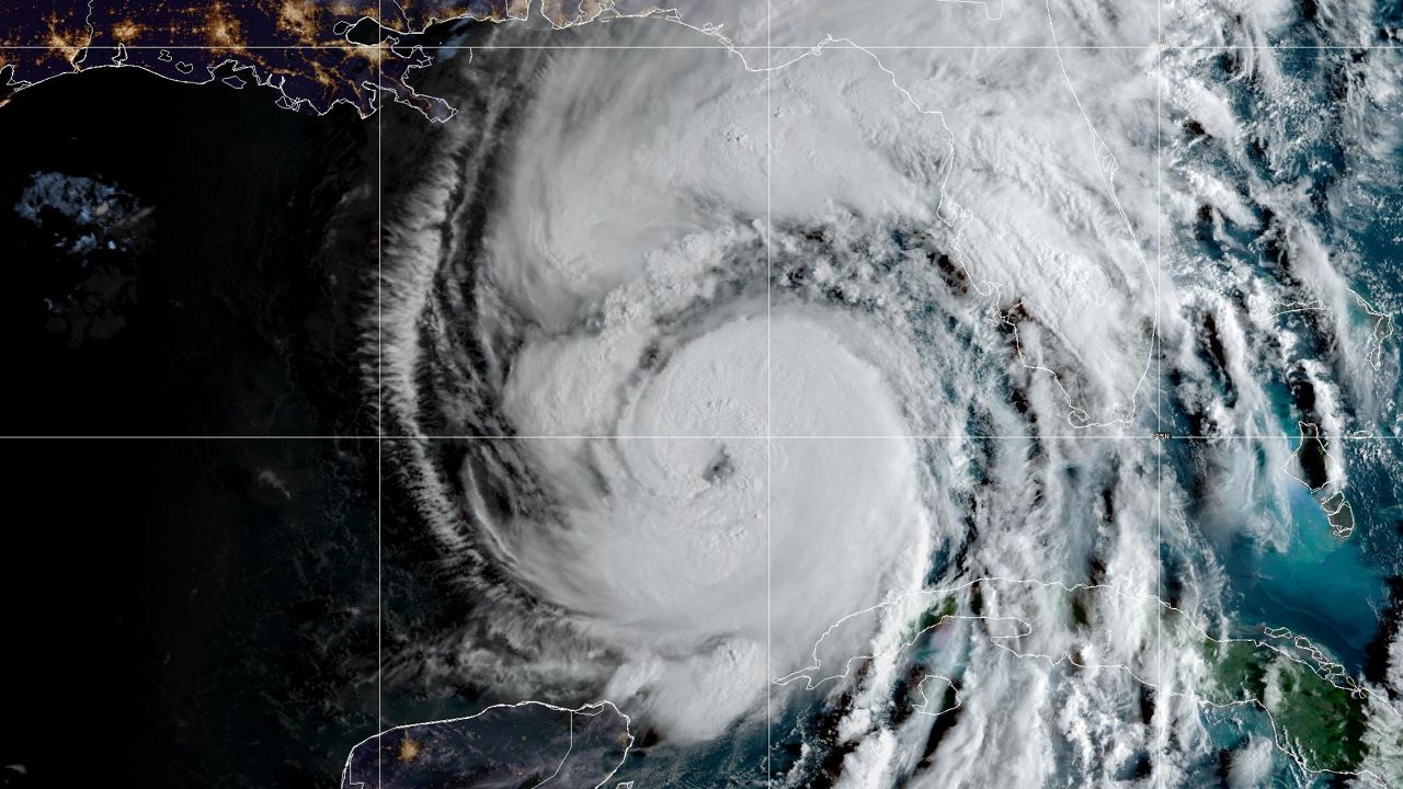
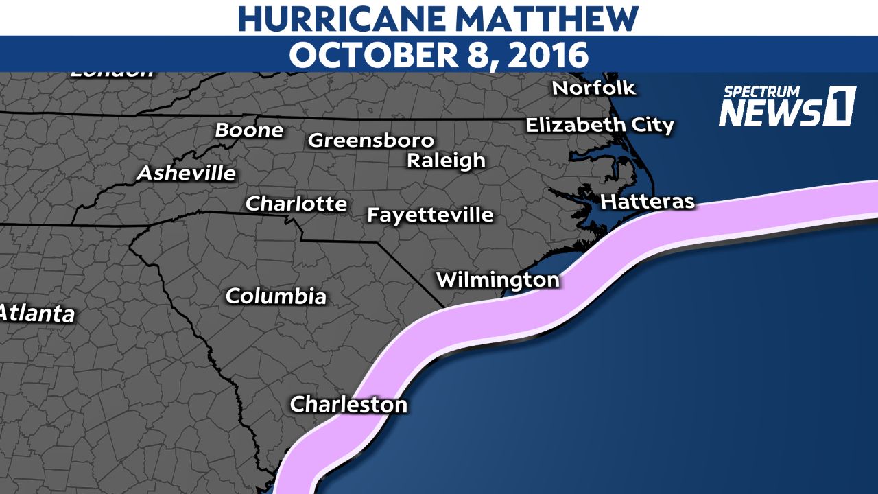
Saturday marks six years since Hurricane Matthew moved up the coast of the Carolinas and produced devastating flooding.
The storm technically never made landfall in North Carolina. Its eye only briefly came inland near McClellanville, S.C. on Oct. 8, 2016.
The center of the storm stayed just off the coast of North Carolina as it weakened from a Category 1 hurricane to a tropical storm.
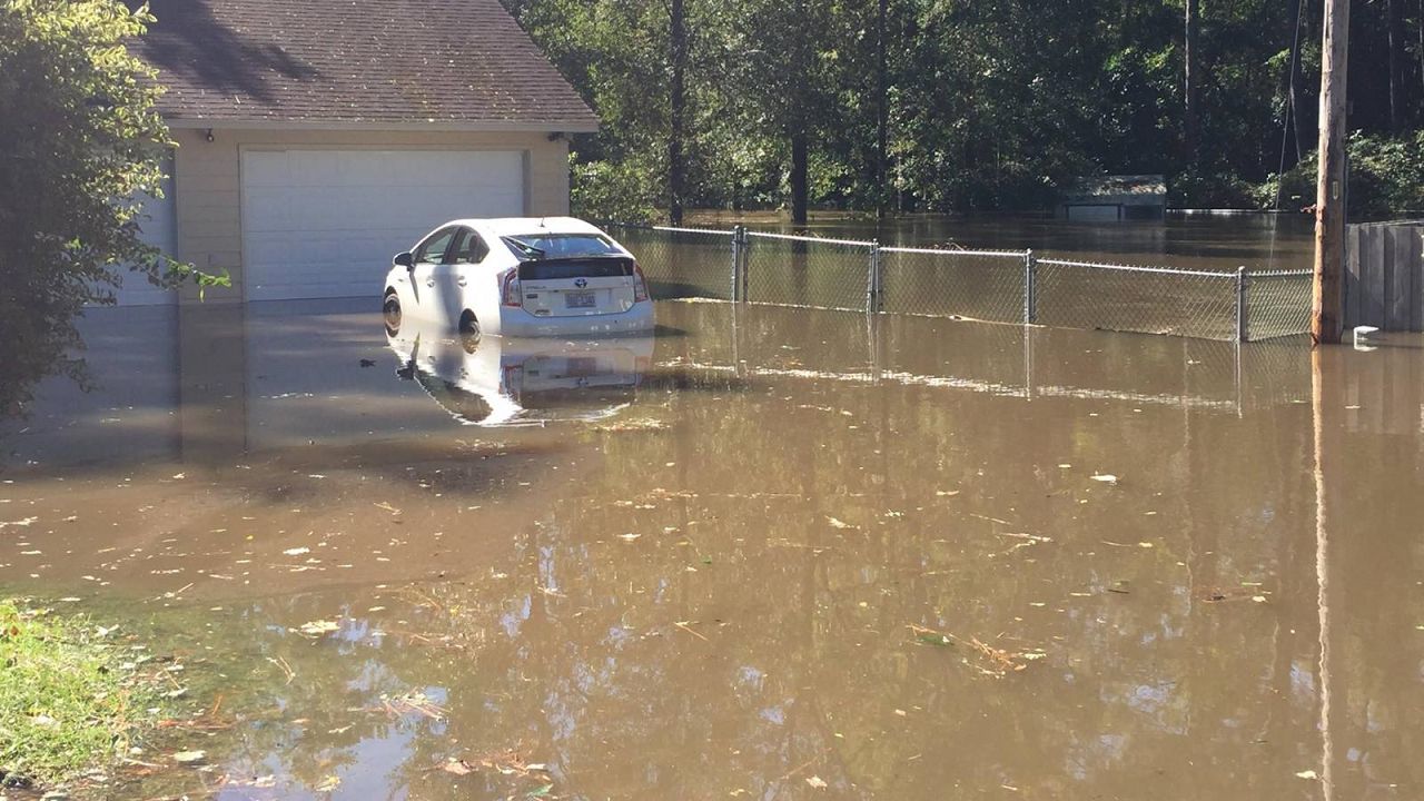
Even though Matthew was not a major hurricane based on wind speed, it is still one that many people will talk about for years and even decades due to historic flooding.
Over 16 inches of rain fell in southeastern North Carolina and northeastern South Carolina.
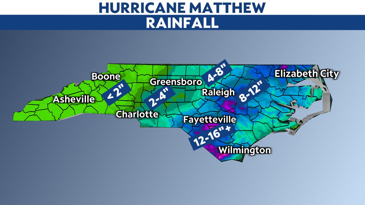
This came around a week after an area of thunderstorms produced heavy rain over some of the same areas. River levels were already high before Matthew.
Rain from Matthew then led to all-time records for river levels for some locations, including the Lumber River near Lumberton.
The extensive river flooding after Matthew was similar to what happened in eastern North Carolina after Hurricane Floyd in 1999.
Twenty-five deaths were attributed to Hurricane Matthew in North Carolina and another four in South Carolina. Overall, the storm killed an estimated 585 people, with the majority happening as Matthew passed over Haiti.
Just under two years after Matthew, Hurricane Florence produced another round of devastating flooding in some of the same areas in southeastern North Carolina impacted by Matthew.
Florence produced even higher rainfall amounts. Totals reached up to three feet in some locations.
Rebuilding and recovery efforts continue in some southeastern North Carolina communities to this day, following the devastation from Matthew and Florence.
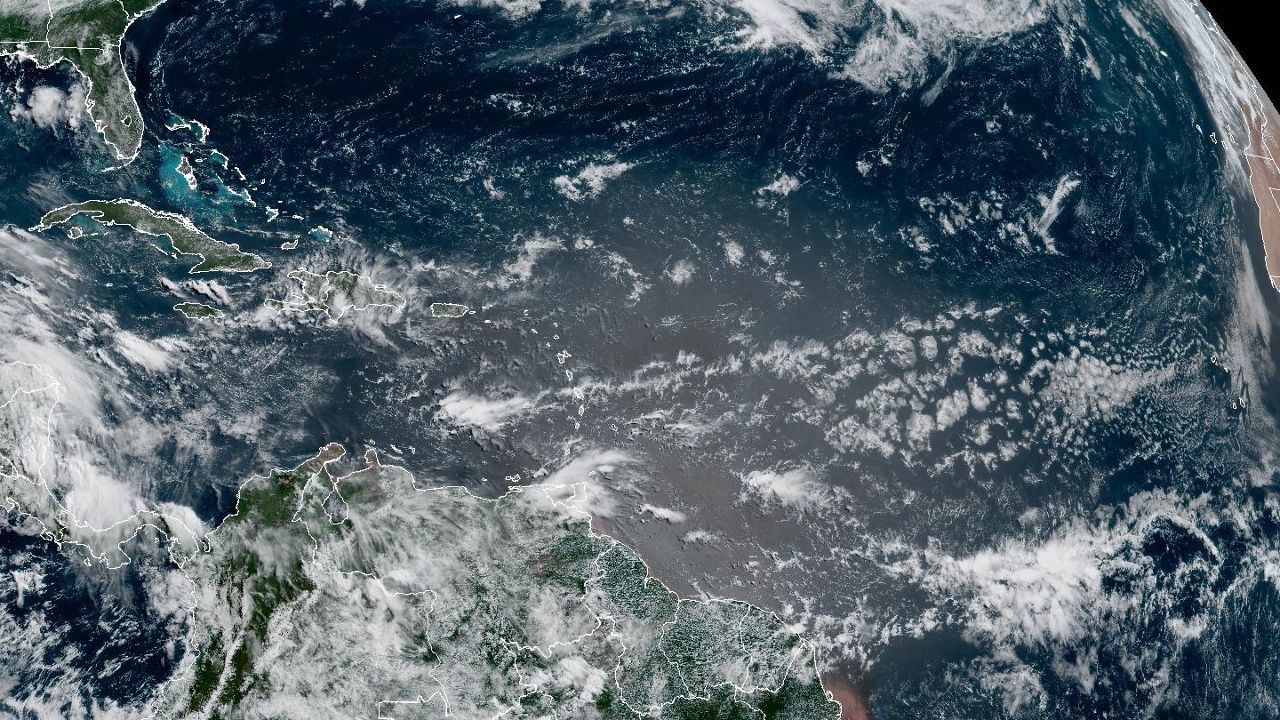
Those two storms are examples of how our warming climate is leading to hurricanes that produce even heavier rain and a greater threat from flooding.
A study at Stony Brook University, published in Science Advances, found that a warming climate enhanced Florence's extreme rainfall.
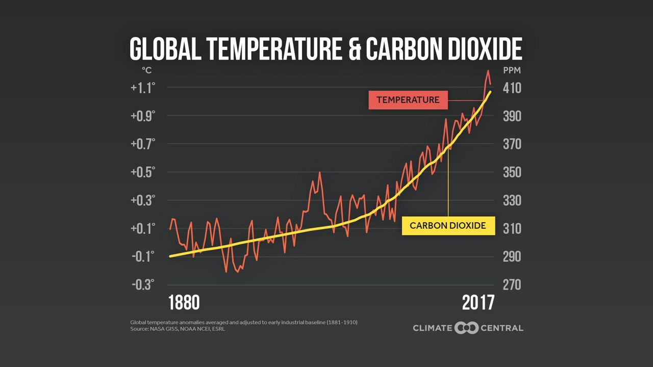
Climate scientists have shown that a warmer atmosphere will lead to more frequent heavy precipitation events, even in nontropical systems.
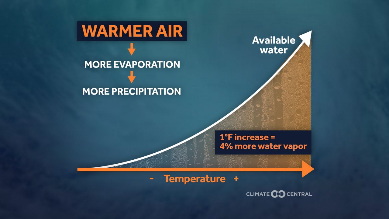
The North Carolina Climate Science Report published in 2020 stated, "Heavy precipitation accompanying hurricanes that pass near or over North Carolina is very likely to increase, which would, in turn, increase the potential for freshwater flooding in the state."
Heavier rainfall is just one of the ways a changing climate is expected to affect hurricanes in the future. A rising sea level will add to the storm surge created by the storms.
While research has not indicated that a warmer climate will increase the number of hurricanes, the North Carolina Climate Science Report and other studies have shown that the intensity of hurricanes will increase.
Our team of meteorologists dives deep into the science of weather and breaks down timely weather data and information. To view more weather and climate stories, check out our weather blogs section.