Drought has continued to develop across North Carolina since the middle of summer, resulting in the third fall in a row with a severe drought across parts of the state.
October brought a statewide average rainfall of only 1.15 inches, resulting in our 10th-driest October in over 100 years.
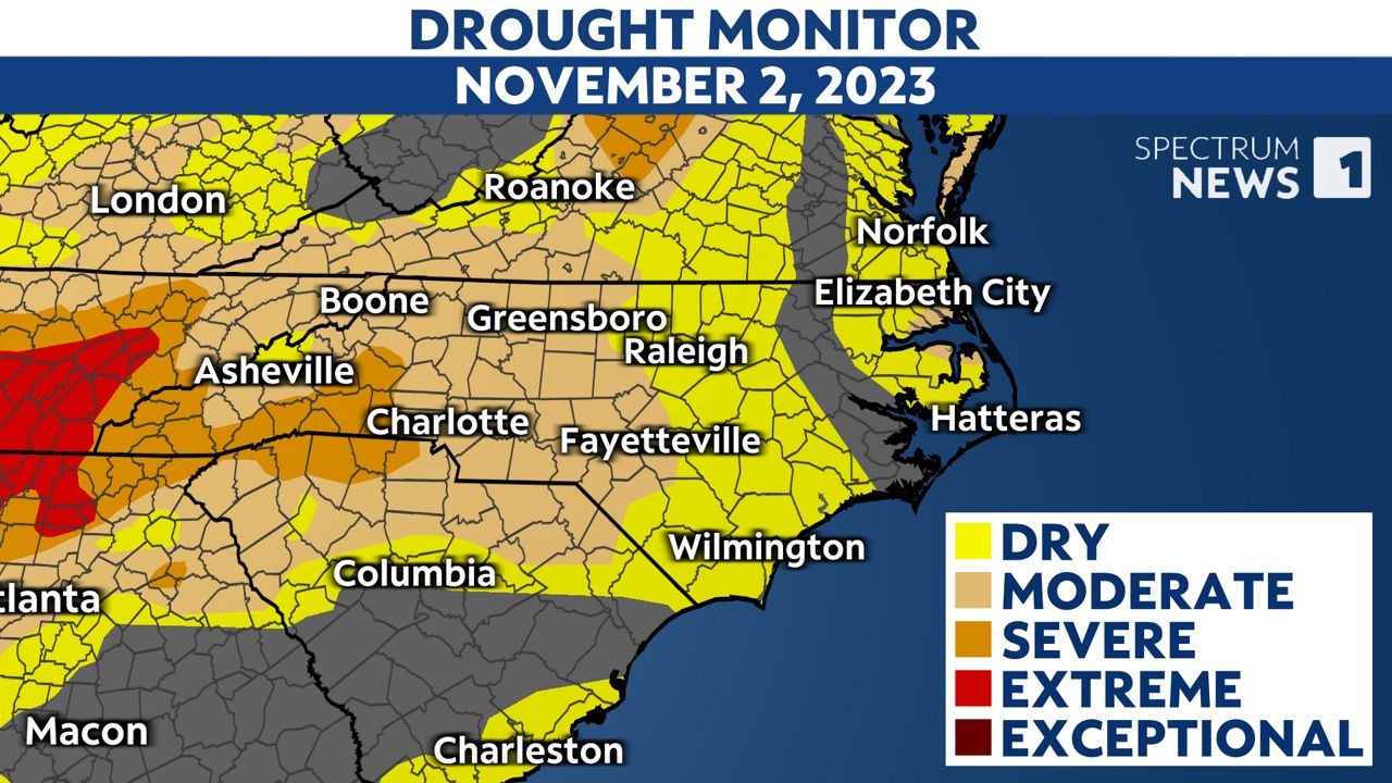
Thursday, the U.S. Drought Monitor published an update to North Carolina's situation showing a drought covering more than half of the state.
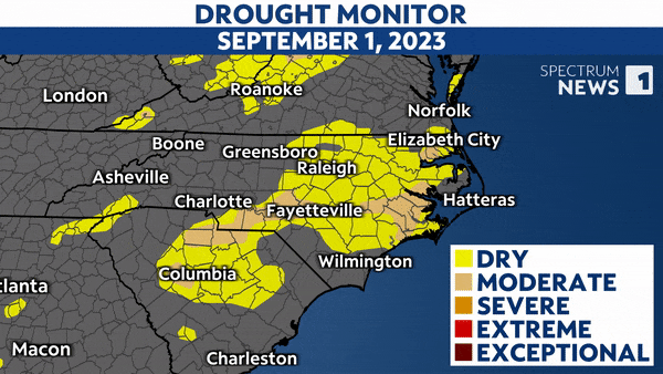
Abnormally dry or worse conditions currently cover more than 91% of North Carolina.
Rainfall has been scarce and only parts of Granville and Halifax counties and a few other areas have had over 100% of normal rainfall in the last two months.
Unfortunately, hoping for a nice steady rainfall from a weak tropical cyclone is unlikely soon. It was around this time last year that Nicole brought some needed rainfall to the state.
One way we measure a drought's intensity is with the Drought Severity and Coverage Index. This is an experimental method from the National Drought Mitigation Center at the University of Nebraska-Lincoln for converting drought levels from the U.S. Drought Monitor map to a single value for an area.

This measurement for North Carolina has been trending upwards since the summer of this year, and it is only the third time in the last decade that the drought has gotten as severe as it is now.
North Carolinians are not all facing the same dry conditions, but many are seeing an impact on their water resources.
Those who use well water and those along the coast are being affected. Rainfall runs off into area streams, but without it, salt water from oceans can back up into those rivers, reducing the quality of local water and the habitats for any freshwater species.
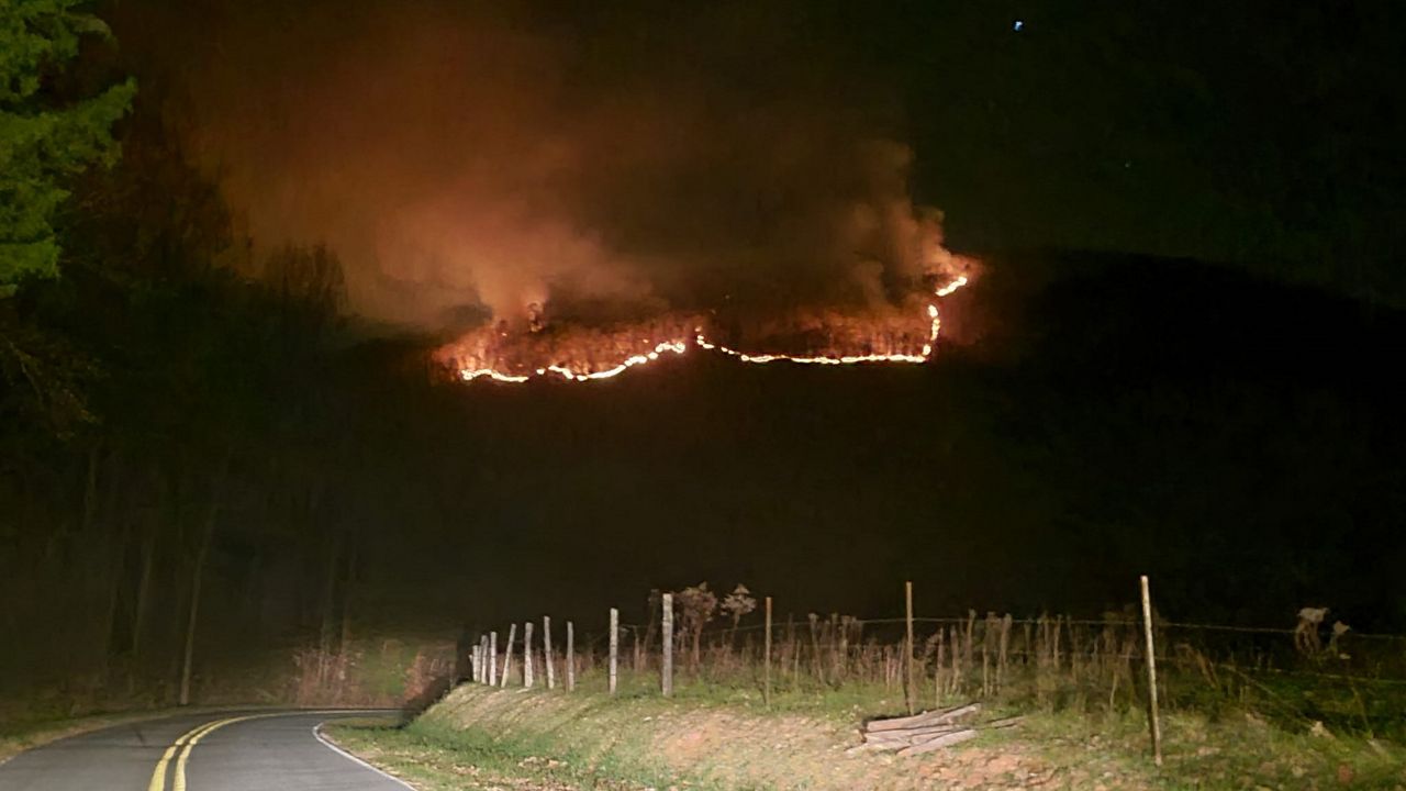
We're also in the peak of fire season and a dry forest can be a dangerous place for fire to develop. The Collett Ridge fire in Cherokee County all began with a lightning strike from a nearby thunderstorm in late October and has burned nearly 100 acres since then.
The last time we had a severe drought this large in November was when Pilot Mountain experienced a wildfire because of an escaped campfire.
Fire season typically lasts into early December and as we go into the middle of the month, significant rainfall does not look likely.
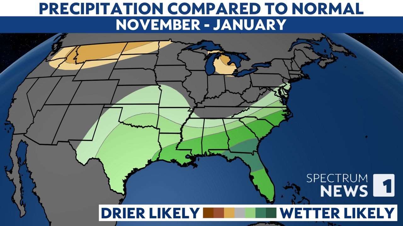
However, the Climate Prediction Center outlook for the next three months shows how El Niño can cause wetter-than-average conditions across the southeastern United States. This means we'll likely see multiple rounds of rainfall from the end of November into winter.
Watch Spectrum News 1 for future forecast updates, including changes to the drought conditions in North Carolina.