


Two of the most notable flood events to impact western North Carolina in the 20th century were the Great Floods of 1916 and 1940. Both these floods were caused by the remnants of slow-moving tropical systems.
When summer gets underway, meteorologists focus their attention on the Tropics because that is when the Atlantic Hurricane season peaks. Searching for signs of early development happening over the warm waters of the Atlantic or Gulf of Mexico, meteorologists keep a close watch on anything that could become our next problem storm.
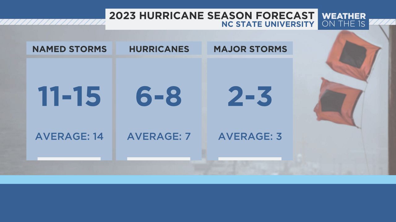
This hurricane season is expected to be slightly below average due in part to the emerging El Niño. However, it only takes one storm to make it a busy season.
Of course, coastal residents are very familiar with tropical systems and the dangers they pose.
Storm surge can inundate areas with flood waters. Powerful winds could topple trees, damage buildings and knock out power for days, if not weeks. With that, torrential rain can cause serious or catastrophic flooding, as with Hurricane Florence back in 2018.
Yet, people will take the increasing risk of living near the beach.
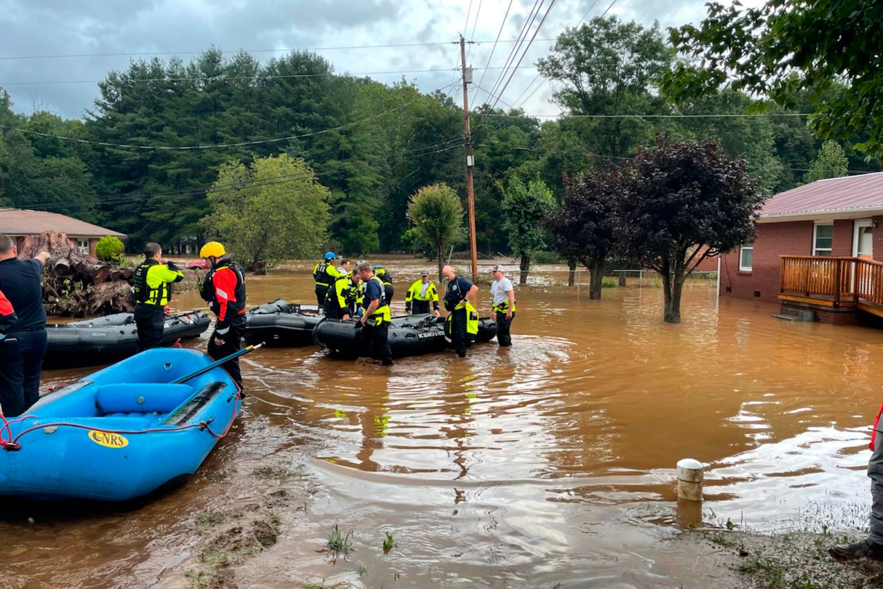
We were recently, and painfully, reminded that tropical systems can bring major flooding across western North Carolina. Just two years ago, the remnants of Tropical Storm Fred served as a perfect example.
There are two such events that come to mind that are considered the benchmarks of catastrophic floods in western North Carolina, the 1916 and 1940 Great Floods.
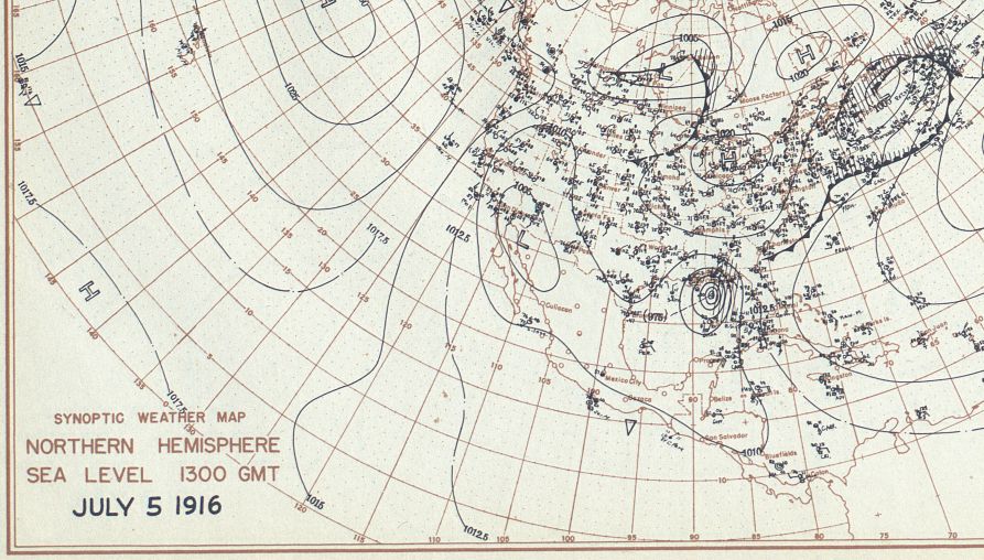
The 1916 flood was caused by the remnants of two hurricanes, one that made landfall along the Gulf Coast. This was followed by another storm that made landfall in South Carolina a week later.
On Jul. 5, an unnamed hurricane made landfall along the Gulf Coast. Even though it weakened as it moved inland, it dumped heavy rain into the North Carolina mountains. This caused the soil to become quickly saturated with rivers and streams reaching their banks.
Roughly a week later, another hurricane made landfall near Charleston, South Carolina. This storm moved into the same areas that were affected by the first storm.
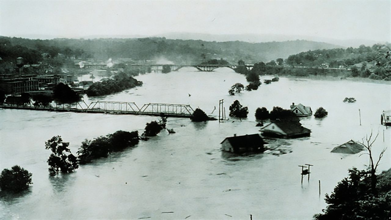
With the soil already water-logged from the first storm, catastrophic flooding was the result. Over 20 inches of rain was recorded in some locations, ranking as the highest 24-hour record rainfall in the U.S. at the time.
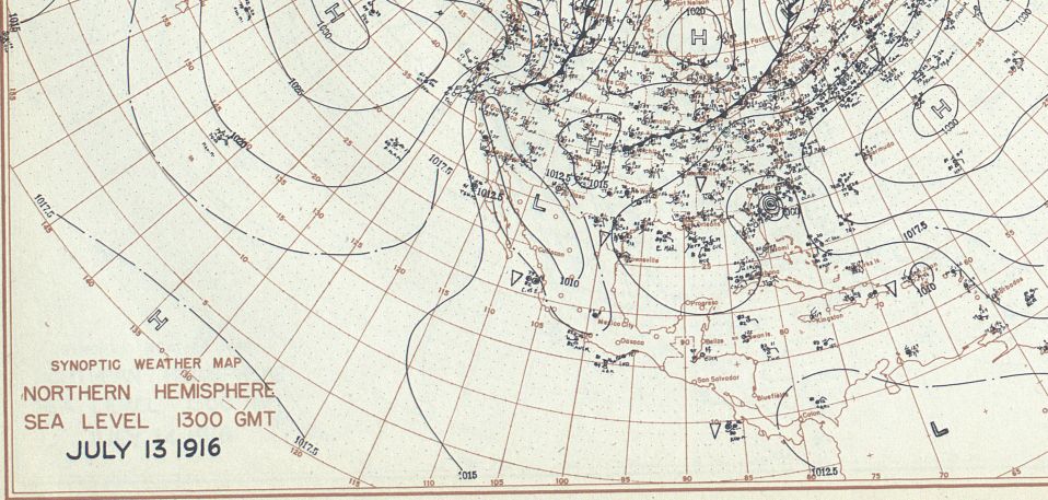
Worst of all, 80 people were killed, with cities and remote towns devastated. Railroads, homes and roads were washed away. Over $20 million in damage occurred.

Just 24 years later, in 1940, the state suffered from another devastating flood event brought on by the remnants of a slow-moving system. This time it was a single, category 2 hurricane that made landfall along the South Carolina coast on Aug. 11.
The storm moved inland into Georgia and then turned north over western North Carolina, where it dumped torrential rain over the region for five days.
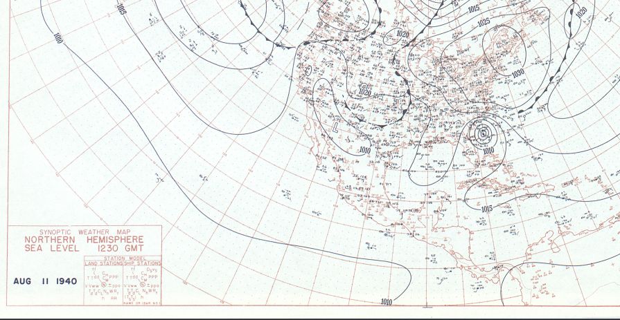
Rivers and streams quickly became overwhelmed by the torrential rains. Mudslides were common due to heavy rain falling on lands that had been clear-cut of their old-growth timber, leaving nothing to hold the soil to the bedrock. Whole mountainsides came rushing down, engulfing homes and killing their residents.
An example of this destruction is what happened to the small town of Mortimer in rural Caldwell County in the Pisgah National Forest. In 1904, the town was built as a lumbering town on the banks of Wilson Creek.
The 1916 flood washed out the railroad there, but not before the area had been clear-cut of the trees that held the soil to the mountainsides. By 1940, there were about 800 residents in the town that included a textile mill, a school, a hotel, a church, and many homes.
On Aug. 13, the tropical rains caused Wilson Creek to flood to an astonishing crest of 94 feet as it torn through the small valley, completely destroying Mortimer. The only remnants that remain are the partial cement foundation of the textile Mill, various buildings, and a couple of railroad trestles.
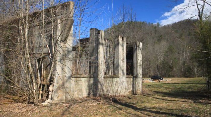
Looking at the area today, it’s hard to imagine there was once a bustling mill town there.
Our team of meteorologists dives deep into the science of weather and breaks down timely weather data and information. To view more weather and climate stories, check out our weather blogs section.