After a beautiful week of weather, the forecast may be far from beautiful for much of North Carolina on Saturday.
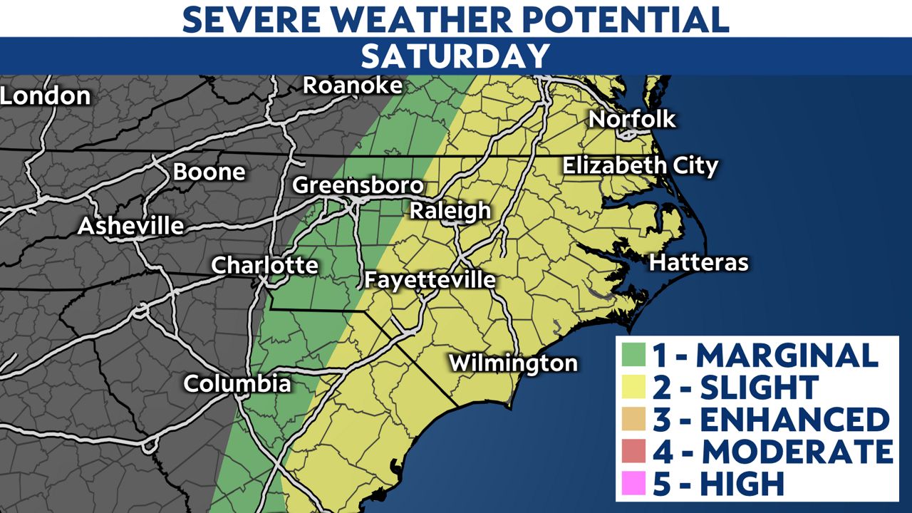
Scattered showers and storms will remain possible through the afternoon and evening, with the greatest threat for severe weather across the eastern half of the state.
A cold front may produce two rounds of storms today. The first lasting until mid-afternoon and the second starting in the afternoon and lasting until midnight.

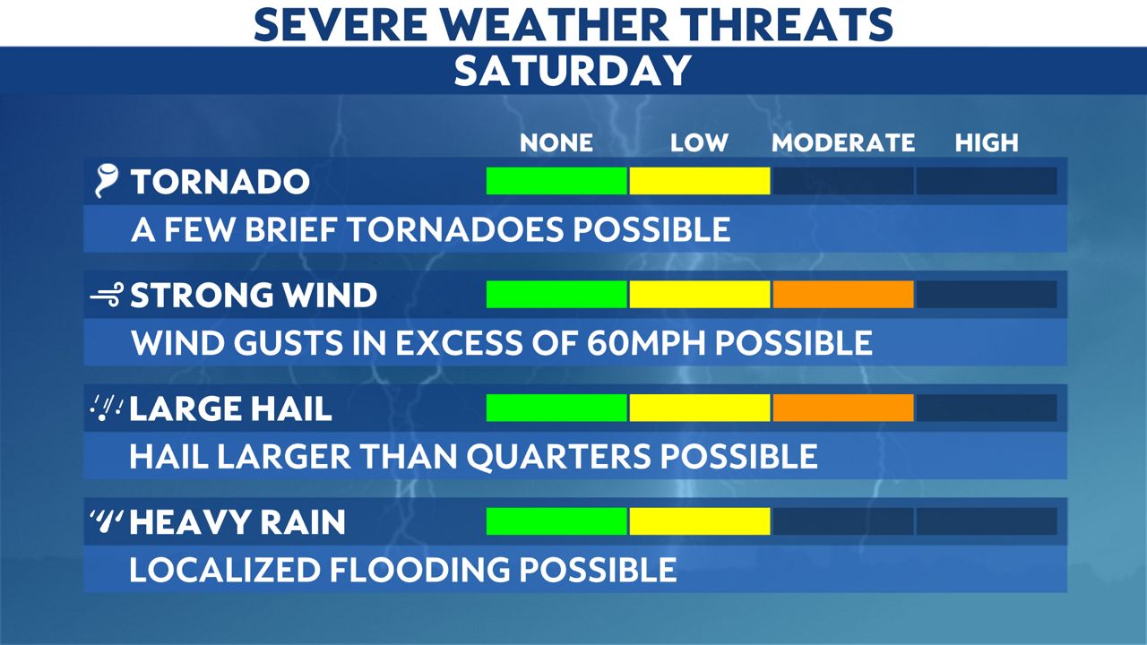
The main threats from the storms will be damaging, straight-line winds and hail. However, there's also a low threat for a few tornadoes and localized flooding.

Everyone in and near the severe weather risk area should have a way to receive weather alerts on today and tonight in case they are issued.
If a Tornado Warning is issued, seek shelter in an interior room on the lowest floor of a sturdy building. Basements, hallways, closets and windowless bathrooms often provide the best protection during a tornadic storm.
.gif)
Showers and storms will be tracking northeast ahead of the incoming cold front from the west. The threat of severe storms will continue for central portions of the state until sunset. However, for eastern North Carolina, storms may not fully move offshore until midnight.
Our team of meteorologists dives deep into the science of weather and breaks down timely weather data and information. To view more weather and climate stories, check out our weather blogs section.


