
A spring-like storm system will bring a chance for severe storms to portions of the state on Wednesday afternoon and evening.
The calendar may say it’s January, but it will feel more like early spring across most of the North Carolina today as a potent storm system heads toward the state.
A warm front associated with the storm system will head north through the state this morning. This will allow warm, unstable air to rush in from the south.
This is setting the stage for strong to severe storms to develop during the afternoon and evening over portions of the Piedmont and the entire coastal plain of North Carolina.
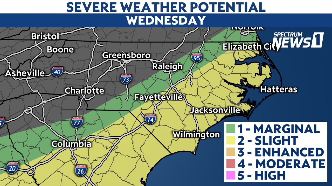
The greatest threat for severe weather will be from the I-95 corridor eastward, with the primary threat being straight-line damaging winds and hail.
However, there will be ingredients in the atmosphere for some storms to rotate and spin-up a brief tornado.
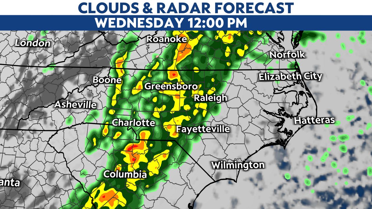
Scattered storms will move eastward through the Piedmont around noon today.
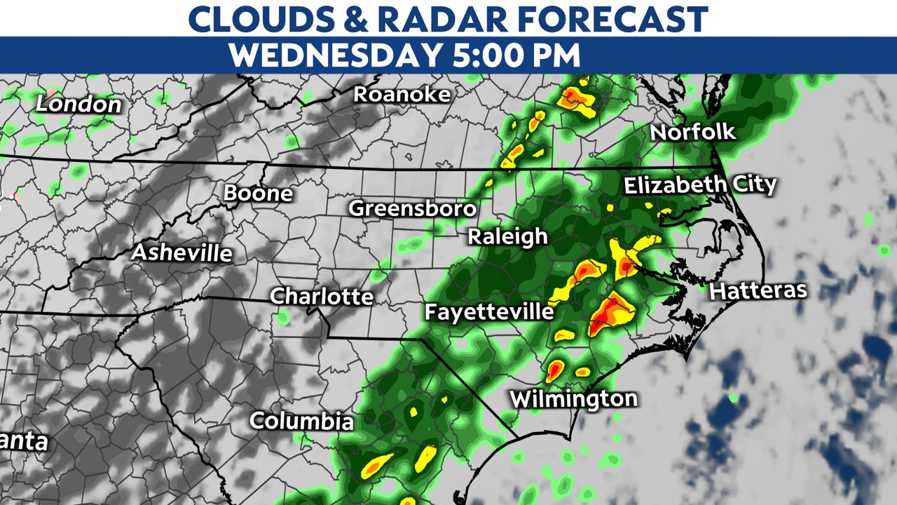
During the afternoon and evening, the severe weather threat will shift down into the eastern portion of the state.
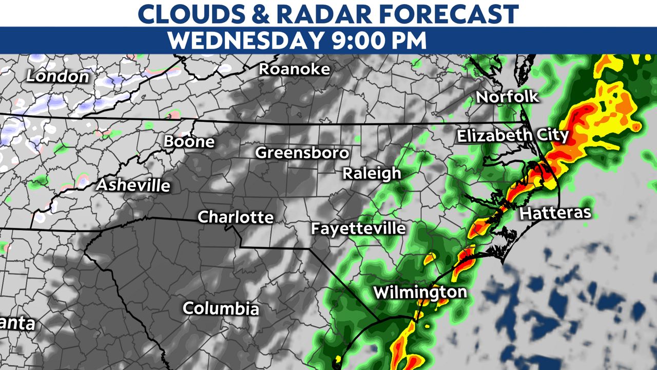
The squall line should clear the Outer Banks around midnight Thursday.
Stay tuned to Spectrum News 1 for the latest forecast, including possible watches and warnings.
Our team of meteorologists dives deep into the science of weather and breaks down timely weather data and information. To view more weather and climate stories, check out our weather blogs section.