Severe weather and an active hurricane season for North Carolina made weather in 2022 anything but mediocre.
North Carolina is infamous for being able to see active weather at every month of the year. Of course, we are used to seeing much of that activity throughout the summer and early fall during hurricane season, which kept us busy later than usual in 2022.
North Carolina saw the most severe thunderstorm warnings (751) since 2012 (1059). However, the 10-year average continued to trend lower to less than 600 severe thunderstorm warnings per year down from 2015’s peak 10-year average of 880 warnings per year.
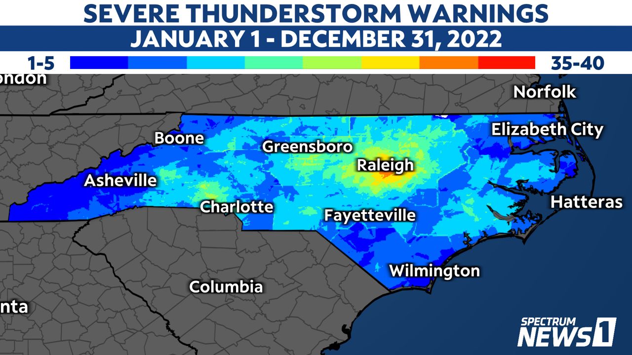
Many of the severe thunderstorm warnings issued were focused on the state capital.
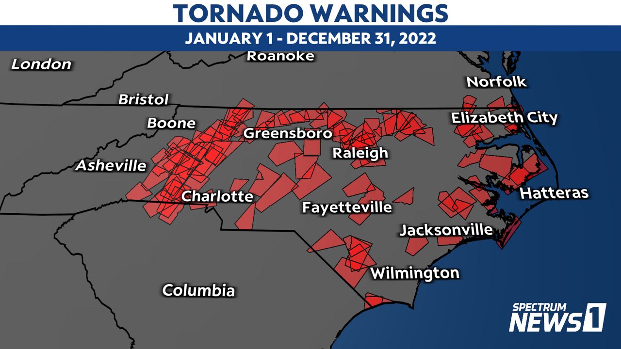
We also saw more tornado warnings than average (90) with 110 total in 2022. The 10-year average has been trending lower since 2012’s peak 10-year average of 106 warnings per year.
This was the fifth year in a row with more tornado warnings than average across the state.
Most of the tornado warnings were issued in the spring (March through May). Burke, Caldwell and Surry counties had the most warnings at nine each.
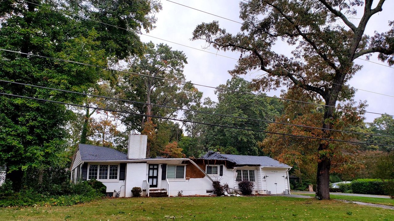
As for confirmed tornadoes in the state, 17 storm reports included tornado damage in 2022 and the National Weather Service recorded twelve of those in May.
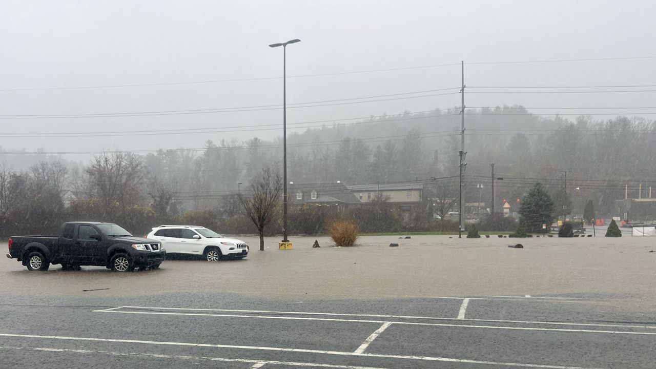
North Carolina also saw 86 flash flood warnings issued, which was below the average of approximately 120 issuances per year. That average has not changed dramatically in the last couple of decades.
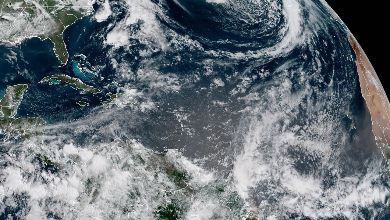
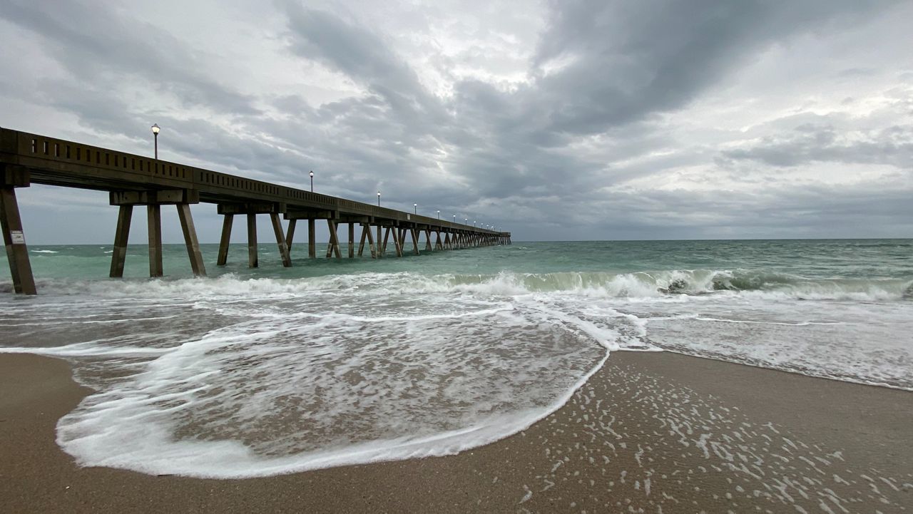
Hurricane Ian tore into North Carolina on the last day of September in 2022, leading to damaging winds, flooding and a slew of issues, including storm surge along the coast. Nicole made landfall in Florida on the early morning of Nov. 10 but brought severe weather and flooding to North Carolina on Friday, Nov. 11.
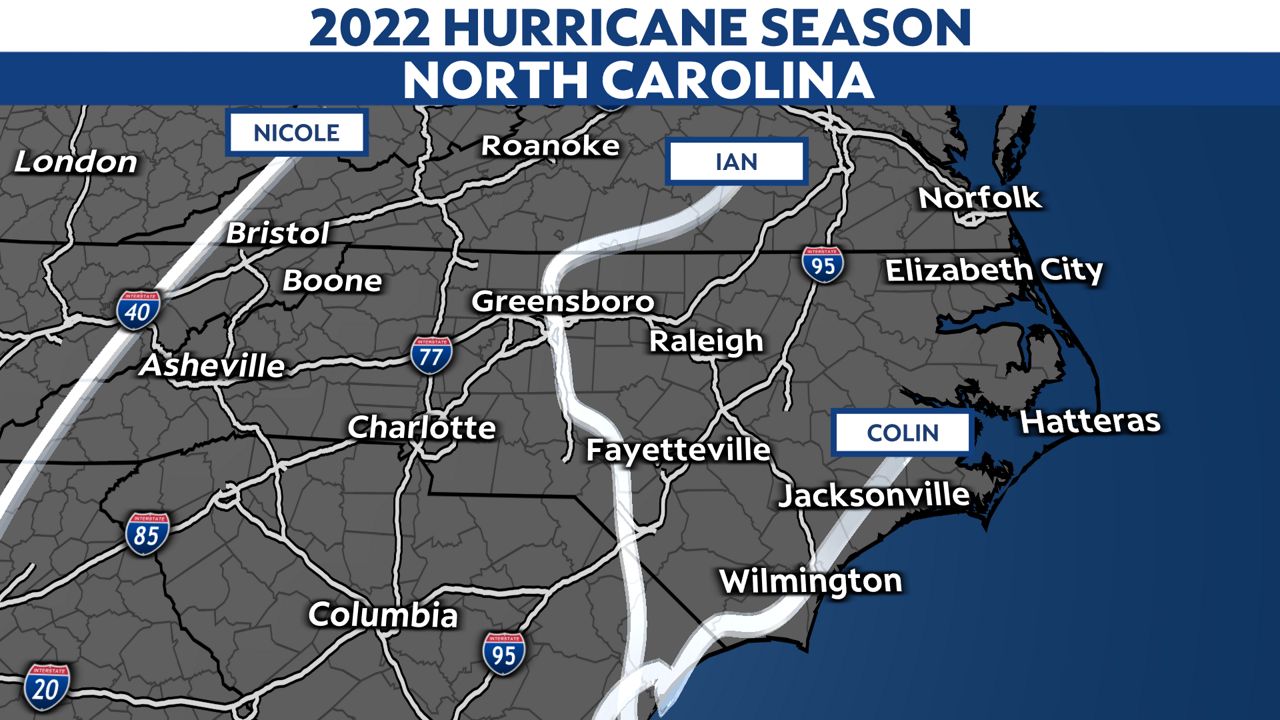
There was Tropical Storm Colin too which developed over the Fourth of July weekend but had very little impact on the weather at the coast.
Both Ian and Nicole occurred past the peak of the season. In fact, it is very rare for hurricanes to cause destruction in the continental United States during the month of November.

It’s worth mentioning that there were other tropical cyclones that prompted a high risk for dangerous rip currents along North Carolina’s beaches last year too. However, the National Weather Service in Wilmington claimed that 2022 saw a lower number of rip current fatalities than in recent history.
At the beginning of July, drought was at its worst point across North Carolina - the middle of the growing season.
Though there were changes from week to week in 2022, the year began with the lingering effects of ending 2021 with over 50% of North Carolina in a severe drought. Then in July, the drought peaked again, with most of eastern North Carolina in a moderate or severe drought and western portions of the Piedmont.
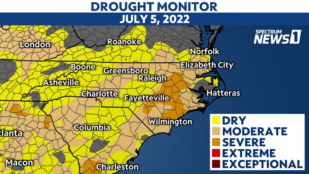
Rainfall during the hurricane season lead to improved rainfall totals across the state but the drought continued to persist through to the end of the year with with more than 28% of the state in a moderate drought at the end of December.
Speaking of precipitation, there were some remarkably low rainfall totals in the Sandhills and across the Coastal Plain last year.
Wilmington had their driest year since 2007, at only 41.34" of rainfall. This was the 23rd driest year based on records dating back to 1871.
Fayetteville had their fifth driest year on record and the driest since 2007. Records there date back to 1910.
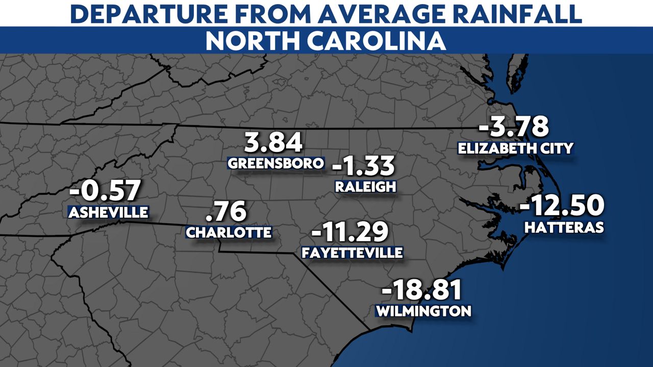
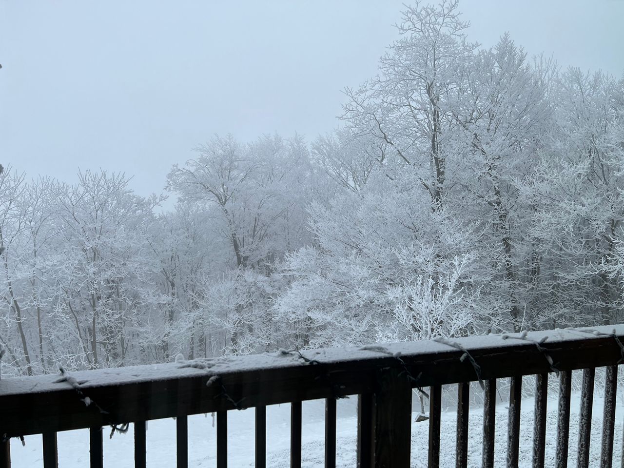
Only Greensboro and Charlotte saw above-average precipitation in 2022, but not by much. Greensboro, however, saw 8.2 inches of snow in January making it the 13th snowiest January on record and the most snowfall in that month in twenty years.
Temperatures were close to average in 2022 for most of the state but Raleigh, Fayetteville and Wilmington had a much warmer than average year.
Raleigh had the second warmest year on record tying 2017 and 1933, with an average annual temperature of 62.7 degrees.
Wilmington saw an annual average temperature of 65.8 degrees which made it the fourth warmest year on record also tying 2017 and 1985.
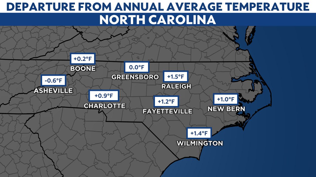
Not everyone saw a warmer than average year.
Asheville ended up colder than average in 2022. Asheville has seen the annual average temperature get colder year over year for the last three years - a feat that has only happened three other times in the last century.
Our team of meteorologists dives deep into the science of weather and breaks down timely weather data and information. To view more weather and climate stories, check out our weather blogs section.