Is it May or is it July? It will be hard to tell this afternoon with record heat moving into North Carolina.
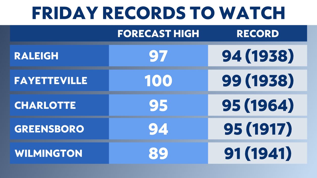
A warm front lifted through the state Thursday, allowing temperatures to soar. The entire state of North Carolina is expecting record or near-record heat Friday afternoon.
Plenty of highs in the 90s and some spots may even see triple-digit heat for the first time this year. To put this in perspective, these highs are warmer than the average highs for July and August!
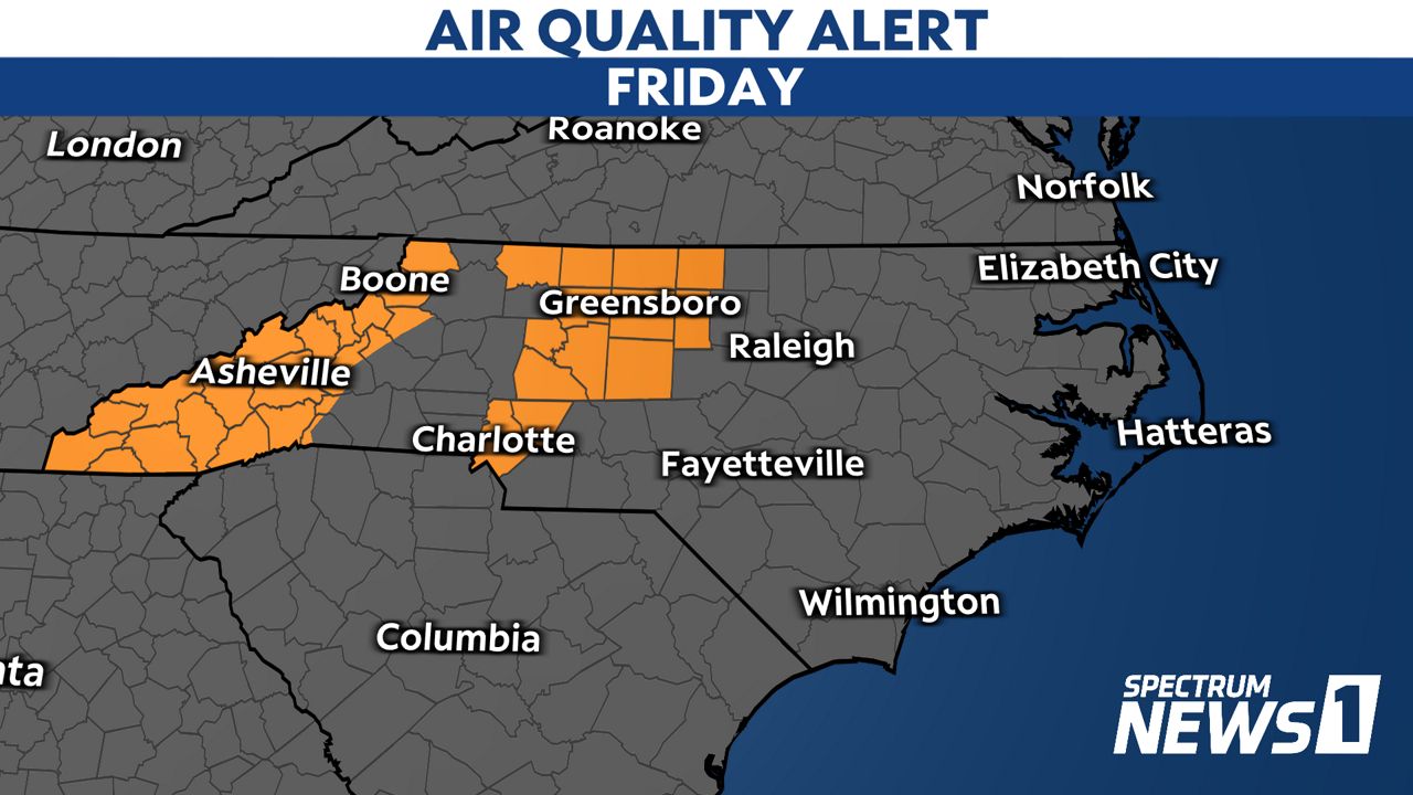
On top of the heat being uncomfortable, air quality is also a concern in the mountains and piedmont of North Carolina. A Code Orange Air Quality Alert is in effect until 8 p.m. Friday.
Code Orange means that ground level ozone concentrations within the region may approach or exceed unhealthy standards, especially for sensitive groups (i.e. young children, older adults, people with health conditions, etc).
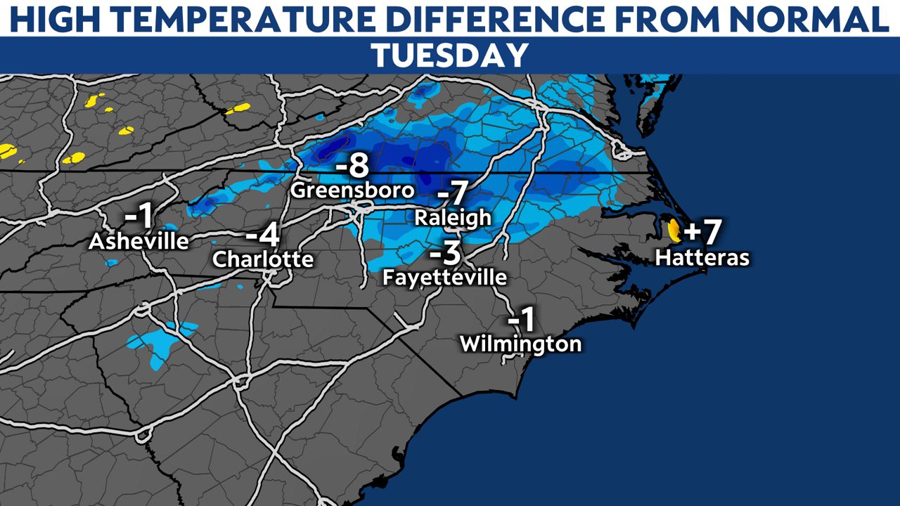
A strong cold front moves in on Sunday evening. Cooler air moves in behind it, along with rain and thunderstorm chances. You might not feel the effects of the cold front Sunday, but the cooler temperatures will be more evident early next week.
A spread of temperatures in the 60s, 70s and 80s are possible across the state Monday and Tuesday.
