May is usually one of the more active months for severe weather in North Carolina, and Monday we'll see a chance for some of that severe weather across the state.
A cold front will track across the Carolinas Monday ahead of some warm and muggy conditions across the state.
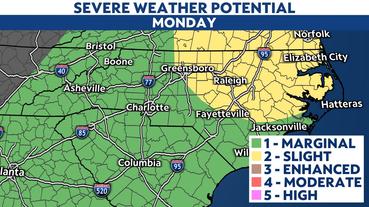
The risk for severe weather will gradually increase later in the morning in the western portions of the state, with storms moving through the Piedmont to reach the Coastal Plain in the afternoon and evening.
The Storm Prediction Center has now highlighted much of the state for a "marginal to slight risk" for severe storms.
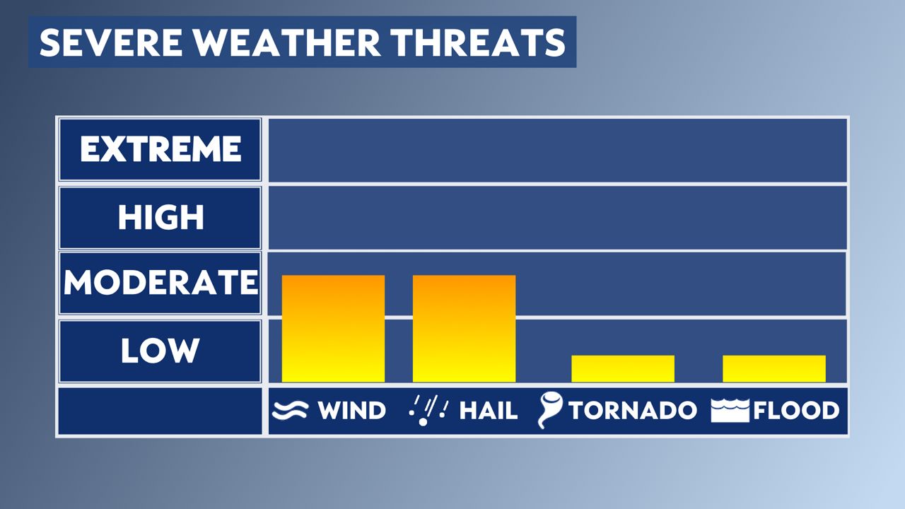
The primary threats from any severe storms will be damaging wind gusts and hail, but a brief tornado or two is possible too.
If a Tornado Warning is issued, seek shelter in a small, interior room on the lowest floor of a sturdy building. Basements, closets, hallways and windowless bathrooms often provide the best protection during a severe storm.

The severe weather threat should come to an end in eastern North Carolina by midnight.

Slightly cooler weather is in the forecast across the state for Tuesday, although a daily chance for pop up showers and storms returns later in the week.
Stay tuned to Weather on the 1s on Spectrum News 1 for updates.
Interactive radar | Share your weather photos with the Weather on the 1s team