


We'll all need to keep a close eye on radar through tonight across North Carolina. Be sure you turn on your severe weather notifications.
A potent storm system with a history of producing severe weather will track toward the Carolinas through Thursday morning.
There have been several reports of tornadoes in Texas on Monday and in Louisiana on Tuesday.
The approaching system will likely be weaker than the storms that rolled through the Gulf states.

However, scattered strong storms are still possible here.
Early rain and cloud cover may help to inhibit storms in the western portion of North Carolina.
However, any sun that happens to break out through early afternoon could create more instability in the atmosphere. That would be fuel to increase the severe storm threat.
The primary storm threats are expected to be damaging wind gusts and hail. However, there's also a low risk for a few tornadoes. Flash flooding is also a concern under heavy downpours.
It's important to note, damaging wind gusts of 60-70 mph can do damage equivalent to an EF0 tornado.
Make sure you have a way to receive weather alerts Wednesday and Wednesday night.
If a warning for a severe thunderstorm or tornado is issued for your community, seek shelter in a small, interior room inside a sturdy building. Basements, closets, hallways and windowless bathrooms often provide the best protection during severe weather.
Showers and storms are ongoing at across the mountains, but the lack of instability might limit the severity of the storms. The lowest of the risk categories exists here for the rest of the day.
By midday, the rain and storms will cross over into the Western Piedmont. However, instability and fuel for storms will be limited. While severe storms are possible during this time frame, they don't look to be widespread.
By mid-afternoon, all the ingredients necessary for storms will come together across the Piedmont and west of I-95, and we think this will be the most likely time for severe storms to get going.
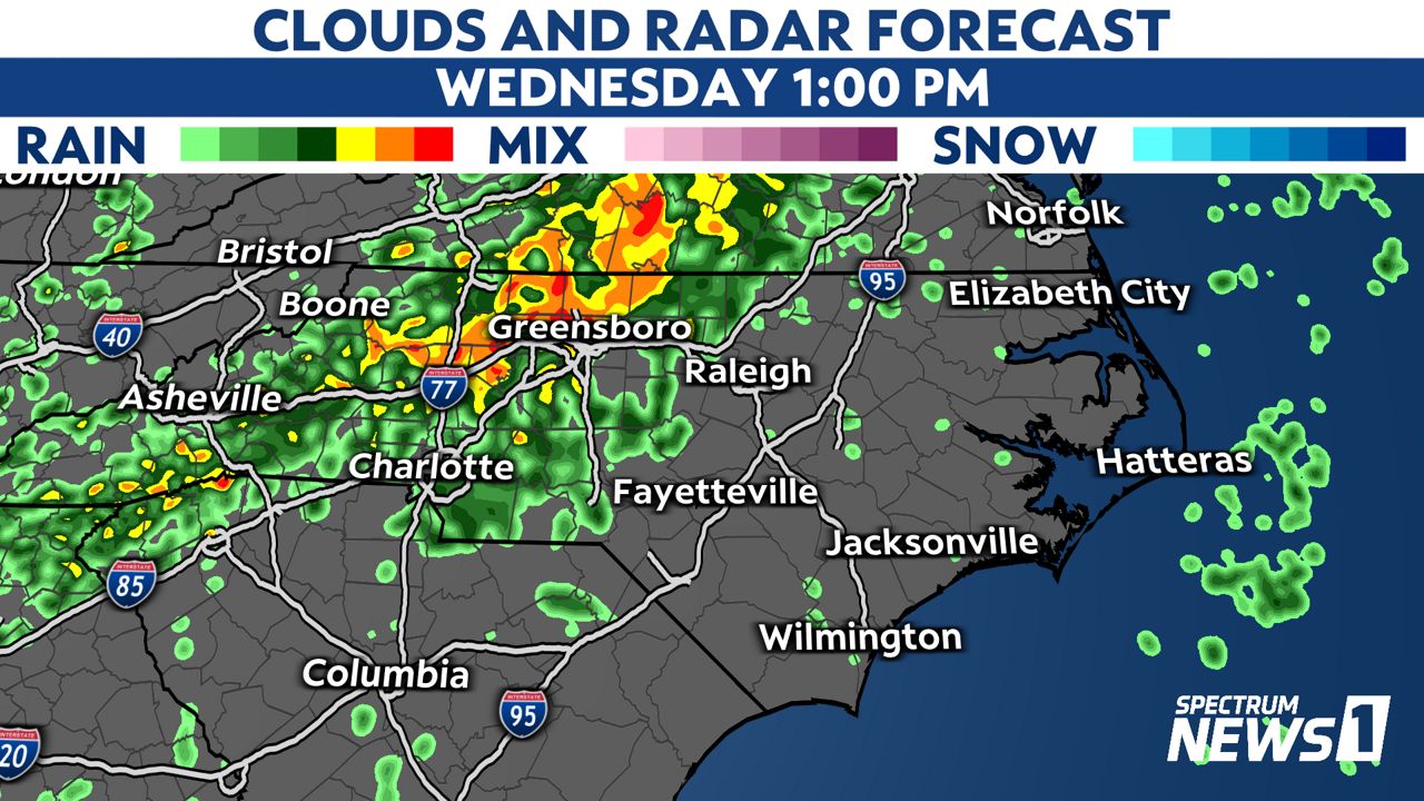

The organization of the storms will be messy, and we'll have to monitor individual storm cells.
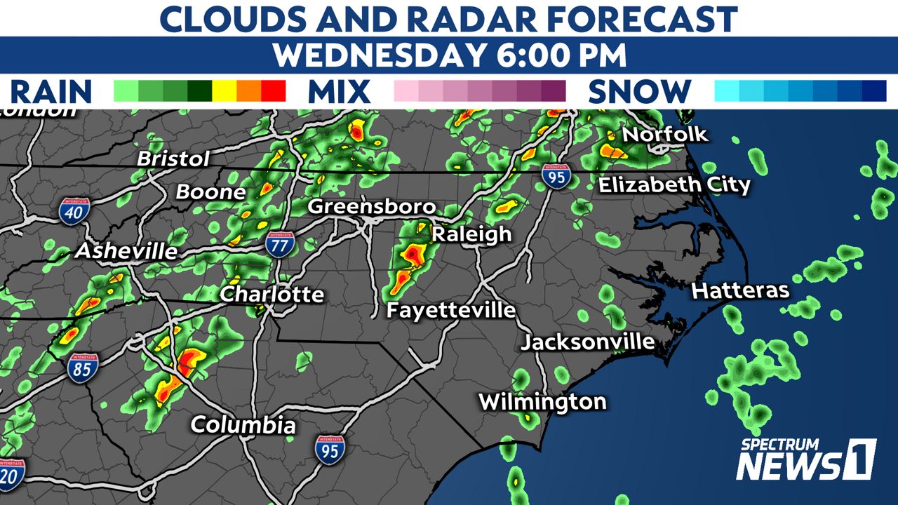
During the evening and overnight hours, the storm threat shifts to the Sandhills and across the Coastal Plain. Any storms that form will have an untapped atmosphere to draw from, including a strong jet of warm, moist air and very strong shear.

The threat of severe storms will then continue across the immediate coast after midnight.
While the storm threat will come to end everywhere by around sunrise Thursday, rain may continue in eastern North Carolina through most of Thursday.
Eastern North Carolina could see anywhere from one to three inches of rain late Wednesday through Thursday.
Stay tuned to Weather on the 1s on Spectrum News 1 and the Spectrum News app for updates.