


In the early spring of 1987, a surprise winter weather system dumped over a foot of snow over parts of North Carolina.
That was the finale of an active winter across North Carolina, and the most active winter weather that season was in the western parts of the state.
This also was my first spring semester at the University of North Carolina at Asheville. That winter season brought three major snow events and many smaller ones.
And to wrap up winter in 1987, the biggest winter storm of the season waited until early spring to occur.
How wintry had it been that year? It was wintry enough that the school canceled my Monday, Wednesday and Friday 8 a.m. chemistry class 10 times that semester. So when spring rolled around in March, we thought we had put winter in the rear-view mirror.
But that would not be the case.
I will never forget the conversation in the weather lab at UNCA on that Thursday.
We were all talking about this big storm system heading toward North Carolina. We thought we were going to get lots of rain with the system and were all saying that if this storm had occurred in January, February or even March, we'd be looking at a big snowstorm.
We wanted another big snow, and we thought that possibility was pretty much non-existent.
Beyond talk of the impending weather system was the fact that the Concorde airliner was landing at the Asheville Airport that afternoon.
As a matter of fact, the plane flew over the campus and I got to see it from a window where I was in a late afternoon chemistry lab.
After class ended, I headed to Canton, just west of Asheville, where I lived that semester. That night, I went to bed with the clock set for 6:20 a.m. for that 8 a.m. chemistry class on Friday.
At 6:20 on Friday morning, the clock went off, and I got up. The first thing I did was look out the window. The second thing I did was gasp because all I could see was snow.
Not only was there 6 to 8 inches of snow on the ground, but it was still coming down and coming down hard.
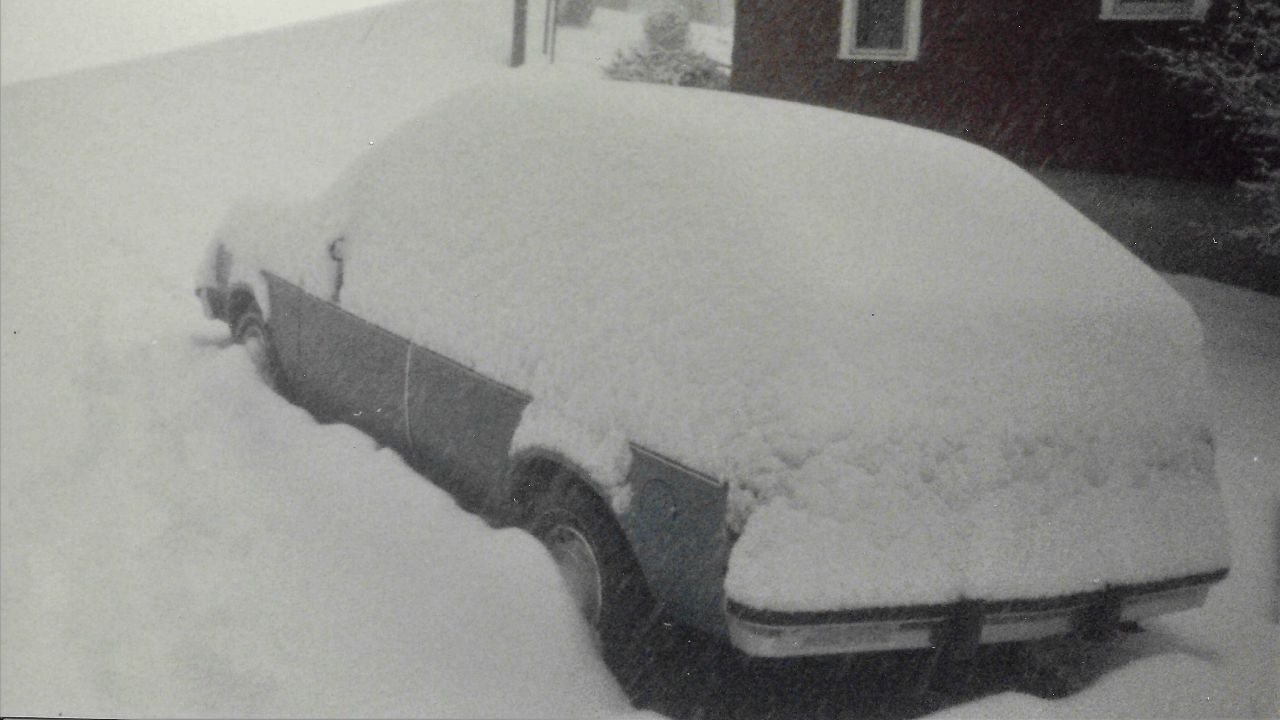
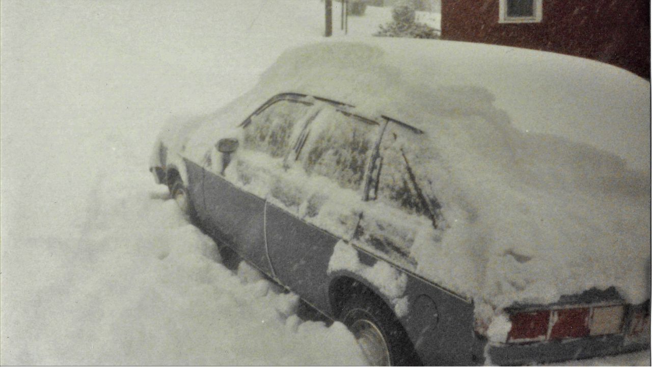
I looked out at my Chevy Chevette in the driveway and knew I wasn't going anywhere.
I turned on the TV and caught the morning weather update on WLOS, the TV station where I would start my weather career less than two years later.
They announced that classes at UNCA were delayed until 10 a.m. I looked back out at my car, now under almost a foot of snow, and said, "I'm not going to school today," turned off the TV and went back to bed.
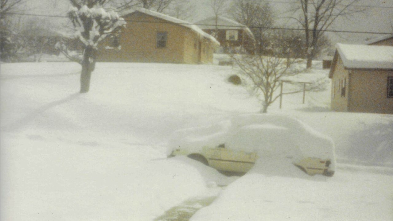
After another three hours of sleep, I popped out of bed to not only see well over a foot of snow on the ground but the snow still falling.
I actually went out and shoveled the driveway, only to find it covered again an hour or so later.
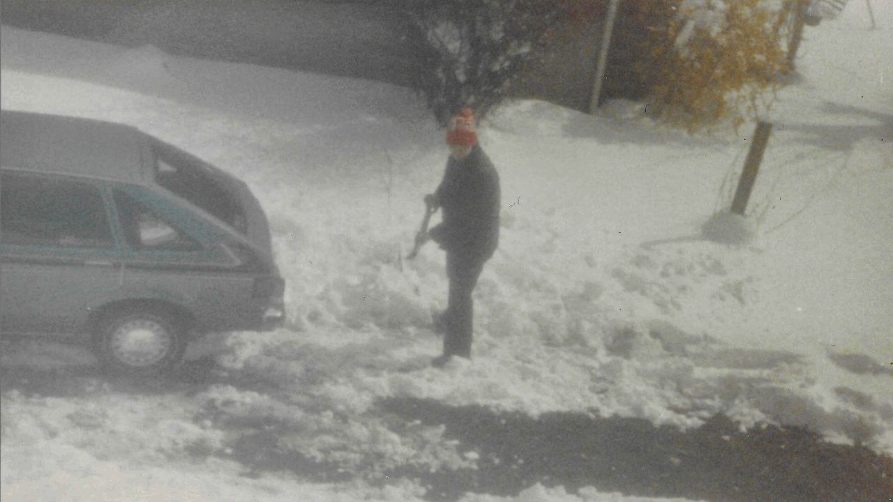
The snow finally tapered off toward the evening.
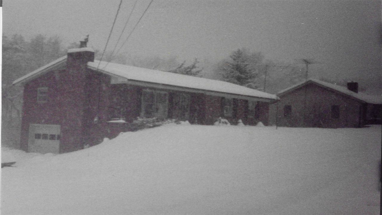
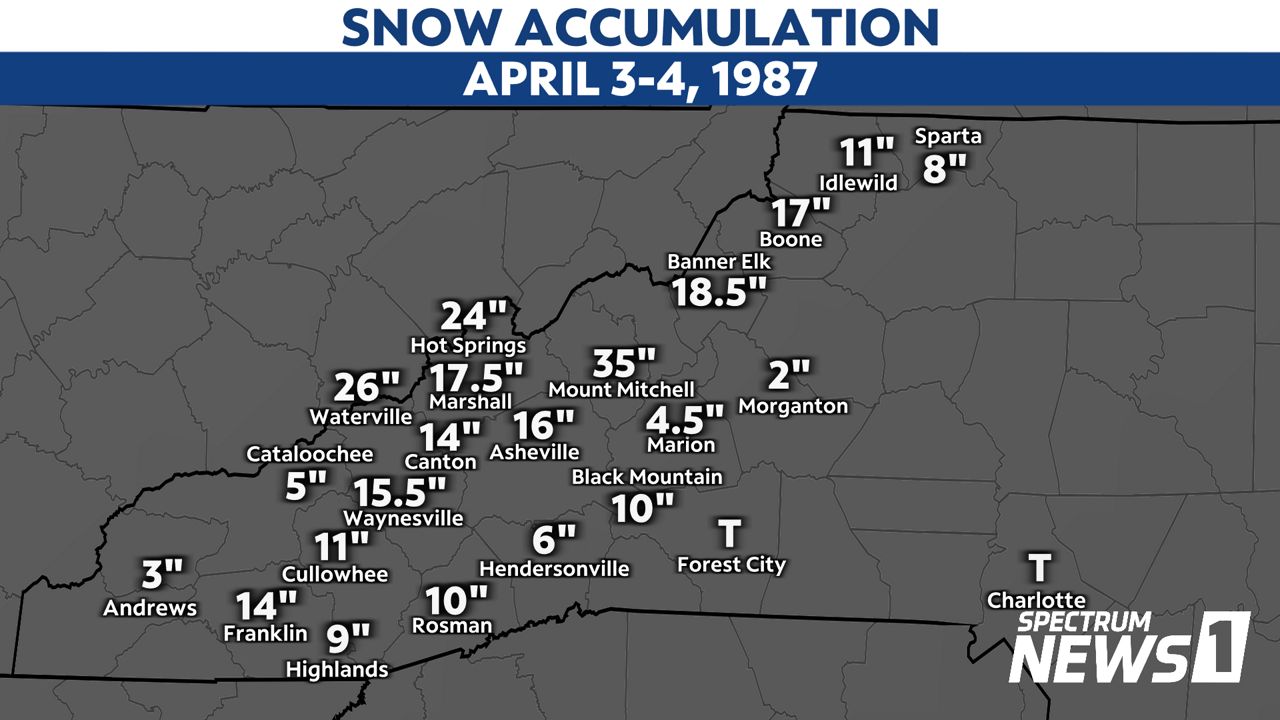
The massive storm dropped over a foot of snow across parts of western North Carolina. Almost 3 feet of snow piled up at Mount Mitchell. From Boone to Banner Elk to Marshall to Asheville to Canton to Waynesville to Franklin, over a foot of snow fell.
Along the North Carolina-Tennessee state line, two feet of snow fell from Hot Springs to Waterville.
Where I was at in Canton, there was 18 inches of snow. It was the most snow I had ever seen in my life. That amount was eclipsed six years later in the March 1993 Blizzard when I had to deal with over two to three feet of snow, but that's a story for another time.
There was so much snow that the Concorde was not able to depart the Asheville Airport on that Friday. It was delayed until Saturday.
Interestingly enough, by Monday afternoon, less than 72 hours after the snow stopped falling, you could see the ground, noting how quickly in can warm up in April and melt that wintry precipitation away.
And after that storm, even us die hard weather students were ready for warmer weather and real spring.
So what went wrong with the forecast? Low pressure intensified more than expected and then it was game on for a winter storm.
That storm proved to me how difficult winter weather forecasting can be. A slight variation in track, intensity, cold air or moisture can throw a forecast out the window.
Thankfully, weather forecasting has evolved to where these "surprise winter storms" are less surprising. But many times I think of the April 1987 "Surprise Winter Storm" as we go into a winter season, wondering if any more winter surprises lie ahead.