CENTRAL N.C. -- The threat for flooding will increase late Wednesday and continue through Thursday as a rainy pattern continues.
Everyone in central North Carolina has seen at least a half inch of rain since Monday. Some locations haven seen over two and a half inches.
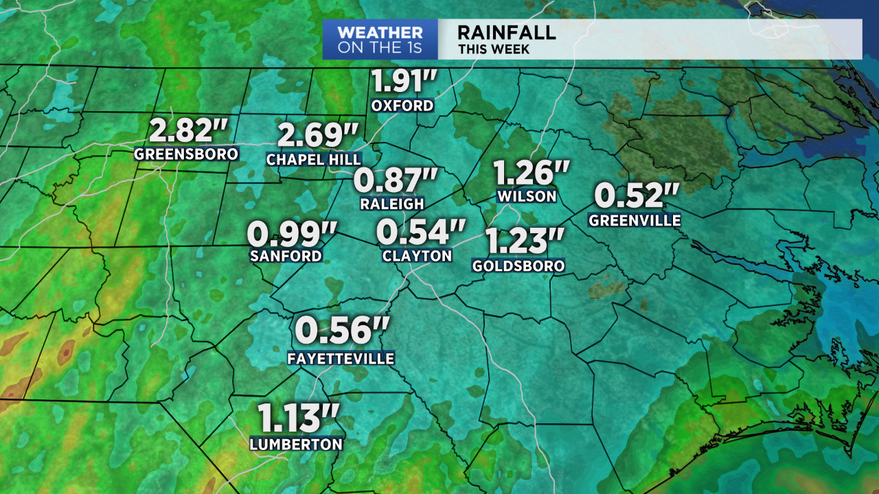
The latest forecast data suggests an additional two to four inches will fall through the rest of this week. Some locations east of the Triangle could see a little less, but it's also possibly that some spots to the west could see a bit more.
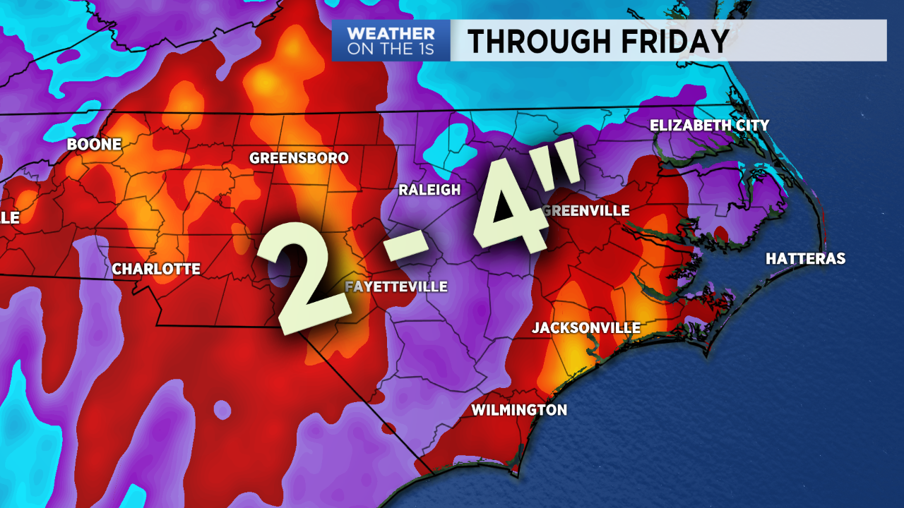
The heaviest of the rain that's to come will likely fall from late Wednesday into Thursday.
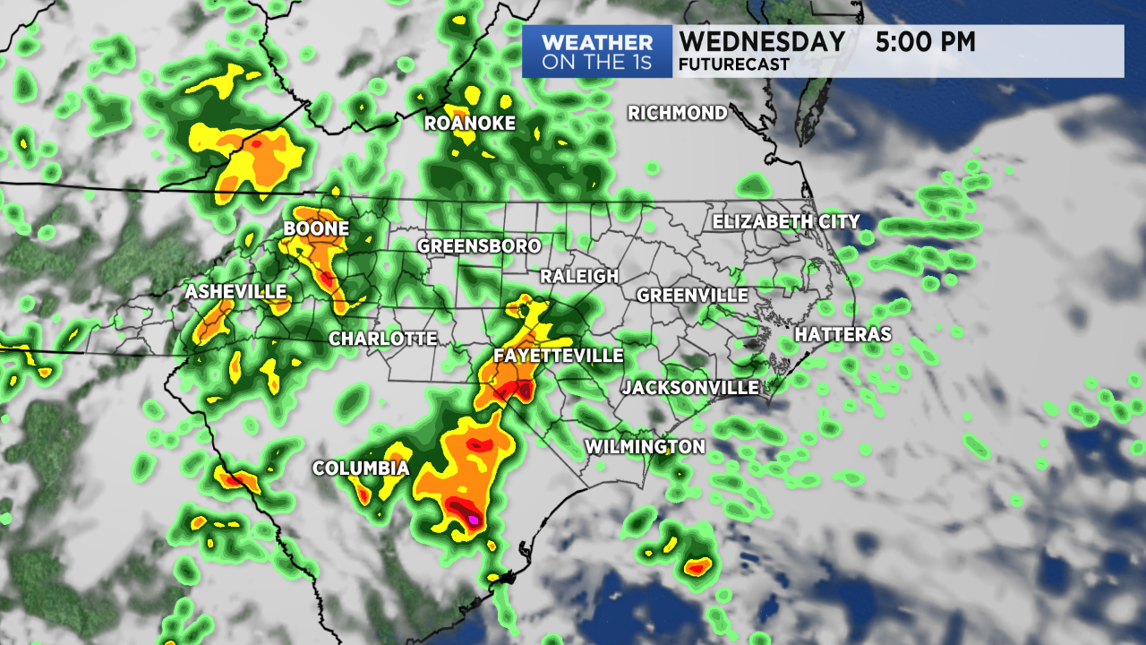
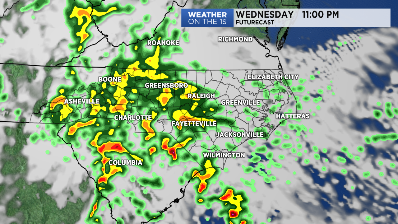
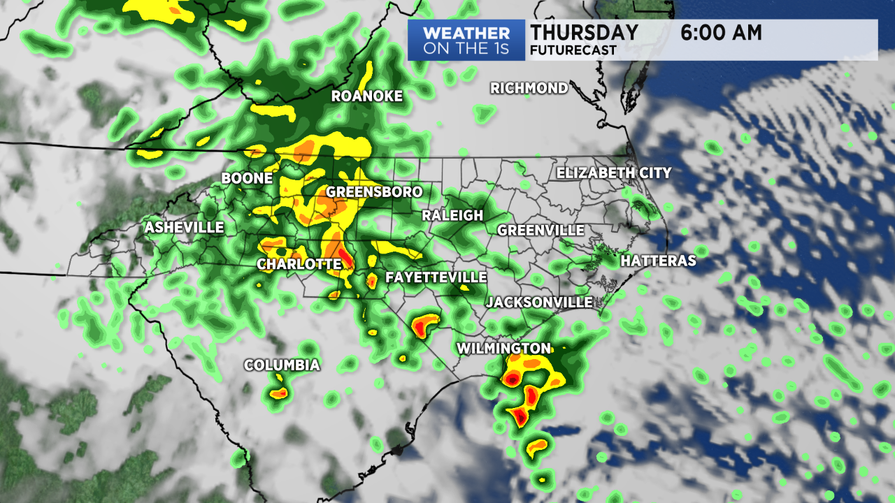
The heavy rain on top of an already saturated ground will cause the threat for flooding to increase. Flooding can be especially dangerous at night because it is difficult to tell how much water may be covering a road.
It only takes around a foot of flowing water to float most cars, SUVs, and even trucks off a road. If you see a flooded road, you should turn around and find another route.
Low pressure in the mid to upper-levels of the atmosphere is responsible for this week's soggy weather in the state. The low has become cut off from the currents in the atmosphere that steer weather systems across the country.
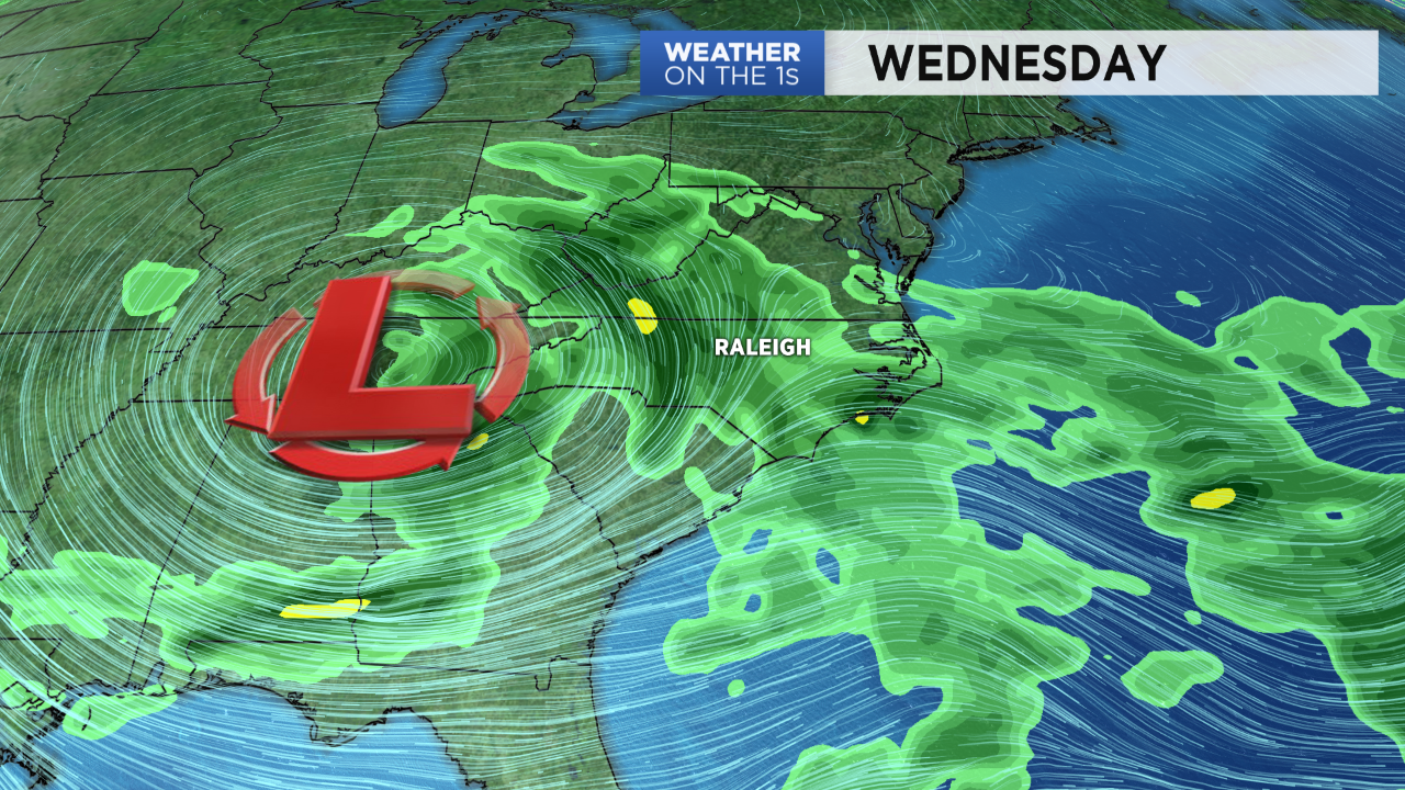
With that low stuck west of us, the wet weather pattern likely will not come to an end until around the start of the Memorial Day weekend.
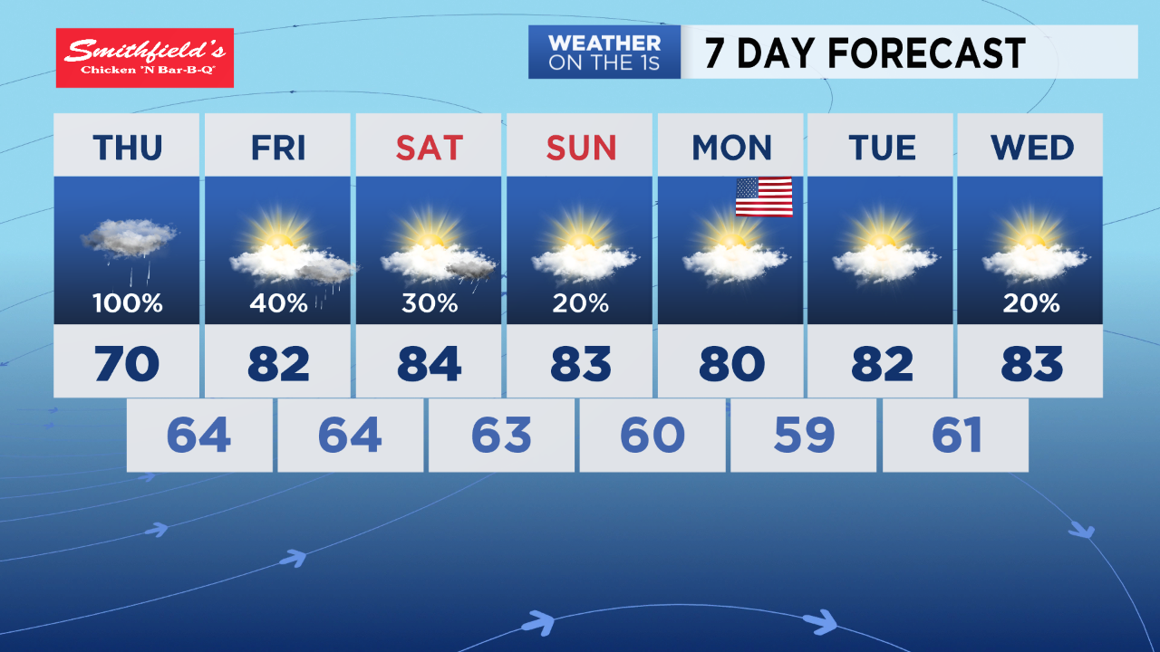
The low should start to break down by Friday and Saturday. That means we should not see as much rain those days, but scattered afternoon thunderstorms could still form.
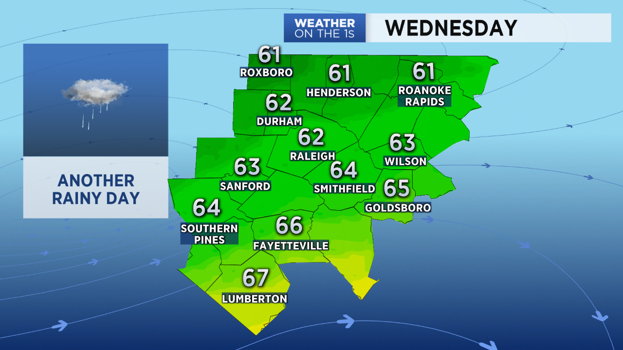
Wednesday's rain will keep temperatures quite cool across central North Carolina. The Triangle may only see highs in the low 60s. Warmer temperatures will return by the end of the week and the holiday weekend.
Follow Meteorologist Lee Ringer on Facebook, Twitter, and Instagram.


