


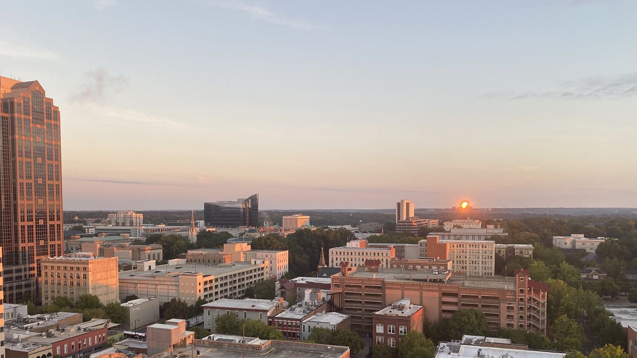
As thousands of new residents come from across the world to Raleigh, growing pains are evident as traffic, infrastructure and affordable housing needs grow.
And at the center of it, the Raleigh Planning Department is tasked with shaping the future of the city and its new residents.
Pat Young heads up the Raleigh department, overseeing a staff that helps enforce regulations and guide the growth in the city. In this Spectrum News 1 interview, he explains the role, powers and limitations of the department.
The interview is Young’s words in response to questions from Spectrum News 1. The interview was edited for brevity, clarity and style.
Spectrum News: Walk me through if someone asked you, what’s your job and what’s your department, what would you say?
Pat Young: I would say that it’s supporting city council and the community in helping set the vision for future growth in Raleigh and help implement that vision. Another thing we do is enforce the city’s building code to ensure buildings are safe. Those are the two big things we do. What we do not do is make rules regarding future development or make final decisions in changes in land use. That is withheld for the city council, who is our elected body, as is appropriate. We do review developments that already have an approved use through zoning -- zoning is what sets and allows for different kinds of uses. So if somebody wants to do an office building, and an office is allowed in their zoning district, staff can review and approve that based on rules adopted by city council. The rules will include things like treatment of stormwater runoff, set back, height, building materials and things of that nature. But we can’t approve changes in land use, that has to go to the city council. We make recommendations to the city council based on community input and best practices.
SN: Planning and development is in the name of the department, but y’all aren’t developers. So what is the role of the department when working with developers in the city?
PY: Over 95% of what you see coming up is the private sector. Sometimes we have partners in city government, county government, state and federal government develop land, but it’s usually the private sector or nonprofits. So we work with those folks to make sure they understand the city’s vision and understand the city’s rules and try to help them along the process. We as a department do not have the ability to stop development. Either it can be approved under city rules as adopted by city council or they can petition city council to change their zoning, which again is that range of uses allowed.
SN: So if a developer has a piece of property, it meets all the rules and requirements, is there still a department process they must go through?
PY: They still have to go through our office to undergo a very rigorous review process. We have about 600 pages of rules about what you can develop and what the rules are for development. I mentioned stormwater runoff, height, setbacks and transportation access. There’s a large number of areas we look at, like utility service, so our staff will review that against council adopted rules, and if they meet those rules, we have to approve it. If it’s consistent with the land use and the zoning. If it’s not consistent with zoning, they have to go to council for a zoning change.
SN: What is the correlation between development happening now and the longer term plans for the city?
PY: There is a relationship. When we have a roads plan, for example, someone comes in with a new development that will trigger additional traffic, if we have a road plan in place, we can ask for additional right-of-ways that is essentially land that is used for future roadway expansion. We can also require the roadway be improved if it is a significant enough impact. But typically we work with developers to mitigate the impact of their developments on traffic through things like turning lanes, traffic signals and other things if their development is causing significant impacts. So there is a close coordination between our operational plans, transportation plans and zoning.
SN: What long-term comprehensive planning documents does Raleigh have? When were they adopted and when will they be updated?
PY: The plan was last updated in 2013. A new plan was adopted in 2013 and it was updated in 2020. It really focuses in on making sure there is adequate infrastructure to keep up with growth, to make sure we focus growth in activity centers where there is high level investment in infrastructure and transit, and then some recent updates have encouraged a greater diversity of housing types across the city, so duplexes, triplexes, small garden apartments, things that before World War II you saw in almost every neighborhood, but we largely got away from since World War II. We think that is a great way to grow gently and incrementally and accommodate growth. If we don’t accommodate growth, the price acceleration we’ve seen over the past few years will continue to get worse.
SN: A lot of the job seems technical, following rules and regulations. But what parts of the job involve community input and wishes?
PY: Public comment and public input is the most important part of what we do with our growth plans. We really take it seriously and listen to all of the folks that provide input when we do the text amendments. A text amendment is changing the rules for how development can happen and zoning is changing a specific piece of land’s appropriate uses. Both of those have a public input process. We have a portal where people can submit online comments and we will provide a response, and then those are available for everyone to see. So those are questions and answers that everyone can see on proposed rule changes and zoning changes are available on that portal.
SN: A lot of folks are probably wondering why can’t the city just stop development. Is that even a nuclear option or is outright stopping it out of the equation?
PY: There are a lot of rights that private property owners have to develop their property. If they can argue we are preventing them from doing any development there are legal concerns with that. In general, I’ll say this. We have one of the best, most attractive regions in the country and we have people all over the world that really want to move to the Raleigh area, and if we don't find ways to accommodate residents that demand will remain constant and could accelerate the price pressure we see already happening. We overly restrict development, and we continue to have higher demand, that’s going to lead to higher prices and less affordability. We really want to keep our city open to people in all points of life and all points of income.
SN: How much does density play into guiding development?
PY: It’s really important to make sure our public investments are efficient. You’re probably aware of our bus rapid transit lines that are for high frequency bus service routes that are going into the north, east, west and south. Those are only going to be successful if we have enough destinations and enough density of housing to support them. So we do think in the right location density is important. I mentioned earlier we have activity centers in our comprehensive plan that we want to have the highest density, but we do think modest, gentle incremental density throughout the city is a good way to make sure we are accommodating all different housing types and all different folks coming to our area.
SN: You’ve mentioned stormwater already, but how does planning address climate change?
PY: Land use is one of the huge drivers of climate change along with transportation. And of course, land use and transportation are closely linked. We are really focused on sustainability and one way we are trying to do that is trying to have more transit supportive development. So development that has enough high quality destinations and residents that we get efficient uses of our buses. The idea is to have in many parts of the city a bus in front of people’s houses every 15 or 20 minutes. That’ll make sure there is less reliance on single occupancy vehicles and get at the climate problem through increased use of transit. And working with our partners in stormwater management to manage the impacts on water quality for development.