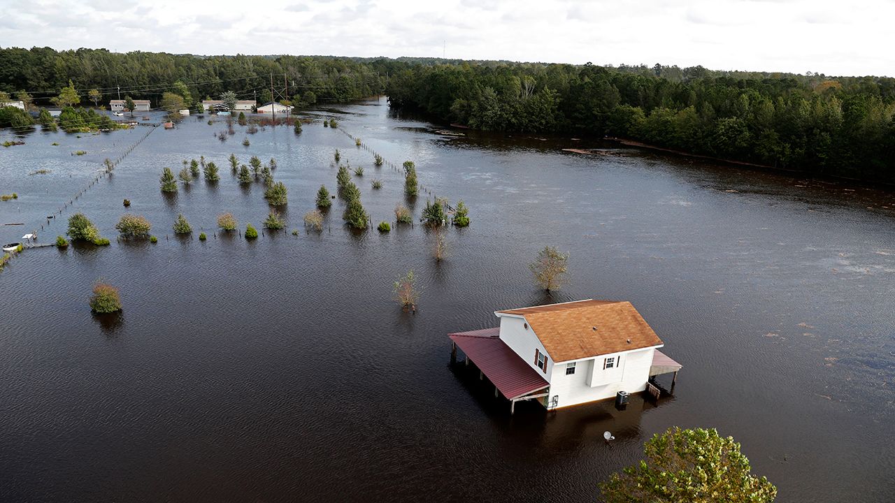
First came Hurricane Matthew in 2016. Then Hurricane Florence two years later. The slow-moving storms brought torrential rains to southeast North Carolina, swelling rivers way past their banks to historic flood levels.
Since those floods that devastated communities along the Lumber River, the state has been working to measure how vulnerable communities are to climate change. Local government councils, working with the state, are preparing a series of reports to improve “climate resiliency” for communities in eastern North Carolina.
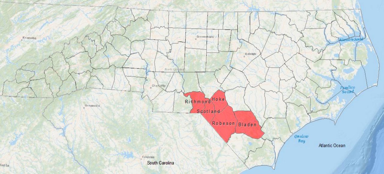
The Lumber River region, which includes the five counties from Rockingham to Whiteville, faces stark challenges from climate change.
“Over the next 30 years, the Lumber River region will experience increasing climate-related natural hazards,” according to a new draft report released by the N.C. Office of Recovery & Resiliency. “Climate scientists project that heavy rainfall and flooding will increase, severe weather will intensify, the number of very hot days will increase, and drought and wildfire may become more common.”
The report on the region is just a draft. The state and the counties are looking for public input as they finalize the vulnerability assessment and ideas to help make the communities along the Lumber River safer from climate disasters.
The report focuses on five counties along the South Carolina border: Bladen, Richmond, Robeson, Hoke and Scotland counties. It’s a mostly rural, low-income area. The region is named for the Lumber River, which runs north of the border before turning south to South Carolina.

“The Lumber River region was significantly impacted by both Hurricanes Matthew and Florence. Though it has been several years since these storm events, the residents of the Lumber River region continue to face challenges created by an increase in natural hazards, mainly flooding,” according to the report.
“However, the strong-willed character of the people living in this region, coupled with firsthand experience in dealing with flooding, have set the tone for many in the community to prepare for these hazards,” the report authors note.
When hurricanes Matthew and Florence dumped feet of rain on the region, the Lumber River rose, swamping towns and farmland.
Local, state and federal officials are already working on several major projects to make the five-county region better prepared for major floods, according to the report.
The strategies include buyouts for flood-prone properties in Bladen and Robeson counties. There’s also work to improve Interstate 95, which runs over the Lumber River and was cut off during the last hurricanes in the area.
Officials are also working on plans to replace or repair dams in Hoke and Bladen counties.
Pembroke, North Carolina, which sits along the Lumber River, studied stormwater in the town and developed a list of maintenance and capital improvement projects to help avoid flooding. To the east, Lumberton is working on a floodgate project to stop water flowing through an overpass for Interstate 95.
Lumberton is also working on a trail network to preserve hundreds of acres within the 100-year floodplain. Lumberton, which sits along I-95 near the South Carolina border, was one of the hardest hit cities during Hurricanes Matthew and Florence. The storms inundated Lumberton and caused upwards of a billion dollars in damage.
The report includes six projects that need more attention:
- Improve emergency shelters and find locations for more shelters
- Emergency management agencies, include state, federal and organizations like the Red Cross, need to improve communication
- Counties, towns and cities should do more in zoning and permitting to keep development out of floodplains that will be vulnerable during the next big storm
- Local governments need to work together to maintain streams and repair dams
- Alternative energy like solar could be used as backup power
- Continue to enhance broadband internet service in the region
The report notes hurricanes and extreme flooding are the top concern for people in the Lumber River region. But drought and extreme heat also pose risks to the area.
“While Lumber River region residents consider extreme heat to be a lower-priority concern relative to other natural hazards in the region at present, climate science studies indicate extreme heat may become a dangerous threat in the region’s future,” according to the report.
Drought too poses a risk, despite the hurricanes and flooding that most people worry about.
“The Lumber River region is particularly vulnerable to drought given the regional importance of agriculture and the prevalence of homes which rely on private wells for drinking water,” the report states.
A big part of the study looks not just at the risks from climate disasters, but how vulnerable the people are to events like floods and extreme heat.
Given the region’s agricultural economic base, the threat from extreme heat is high because many people work outside. And in a low-income area like the Lumber River region, fewer people can afford to cool their homes. That includes an aging population and a high number of people with disabilities, the report states.
“Many residents live below the poverty line. Communities in the Lumber River region have lost residents due to displacement after disasters as well as the loss of jobs, tax base, crops, and infrastructure failures,” according to the report.
Programs to help the area deal with floods should also focus on helping people displaced by flooding stay in their communities with affordable housing after the waters recede.
“Despite these challenges, the Lumber River region has unique assets that support efforts to build resilience. Many residents have longstanding ties to the region, which ensures that local solutions are grounded in local realities and local leadership,” according to the report.
“Through the difficulties of surviving and recovering from two major hurricanes, the region’s residents and local leaders may have more first-hand understanding of resilience than in any other place in the state,” the report says.


)

