


Well, March feels like it’s flying by, but the active severe weather season continues here in the Lone Star State. What weather can Texas expect and plan for in April? Let’s look together with the April outlook from the Climate Prediction Center.
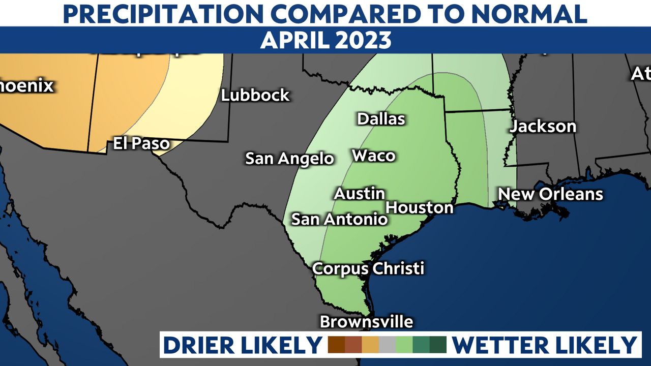
The Climate Prediction Center has issued the April outlook, and the confidence is high that above-normal temperatures will continue across Texas. What's optimistic? The rain or precipitation outlook. Areas of green below show where above-normal rainfall is likely from north to south Texas.
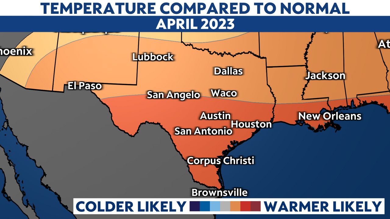
For parts of south Texas, 90s and 100s have already occurred, so with more heat likely in the April outlook, there's a growing concern for drought conditions to spread or worsen. There could be a few more pleasant and mild days into mid-April, but heat stress is a concern if early-season heat continues for parts of the state.
Rapid wildfire growth is also a concern. Cold fronts that clear parts of the state will bring gusty winds and low humidity, and with dry vegetation and drought conditions already in place, fires that start could grow and spread rapidly.
Lets dive into the reasoning behind the above-normal rain outlook from north to south Texas. March has been an active storm season for not just the U.S., but also for Texas, and this trend may continue into April and even May. The recent pattern and track of fast-moving disturbances may shift farther south. This pattern would trend the warmer-than-normal temperatures, but could also lead to a setup for heavy rain events.
However, this potential wetter-than-normal pattern doesn’t look likely statewide. Drier than normal conditions are likely in far west Texas, including El Paso, and equal chances of rainfall probabilities are expected from Big Bend to the Panhandle.
Since this is a longer-term outlook and not a short-term forecast, it’s hard to know exactly where future storm systems will track, and ultimately where the heaviest rainfall wind end up. Will there be enough moisture in place when the next upper level system arrives? It’s hard to tell more than a week out, but we’ll be here to keep you up to date with the latest.
As we wrap up spring and head into summer, it’s likely drier and hotter conditions return statewide. We’ll be keeping an eye on the likely development of El Niño by late summer. This pattern may have more of an impact on Texas weather by the fall, but it could affect the Atlantic hurricane season.
Our team of meteorologists dives deep into the science of weather and breaks down timely weather data and information. To view more weather and climate stories, check out our weather blogs section.