Unseasonable and near-record heat continues to be the major story across Texas into the start of the weekend, but then a welcomed change in the weather pattern arrives with a cold front.
Without a change in the weather pattern, it’s more above-average heat and likely new records for most of the state into Saturday.
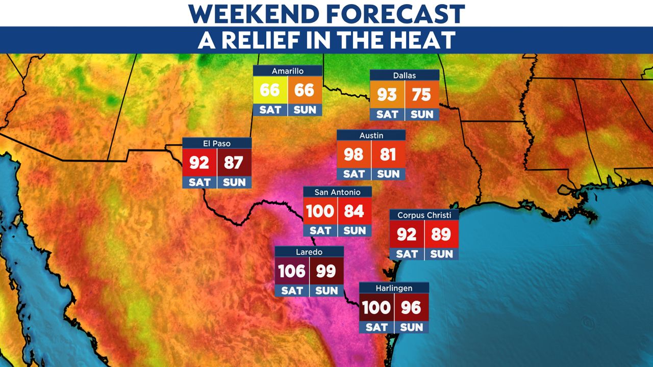
Here’s a look at forecast highs into the weekend. Notice the significant drop in temperatures by Sunday from South-Central to North Texas.
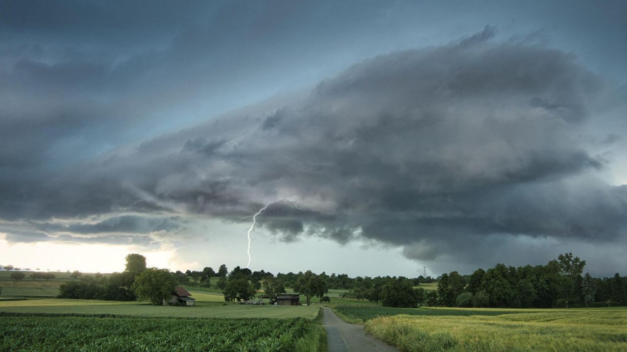
A cold front will arrive in Texas on Saturday and then push into the Rio Grande Valley by Sunday morning. This will be the focal point for much needed rain and storms. The positive? This looks like the beginning of a more active weather pattern for parts of the Lone Star State.
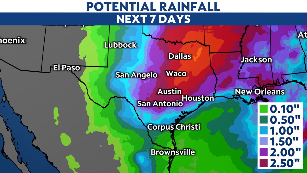
We expect more rounds of rain and storms into next week, thanks to a slow moving upper-level low and another cold front mid-week. This amount of rain could be a drought buster for some across Texas.
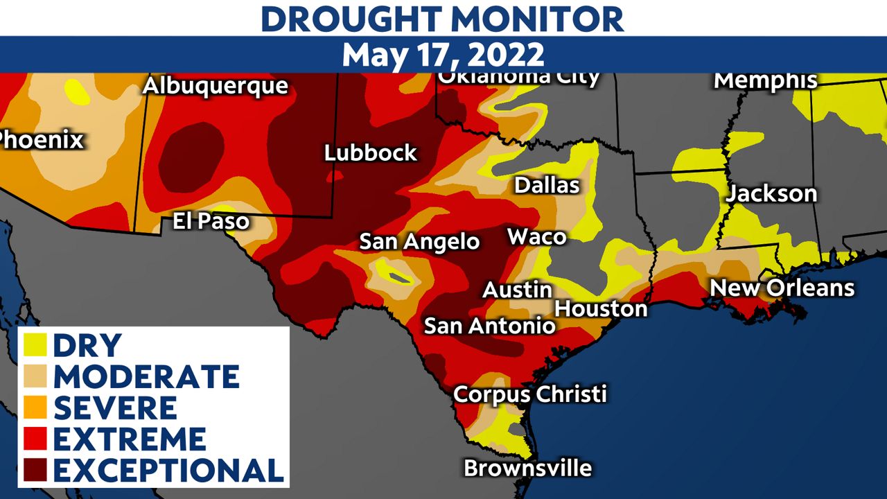
Right now, the worse of the drought is in parts of West Texas, but areas along and west of I-35 continue to find “exceptional drought” conditions expanding.
According to NOAA, the next 7 days may bring 2 to 5 inches of rainfall across parts of South-Central to Central Texas.
So as you make your weekend plans, keep in mind if thunder roars, head indoors!