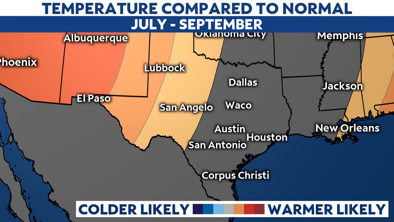
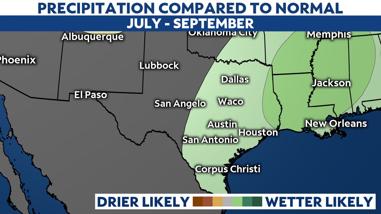
The Climate Prediction Center just released the three-month outlook, and it looks like a tropical influence may impact rain and temperatures across Texas into the summer.
What You Need To Know
- The three-month outlook from the Climate Prediction Center reveals conditions likely in Texas this summer
- Most of the state will experience an equal chance for below, normal or above-average temperatures
- Most of the state will likely experience wetter than normal conditions, especially along and east of I-35
Well, the calendar finally says it's summer, and right on cue, the Climate Prediction Center has released a new three-month outlook that includes July through August.


What can Texans expect? Well, it looks likely that the Gulf of Mexico will continue to influence most throughout the summer. It is still hurricane season, after all.
The temperature outlook shows most of the state will experience an equal chance for above, normal and below average temperatures. West Texas, in the orange color above, will likely experience above-average temperatures.
The precipitation outlook shows most of Texas will find an equal chance for above, normal or below average rain. Areas along and east of I-35, in the green color above, will likely find above-average rainfall.
Why the Gulf of Mexico connection? This outlook is for July through August, and this is close to the peak of the Atlantic hurricane season.
It's likely, even without a tropical disturbance or system, the Gulf of Mexico will have a major influence on the weather pattern for most of Texas (think about daily shower and storms moving inland with the sea breeze), and this summer climate outlook agrees.
The start of summer made me think of the triple-digit heat that's ahead for most of the state, and I was wondering what the hottest high temperatures on record are. I did some climate research, and here are my findings:


