


Southerly winds will increase Friday night into Saturday morning, gusting over 40 mph at times. Temperatures will rise to near or above record levels on Saturday.
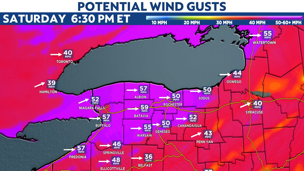
A cold front then sweeps through, and by Saturday afternoon, the wind could gust 50 to 70 mph.
What You Need To Know
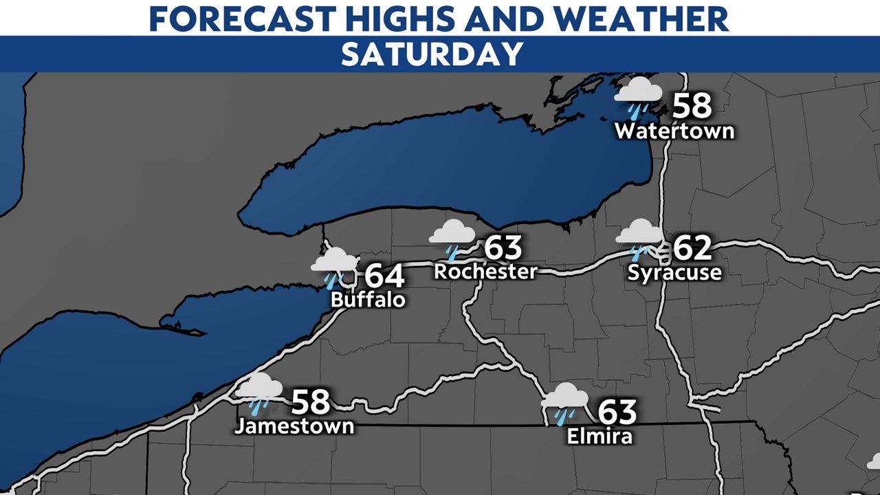
- The record high in Buffalo on Saturday is 61, set in 1899
- The record high in Rochester on Saturday is 62, set in 2015
- Forecast highs are in the low to mid-60s
- Saturday afternoon and evening expected to bring wind gusts of 50 to 70 mph
After several days of cold temperatures and lake-effect snow, much warmer weather is on the way to Western New York. At this time, we are projecting new record high temperatures in Buffalo and Rochester by Saturday afternoon.
A cold front will then sweep through during the afternoon. As we saw on Monday, Dec. 6, there will be several hours of strong southwest winds. The graphic below is projected wind gusts early Saturday evening at a moment in time. We expect wind gusts between 50 to 70 mph at times Saturday afternoon through the evening hours. The greatest threat of winds this strong will be in the purple shaded areas.
The strongest gusts will likely occur in and around Buffalo, Niagara Falls, Rochester and along the Lake Ontario shore up through Watertown. Winds of this magnitude will cause tree damage and potentially topple shallow rooted trees. Pine trees will be the most susceptible.
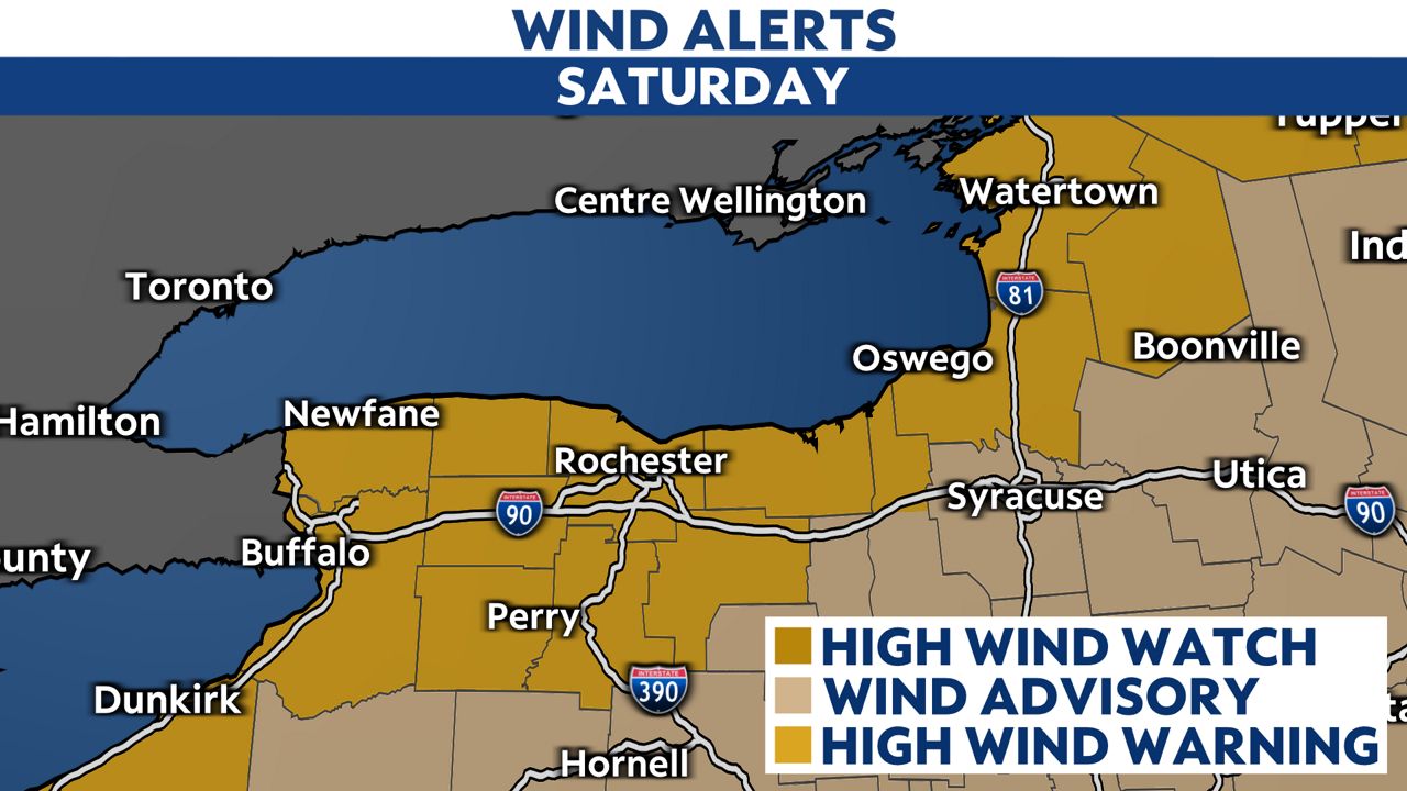
We expect power outages to develop in many of these communities.
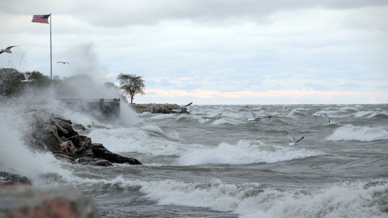
Strong southwest winds will cause rising water levels on Lake Erie and Ontario. The rising water and waves will cause lakeshore flooding and erosion. The wind will shift west and ease later Saturday night.
Keep checking in with our local forecast as Saturday approaches and sign up for weather notifications.