Now that we are a third of the way through March, let's see what we can expect for the next one to two weeks.
What You Need To Know
- We started bitter cold with below-average temperatures
- A record-tying high on the 10th and near 70 on the 11th skewed the average to above
- After our spring fling, colder weather will return
- With history as our guide, it will snow again in Rochester and the Finger Lakes
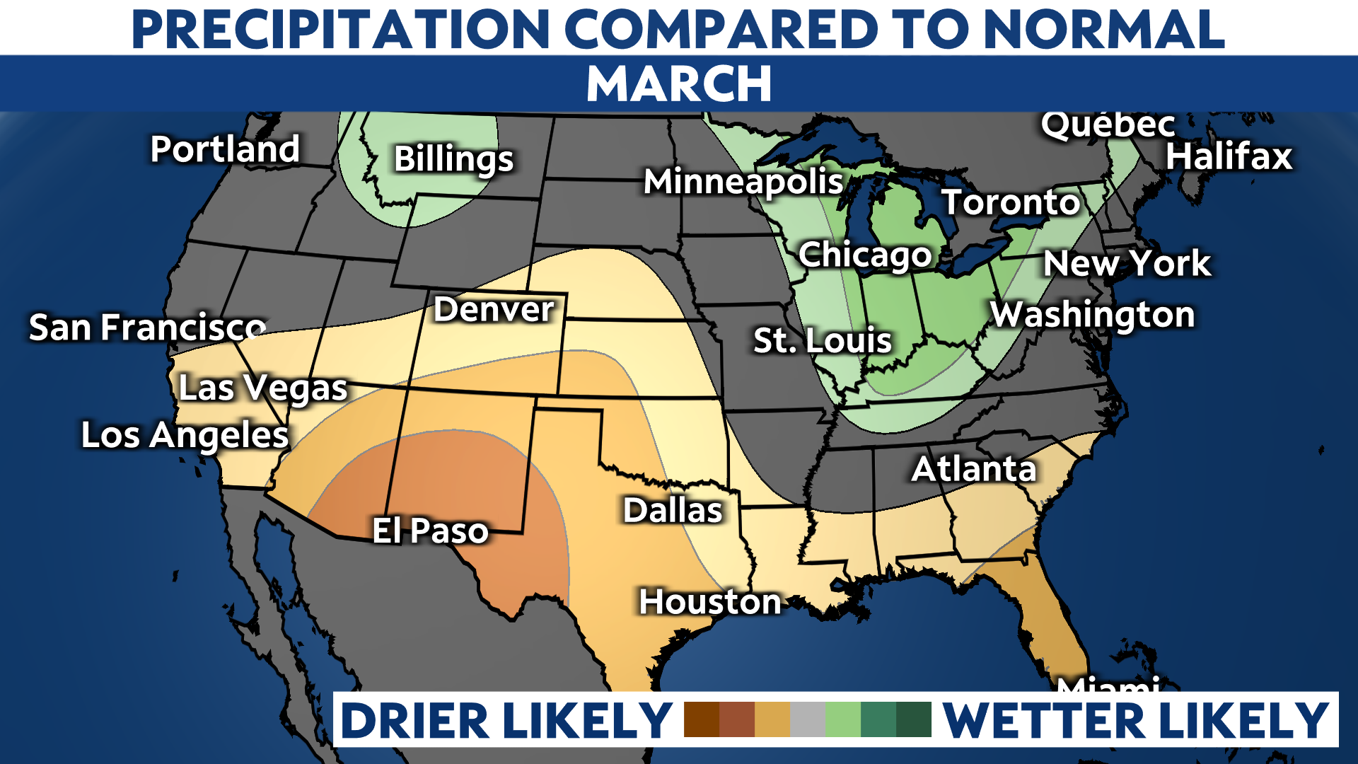
In February, the Climate Prediction Center (CPC) issued its one-month outlook for March, with warmer than average temperatures and above-average precipitation.
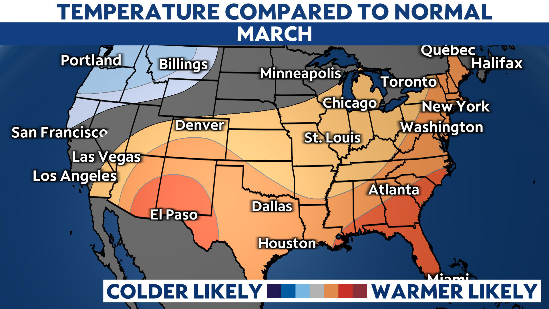
The forecast for the month was for above-average temperatures and precipitation.
Through March 10, our average temperature is close to the monthly average, thanks to the big warmup on the 10th. After soaring to near 70 on the 11th, the month is now running above average.
Precipitation is running below average for the first 11 days of March.
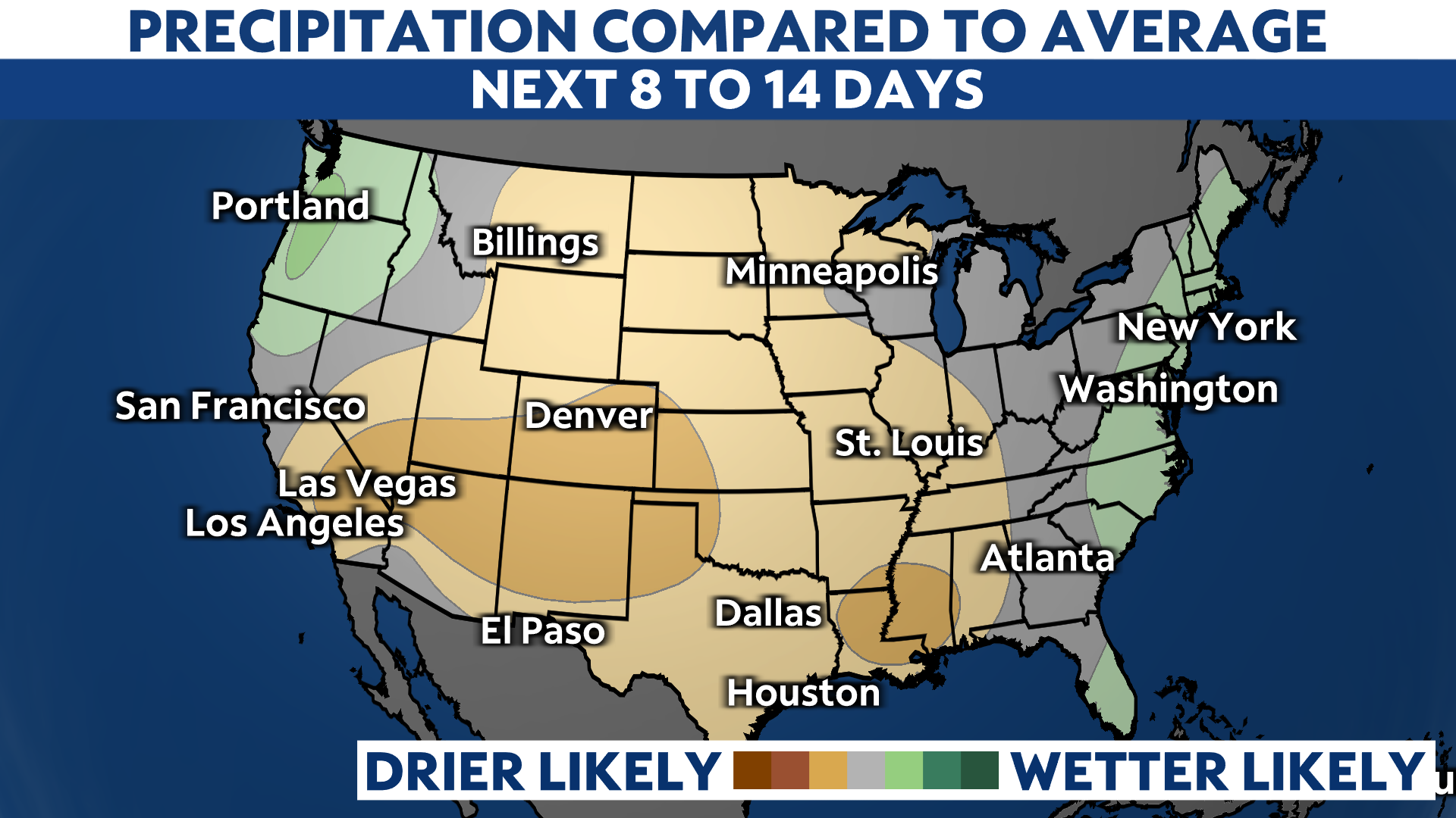
The CPC issued the following for the next 8 to 14 days: a continuation of above-average temperatures and just average precipitation.
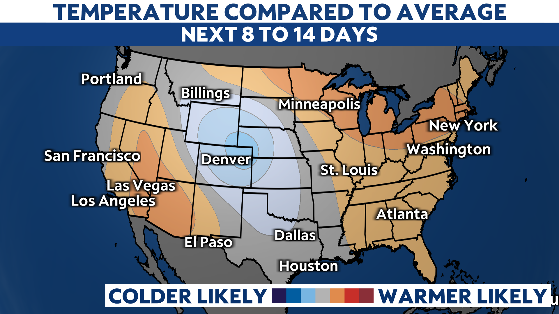
However, in my opinion, the number of colder than average days will be more than above average days. After the record warmth of the 10th, we are bitterly cold on the 13th and 14th.
Temperatures will try to warm again early next week, but there are signs of more cold. There are two chances for snow, one on Tuesday afternoon the 16th.
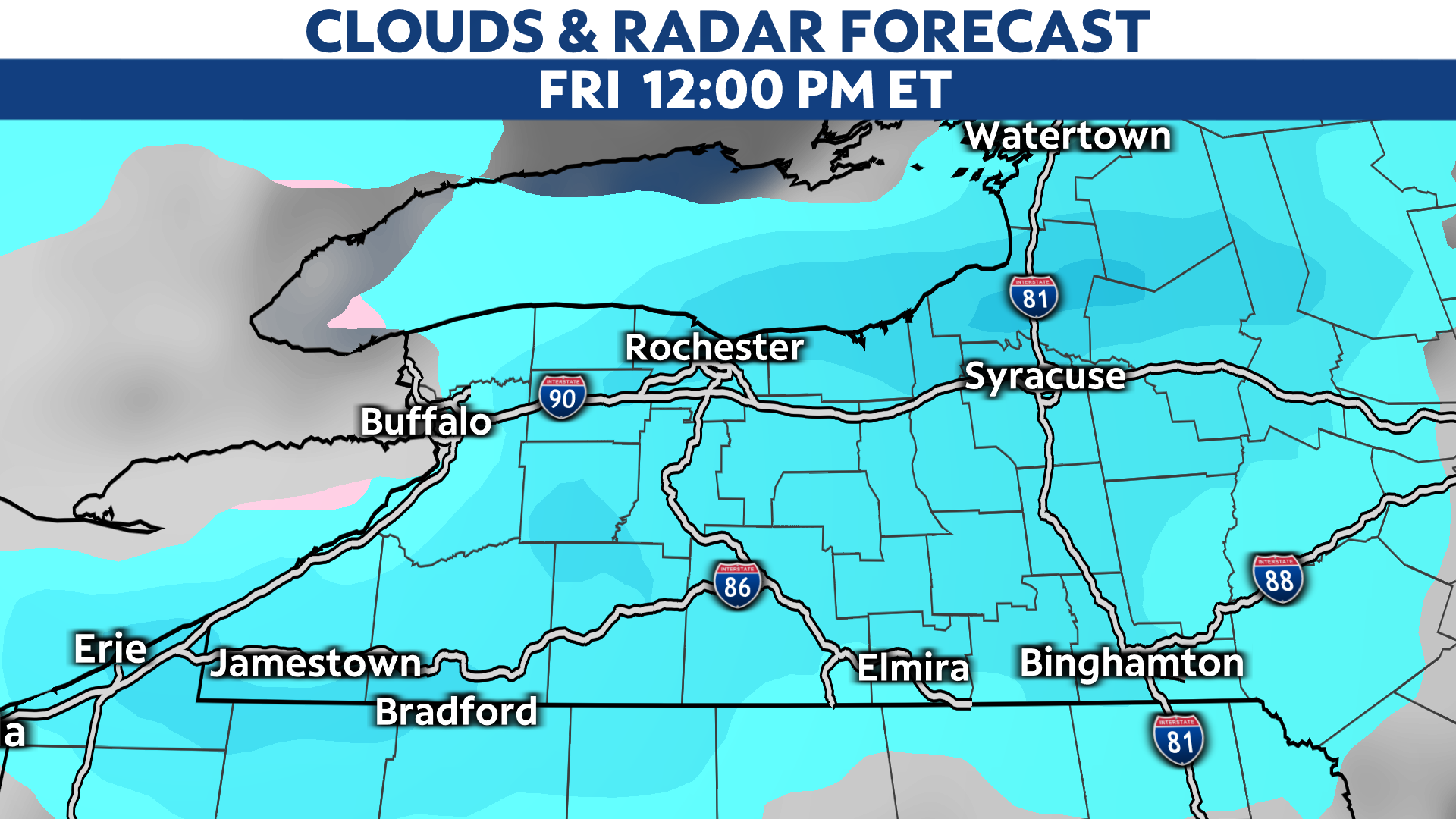
This image below is one model's solution for Friday the 19th, with possibly heavy snow in the forecast.