


Despite Buffalo’s record-snowy start this winter, it’s actually been a fairly mild one. Outside of three primarily lake-effect events, there really hasn’t been much winter weather in between.
Buffalo has seen 101.6 inches of snow so far this season, which already puts it above the full-season average of 95.4 inches.
However, both November and December finished with above-average temperatures: 2.3 degrees above average for November and 0.6 degrees above average for December. This warmth is why so many places, including Rochester, Syracuse and New York City, are running near-record snowfall deficits so far this winter.
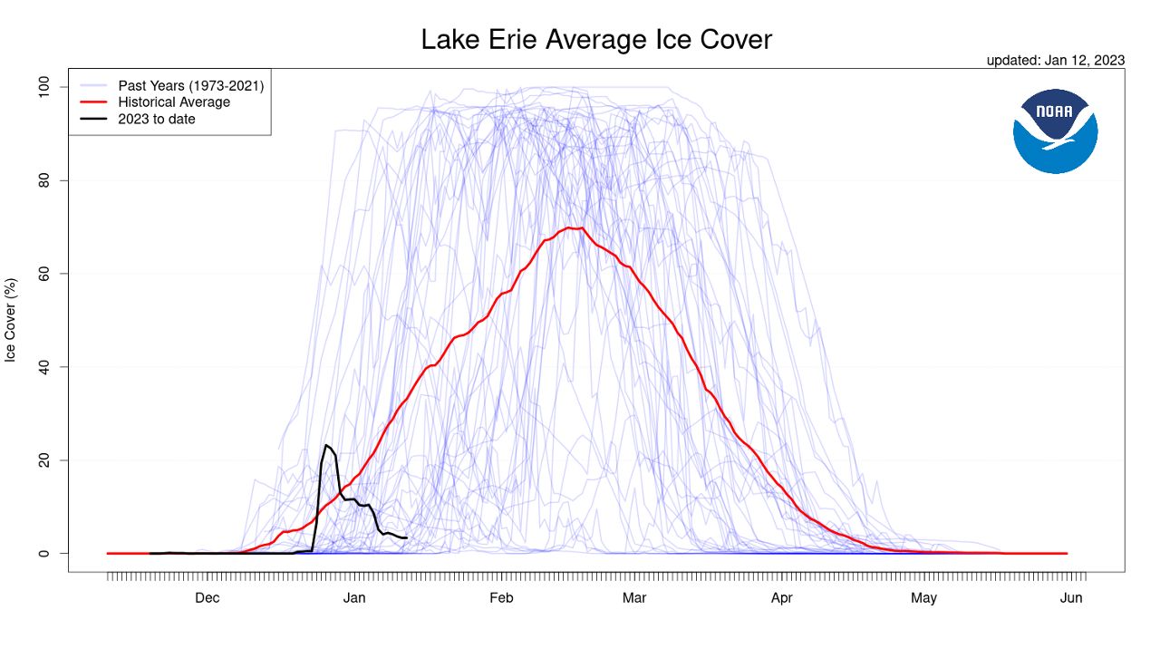
It’s also why Lake Erie and the rest of the Great Lakes are running way behind in ice coverage. You can see in the graph below that Lake Erie made up lots of ground quickly in late December during our blizzard, but the long mild stretch to follow quickly melted most of it.
Now we’re running way behind the average ice cover for this point in the season.
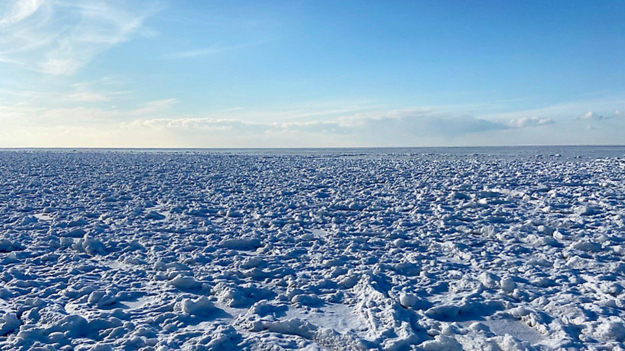
Lake Erie isn’t the only Great Lake with a lack of ice. Outside of some bays and the western basin of Lake Erie, you can see most of the lakes are running wide open and ice-free. Great Lakes' total ice cover is only sitting at 3.1%.
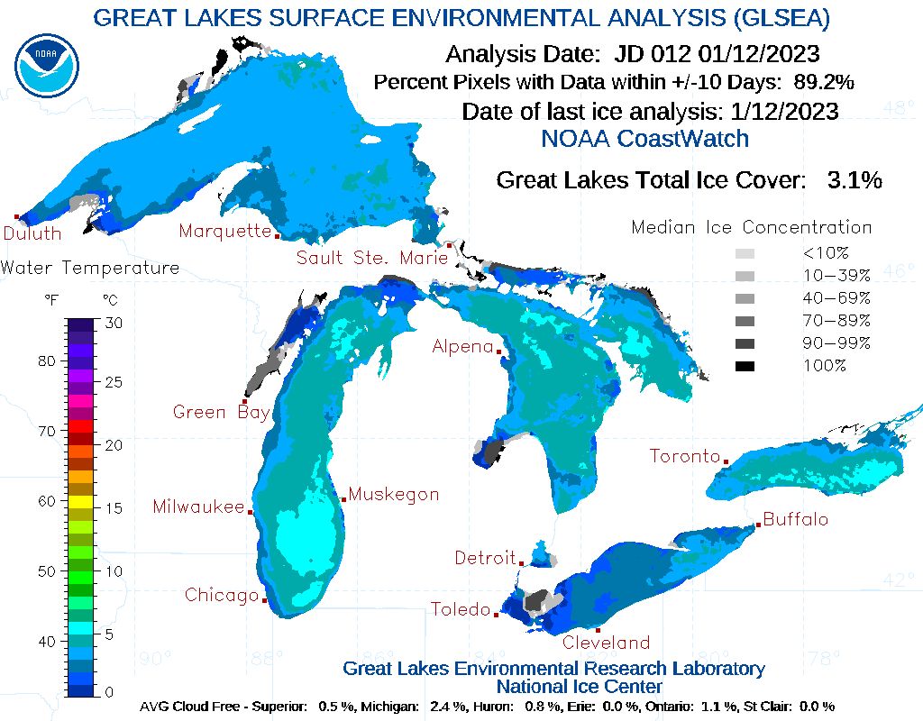
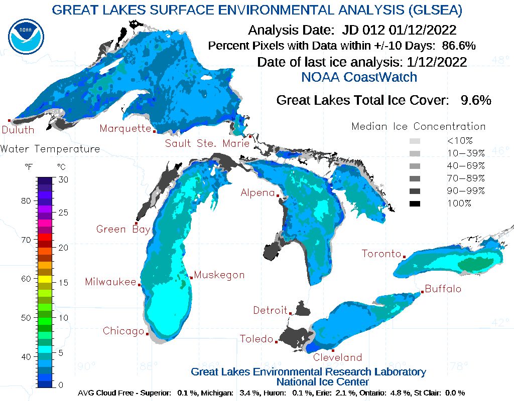
Compare that to last year at this time, when the Great Lakes were at 9.6% ice coverage.
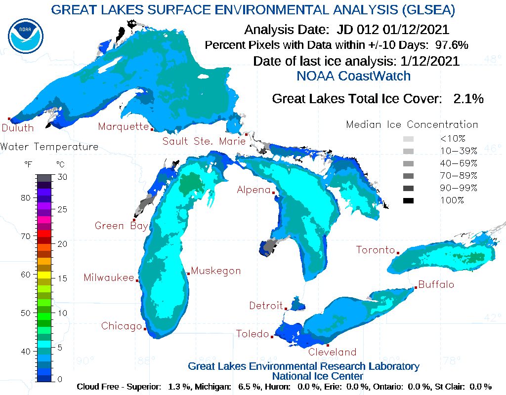
Only one year was lower than this year, and that was 2021 when Lake Erie was still 100% open at this point. The Great Lakes' total ice cover was at only 2.1% then.
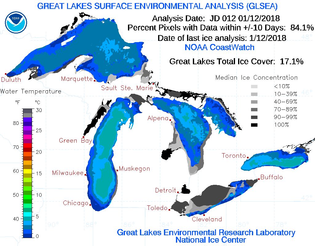
The highest ice cover in recent years was 2018, when Great Lakes ice cover was at 17.1% and the majority of Lake Erie had ice on it.
The question is, "does this mean more lake-effect snow?" The answer is potentially yes.
Many like to talk about the lake temperature and how warm or cold it is, but the key ingredient is cold air. Without cold air intrusions, it doesn’t matter how warm or cold the lakes are. Here's a blog on why cold air is, by far, the most important ingredient for lake-effect snow and the lake temperature is a bit overblown.
Of course, almost no cold air intrusions have come across the Great Lakes this month with the average monthly temperature for Buffalo running a whopping 8.9 degrees above average.
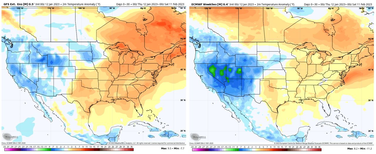
You can see in the maps below, whether it’s the GFS or European weather forecast models, that we’re still expecting above-average temperatures over the next month. That means the lakes will continue to run an ice deficit and at least have the ability to produce lake-effect snow. We would just need a blast of cold air.
If there is a time where we could see such a blast, it’d be late this month into early February.
Overall, this milder pattern with more days than not having above-average temperatures looks to continue. I don’t anticipate Lake Erie becoming ice-covered this season.
Our team of meteorologists dives deep into the science of weather and breaks down timely weather data and information. To view more weather and climate stories, check out our weather blogs section.