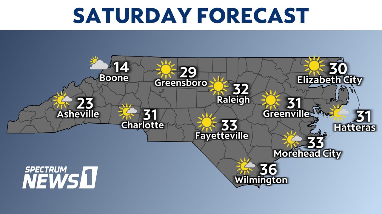
Arctic air has arrived in North Carolina and will make for one of the coldest Christmas Eves in the state in over 30 years.
The mountains of western North Carolina are the only locations that saw snow with the frigid air.
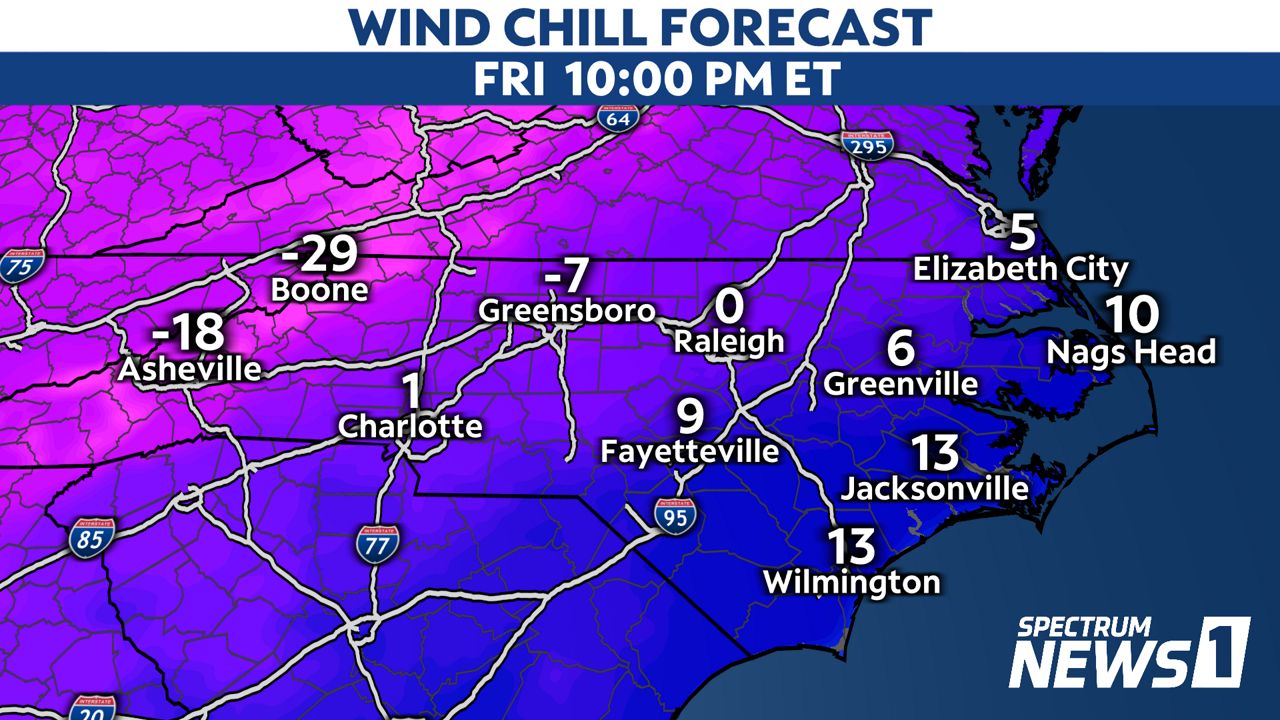
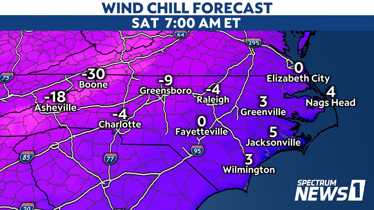
Across the state, temperatures have dropped all day Friday, with wind gusts reaching peak speeds between 40 and 50 mph for most locations but some saw higher speeds.
Wind chills, or feels-like temperatures, dropped to the single digits and teens in much of the state Friday afternoon and will drop below zero overnight in some spots.
It will be coldest in the mountains, where it will feel well below zero.
Locations most likely to see wind chills drop below zero east of the mountains are in the Piedmont and central North Carolina late tonight through Christmas Eve morning.
It will feel like the single digits even near the coast.
Those dangerously cold conditions could lead to frostbite.
If you must spend a prolonged period outside overnight or Saturday morning, be sure to cover as much skin as possible by wearing not only a winter coat, but gloves and a hat.
Winds will be a bit lighter by Christmas Eve afternoon, but a cold breeze could still make it feel several degrees colder than the actual temperatures.