


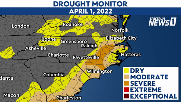
North Carolina has been dealing with a developing drought with conditions gradually worsening since the middle of February.
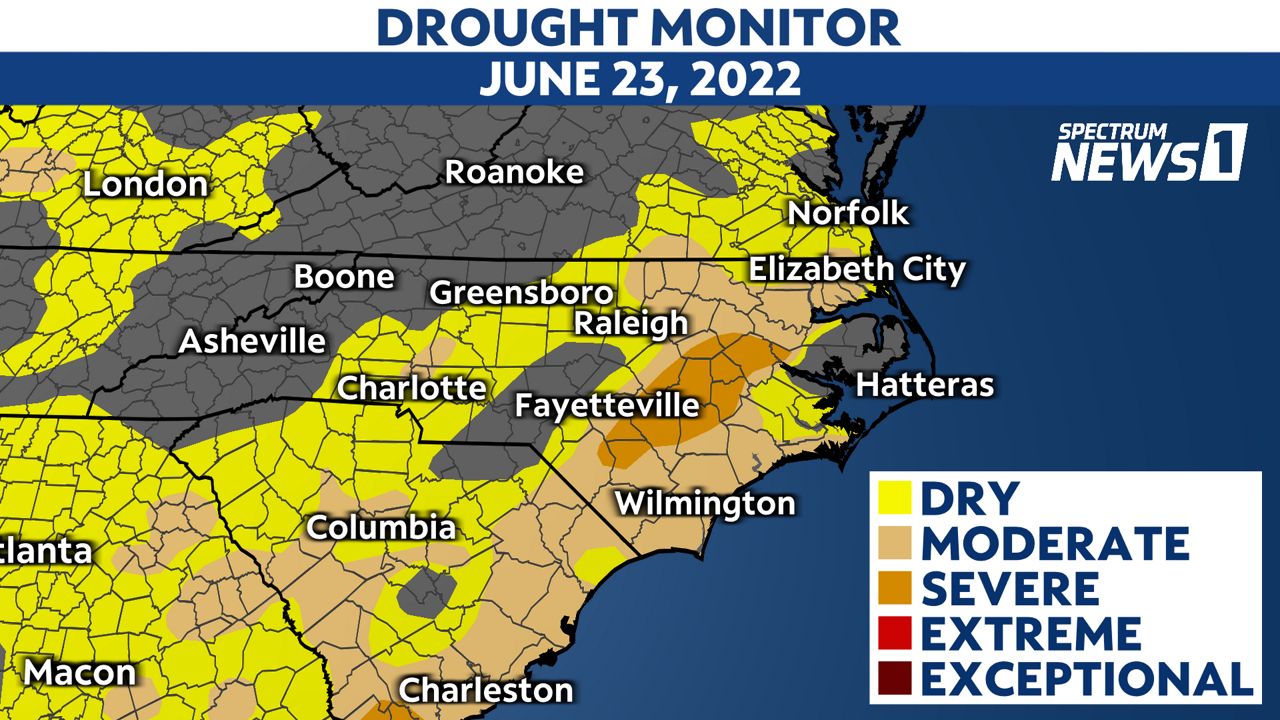
Despite recent thunderstorms, abnormally dry or worse conditions currently cover more than 65% of North Carolina. Thunderstorms have been scattered lately, and have only provided sufficient rainfall near Wilmington.
We're facing a severe drought over a small section of Eastern North Carolina just east of Interstate 95. It covers just under 10% of the state.
The drought has been worsening over the last few months and seems to continue that trend through the end of the month. However, much of North Carolina typically sees the most significant rainfall of the year during the middle of the hurricane season, which is another couple of months away.
Unfortunately, hoping for a nice steady rainfall from a weak tropical cyclone is unlikely to be realized as trends have lately shown that tropical systems are more likely to produce too much rainfall than a sufficient amount.
One way we can measure drought with a single parameter is with the Drought Severity and Coverage Index. This is an experimental method from the National Drought Mitigation Center at the University of Nebraska-Lincoln for converting drought levels from the U.S. Drought Monitor map to a single value for an area.
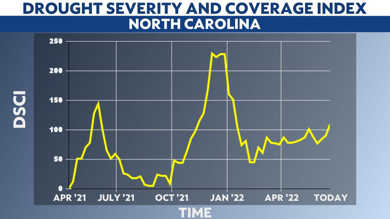
This measurement for North Carolina has been trending upwards since the spring of 2021 but reached a major peak over this past winter when we had our driest conditions since August 2008.
North Carolinians are not all facing the same dry conditions, but many are seeing an impact on their water resources. Plus, more extreme heat, which we’ve seen lately with record high temperatures reached across different parts of the state, can often follow drier than average conditions in the summer.
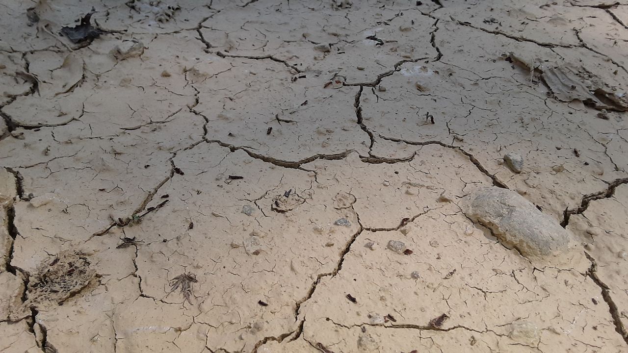
Recently, drier-than-average conditions and a thunderstorm combined to cause a lightning-born wildfire that burned over 1,000 acres on private land in Hyde County. Parts of Cleveland County have had no rain in more than two weeks and temperatures have reached the upper 90s there.
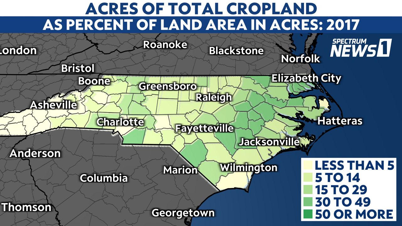
From the image below, you may also notice the location of the “severe” drought correlates with some of the more densely active agriculture across North Carolina.
Brunswick County has recommended voluntary water conservation to their residents, limiting outdoor irrigation to every other day to ensure supplies meet this summer’s demands. In addition, declining inflows and losses due to evaporation are causing reservoir levels to decline across the Piedmont
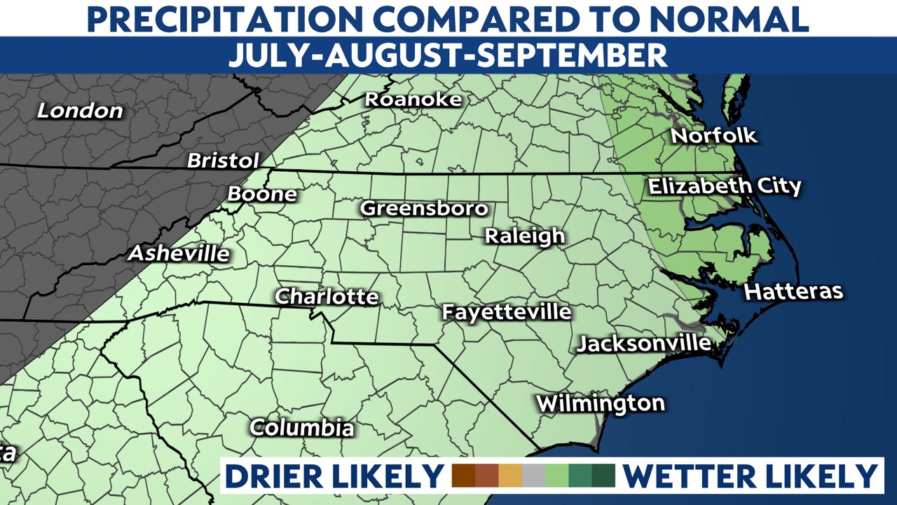
Whether or not we see a tropical cyclone make landfall, the next three months have a 33% to 40% chance to produce above average rainfall over the areas that need it most in North Carolina. The Climate Prediction Center with the National Weather Service released a 3-month outlook showing the odds edging toward a wetter outcome.
This could end up being from thunderstorm complexes that produce significant rainfall. It’s worth mentioning that just because we are dealing with a drought, flash flooding can still occur from thunderstorms.
Always remember that during a flash flood you should never drive through a flooded road!
It’s also a good sign that this looks to be a more short-term drought for North Carolina. Other parts of the country are dealing with water shortages that are significantly more severe, including in the western United States.
Our local drought may be removed, or at the very least, dramatically improved by the end of summer if not sooner.
Watch Spectrum News 1 for future forecast updates including changes to the drought conditions in North Carolina and the hurricane season.