


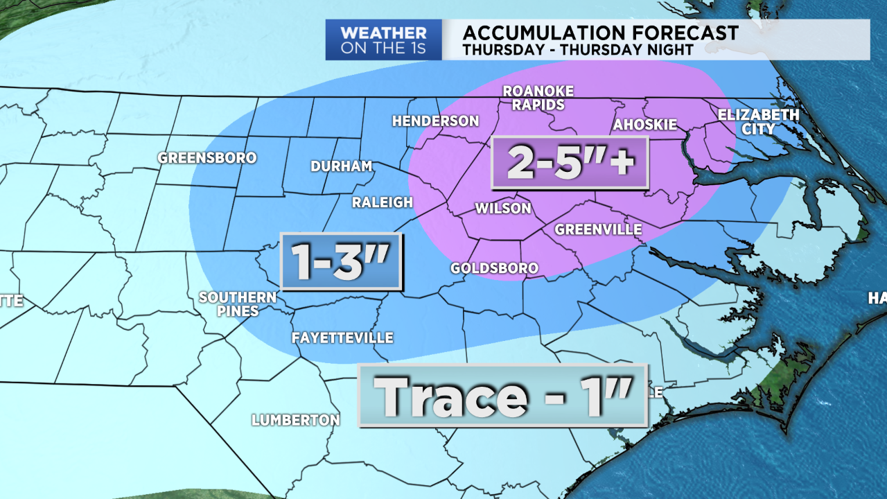
Something unusual is happening in North Carolina Thursday. Every county in the state is under either a Winter Weather Advisory or a Winter Storm Warning. The winter storm should produce more snow in eastern parts of the state than it will in some parts of the mountains.
Much of central North Carolina shoulud see around one to three inches of snow. Locations east and nort east of Raleigh could see higher totals with isolated spots up to six inches possible. Some spots in the southern Sandhills may end up will less than one inch.
- Interactive radar
- Share your snow reports and photos with Spectrum News on Facebook
- Check the latest travel conditions with our interactive traffic map
- Closings and delays
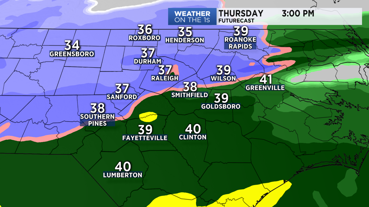
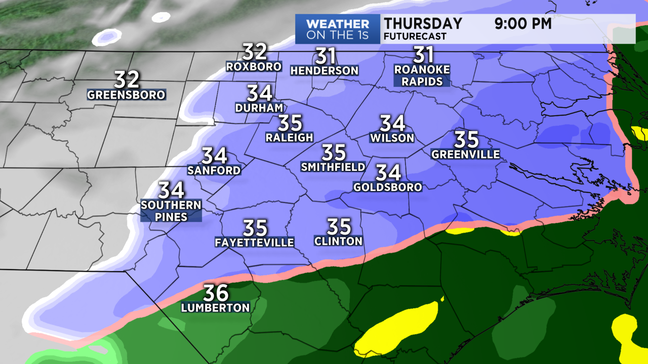
Rain has been moving into the state from the south through the morning. A rain/snow line will develop near the Triangle through the afternoon and move to the southeast across the Sandhills by evening. During the transition from rain to snow, a wintry mix including sleet will be possible.
Winter storms in the Carolinas do not always evolve exactly as forecast. There are several things that our team will be watching that could affect the amount of snow that accumulates in your area:
- It has been one of the top 3 warmest winters on record for central North Carolina, so the ground is unusually warm for February. Soil temperatures are in the 50s. Lighter snow will melt as it hits the warm ground.
- Temperatures may hover just above freezing (33-35) during much of the snow fall. Snow can still accumulate in these conditions, but it will have to be moderate to heavy snow.
- Sleet should at least briefly mix in with the rain and snow during the transition. A longer period of sleet would cut down on accumulation amounts in some areas.
- A narrow band of heavier snow will likely develop somewhere in the system. It is difficult to pinpoint exactly where that will happen, but it appears that band may set up east and northeast of Raleigh. This is where we should see the highest accumulations Thursday evening.
While we all want to know exactly how much snow may fall in our backyards, but with that subject to change some, we really should be more focused on how the storm will impact our day and night.
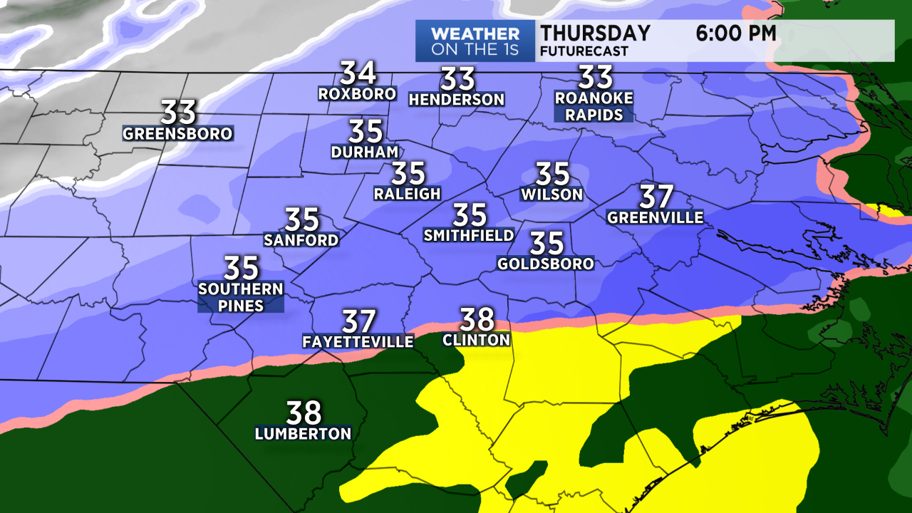
Roads should remain wet through much of the afternoon. However, during heavier bursts of snow, a slushy accumulation could begin in some spots near and north of the Triangle between 3 and 6pm. This could impact the evening rush hour. Travel conditions will continue to deteriorate after sunset with snow and possibly sleet collecting on some roads.
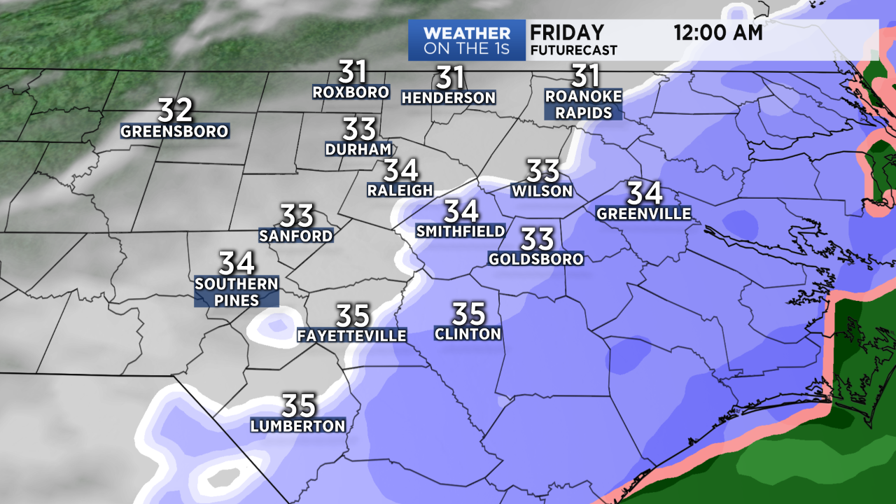
The most dangerous travel conditions may actually come after the snow has ended from midnight through Friday's morning's rush hour. During that time, temperatures will drop to the 20s. Any puddles and slush left on the roads will freeze over during that time creating icy conditions.
Road conditions should improve Friday between 10am and noon thanks to plenty of sunshine and temperatures that will be rising above freezing during that time.
Stay tuned to Weather on the 1s and Spectrum News for winter weather updates all day and night.
Follow Meteorologist Lee Ringer on Facebook, Twitter, and Instagram.