


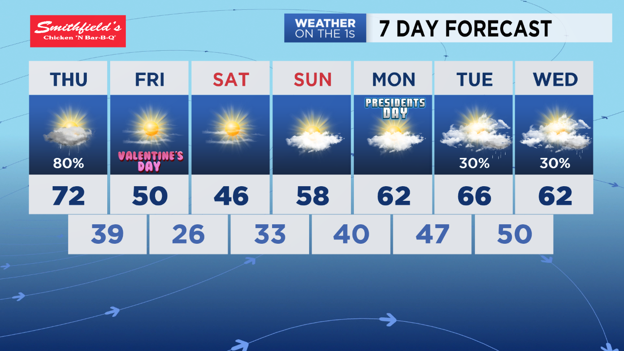
Don't store your rain gear too far away. We may not need it for most of Wednesday, but showers and a few storms will be back in the forecast Thursday.
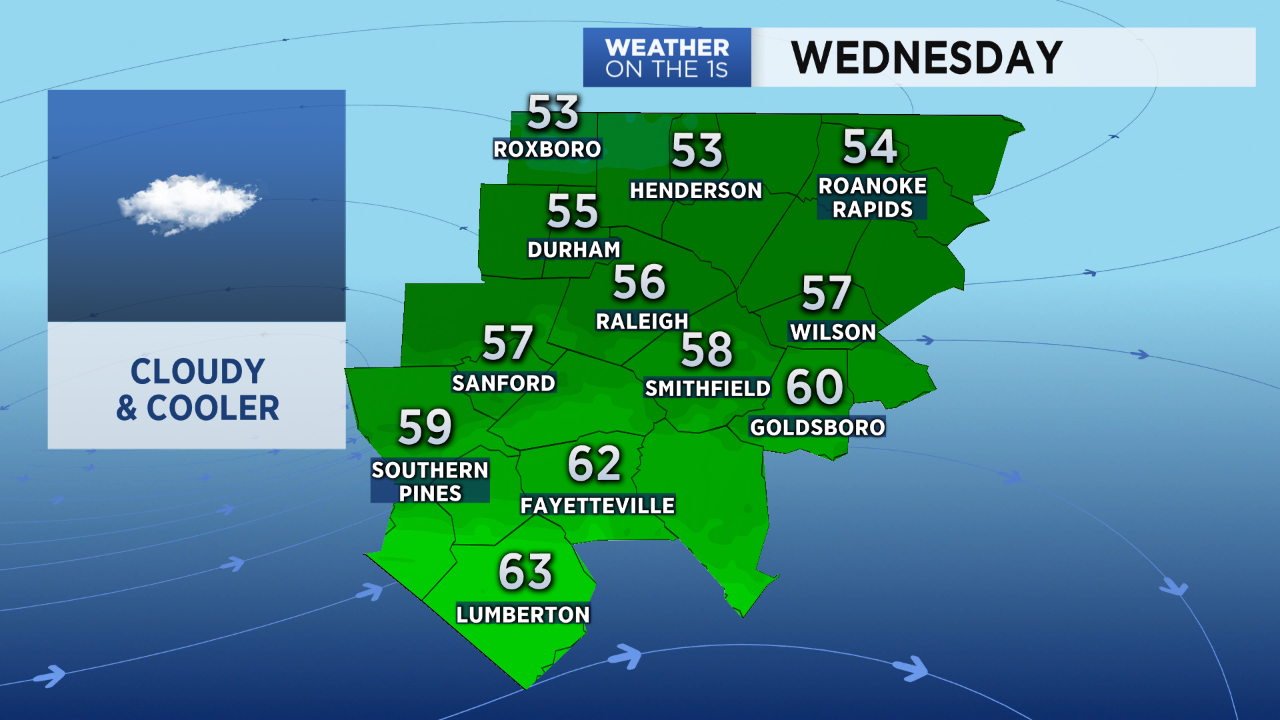
Before we get to that next chance for rain, Wednesday will be cloudy and cooler than the first couple days of the week. Temperatures will hold in the 50s all day in the Triangle. The Sandhills should see the low 60s in the afternoon.
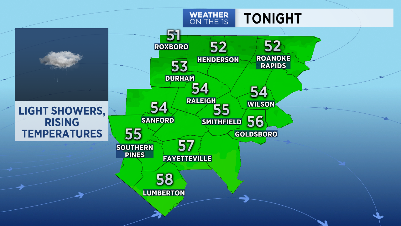
Despite the clouds, most of Wednesday will be dry. Patchy light rain or drizzle will be possible by the evening as a warm front starts to lift toward North Carolina from the south. Temperatures may drop a few degrees around sunset but will then start to warm up through the night. Wednesday night's lowest temperatures should come around 6 to 9pm.
Temperatures in the 60s are likely by sunrise Thursday morning. We should eventually warm into the 70s in much of central North Carolina by Thursday afternoon.
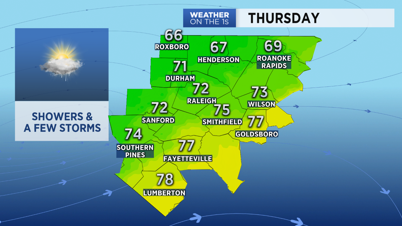
A line of showers and storms will move through the area around midday through the afternoon Thursday. This should not be a repeat performance of last Thursday when 2.5" to 4" of rain fell across central North Carolina with several severe storms. However, a few strong storms fueled by the warm temperatures cannot be ruled out.
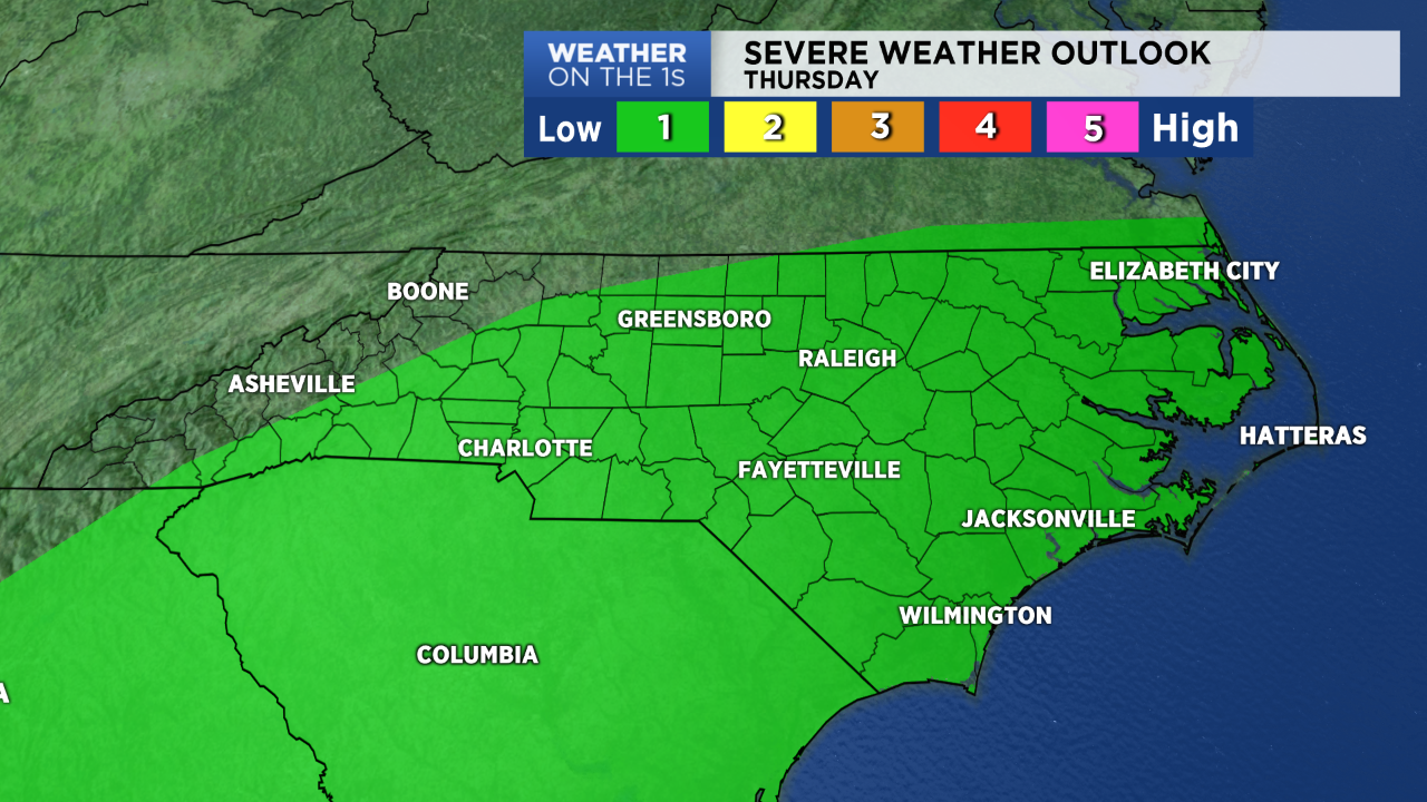
The Storm Prediction Center has outlined much of North Carolina for a marginal risk for severe storms Thursday. That's level 1 of 5 on the severe weather threat scale. Last Thursday, central North Carolina was at a level 3.
If strong storms develop Thursday, we will have to watch for the threat for damaging wind gusts in addition to localized downpours.
Rainfall totals should range between 0.25" and 0.75". The chance for rain will come to an end by the end of the day Thursday. Drier and colder air will then move into North Carolina.
Sunshine will return for Friday with highs only near 50. Low temperatures are forecast to drop to the 20s late Friday night into early Saturday morning.
Follow Meteorologist Lee Ringer on Facebook, Twitter, and Instagram.