


The tropics remain very active Wednesday. Tropical Storm Imelda formed as it was moving inland over Texas Tuesday and continues to bring heavy rain to the Lone Star State. Hurricane Humberto is moving close to Bermuda, and now Tropical Storm Jerry has formed in the Atlantic.
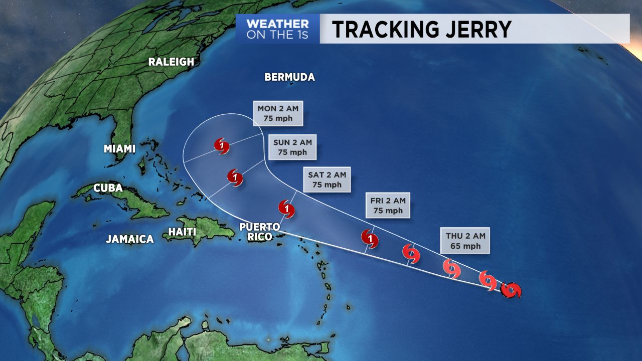
Jerry is located just under 1000 miles east of the Lesser Antilles and is forecast to become a hurricane by Friday as it moves to the west-northwest. It should move north of Puerto Rico and eventually take a northerly turn by early next week. That northerly turn may steer the storm away from the U.S. However, a lot can change when it comes to tropical system tracks over several days. Everyone along the East Coast including the Carolinas should continue to watch Jerry closely until it actually takes that turn.
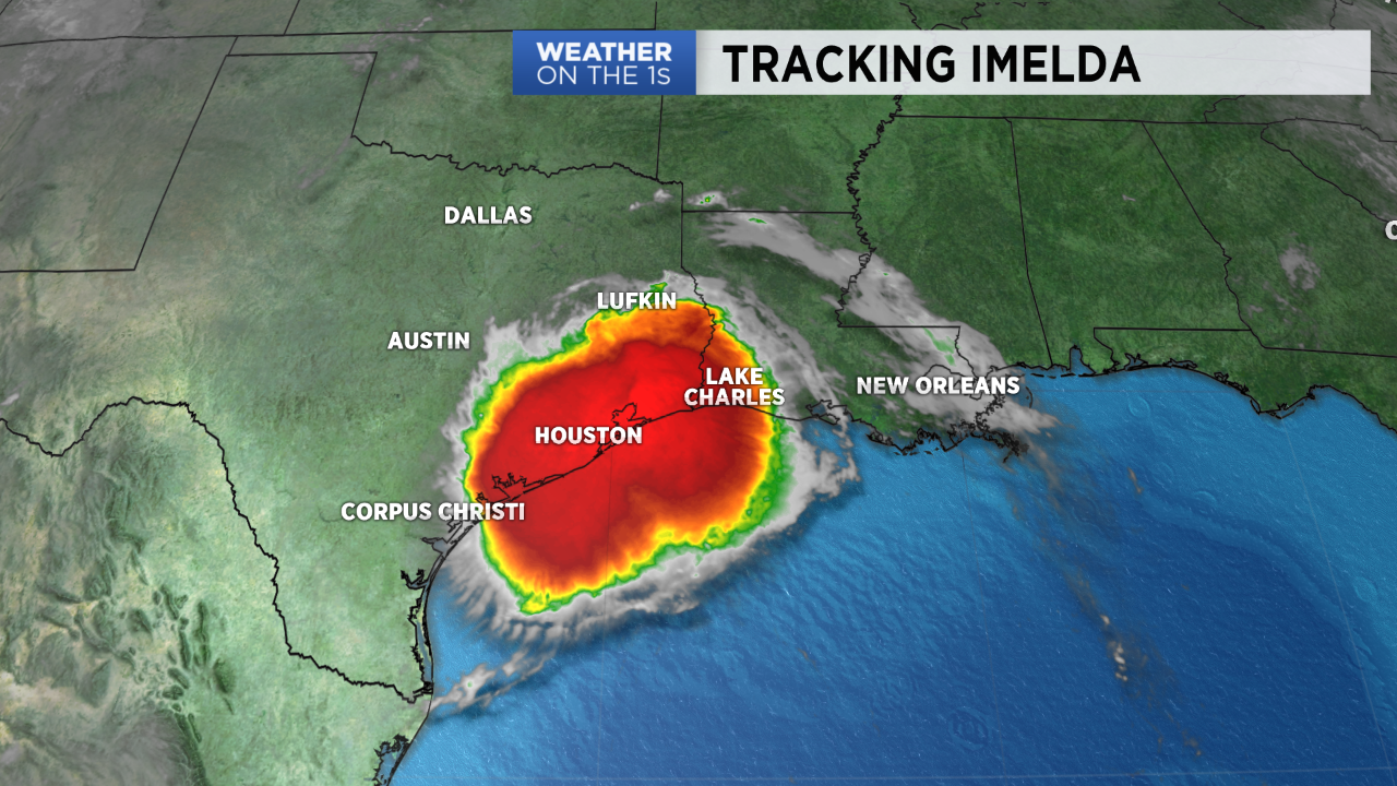
The National Hurricane Center decided to name a disturbance along the Texas coast Tuesday afternoon. It moved inland near Houston as it become Tropical Storm Imelda. The remnants will now bring soaking rains and the threat for flooding to East Texas over the next couple of days. Around a foot of rain could fall near Houston.
- Are Hurricanes Becoming More Intense
- PODCAST: Is NC Ready for Another Hurricane? Lessons Learned from Florence
- Hurricane Hunters are Critical to Hurricane Forecasting
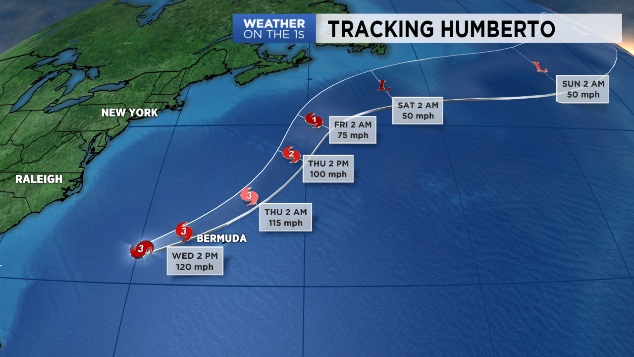
Elsewhere, residents of Bermuda are bracing for now category 3 Hurricane Humberto to pass just to their north through Wednesday night. A Hurricane Warning has been issued for the island. Humberto will eventually becoming an area of low pressure in the northern Atlantic by the weekend.
Even though Humberto is moving away from North Carolina, it will continue to bring a high risk for rip currents at our beaches. Everyone is encouraged to stay out of the water as these strong rip currents can pull even experienced swimmers away from shore.
Stay tuned to Weather on the 1s on Spectrum News for the latest. Our Tropical Updates air at :21 after every hour.