


It has been less than a week since Hurricane Dorian made landfall along North Carolina's Outer Banks, and we may soon have another named storm to watch closely.
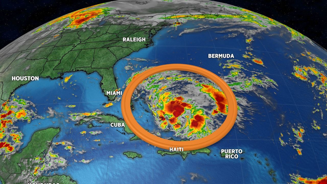
A disturbance near the southeastern Bahamas is becoming better organized Thursday morning and will likely become our next tropical depression or tropical storm within the next couple of days as it moves to the northwest. This will bring heavy rain and gusty winds to the area of the northern Bahamas that experienced catastrophic damage during Hurricane Dorian.
If the disturbance develops into a tropical storm with sustained winds of 40mph or higher, it will be given the name Humberto.
- Storm Season 2019
- Latest News on Hurricane Dorian Recovery
- Follow updates from @LeeRingerWx on Twitter
Earlier this week forecast data suggested this disturbance would move across Florida and into the Gulf of Mexico. However, since there are now signs that this system is developing more quickly, it could take a more northerly turn as it approaches Florida. One of our more reliable forecast models for forecasting tropical systems, the Euro model, is suggesting the storm may track near or up the southeast coast of the United States.
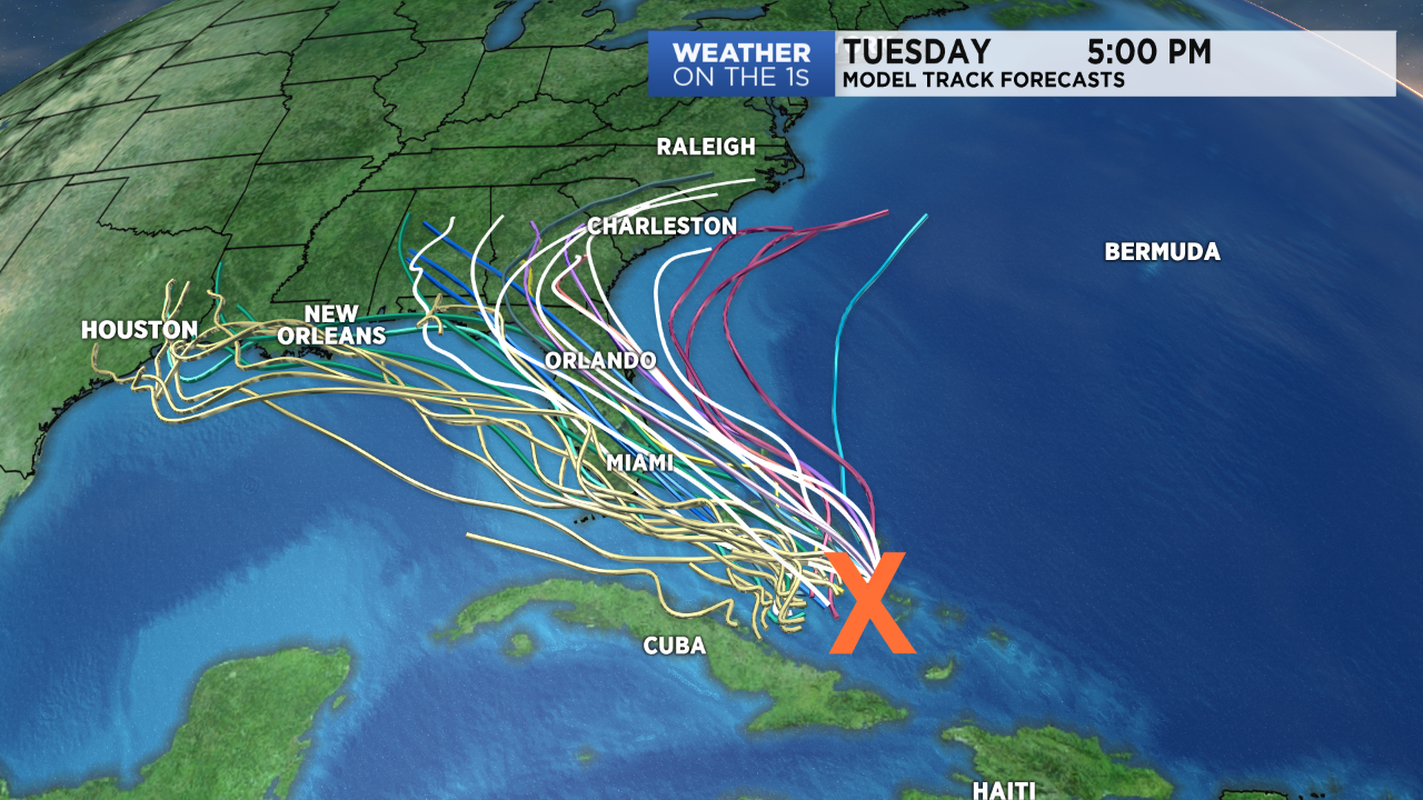
For now, it is highly uncertain if the developing storm will move toward the Gulf or up the southeast coast. A hurricane hunter aircraft is scheduled to fly into the system Thursday afternoon. As data from this flight and others gets ingested into our forecast models, the outlook should become more certain over the next couple of days.
For now, everyone from Texas to the Carolinas should watch this one closely. If it were to impact the weather in the Carolinas at all, that would not happen until next week.
Stay tuned to our tropical updates at :21 after every hour on Spectrum News for the latest.