


RALEIGH, N.C. -- Sunday's rain put just a small dent in the growing rainfall deficit across central North Carolina.
Just under 0.4" fell a the Raleigh-Durham Airport. Since September 1, the Triangle is still just over four inches below normal for rainfall. The Fayetteville Airport measured just under a half inch Sunday. The rainfall deficit for the Sandhills for fall now stands at just over two inches.
We should see more needed rainfall later this week. However, the work and school week is starting with dry weather conditions.
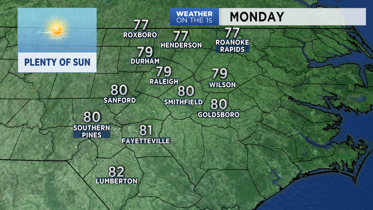
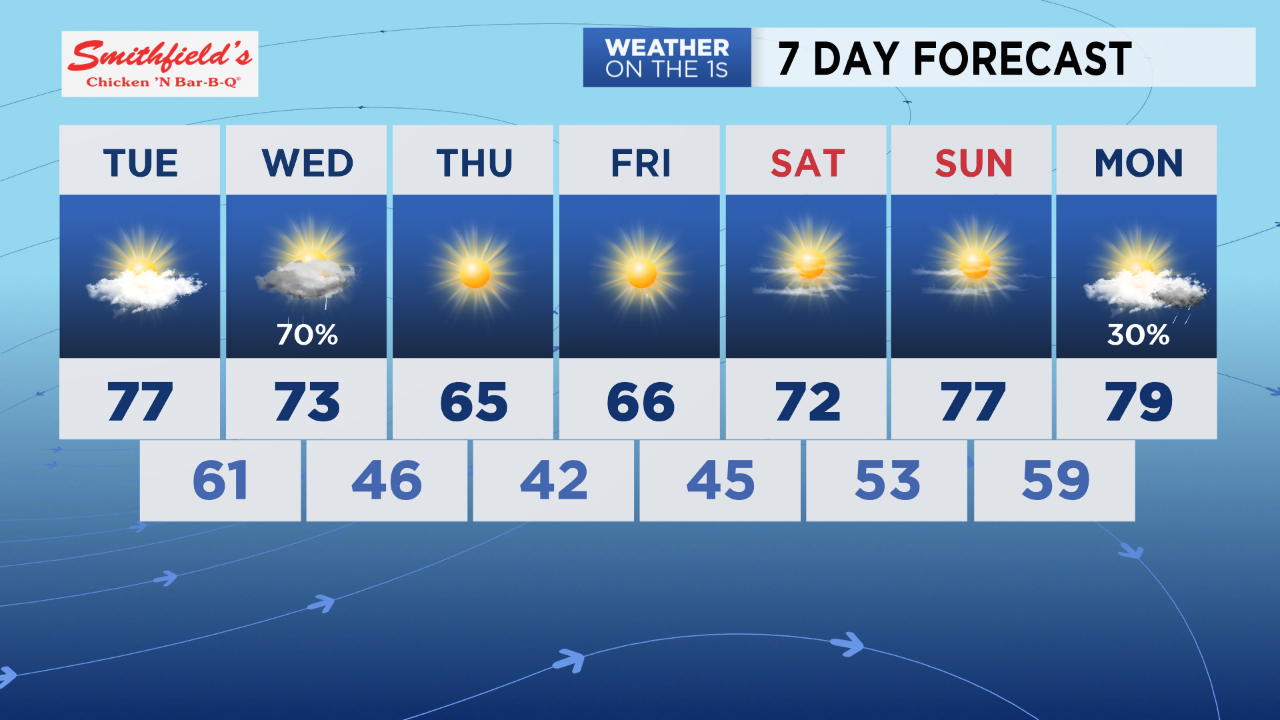
After early morning clouds and patchy fog, much of Monday will feature plenty of sunshine. Highs temperatures will warm to near 80.
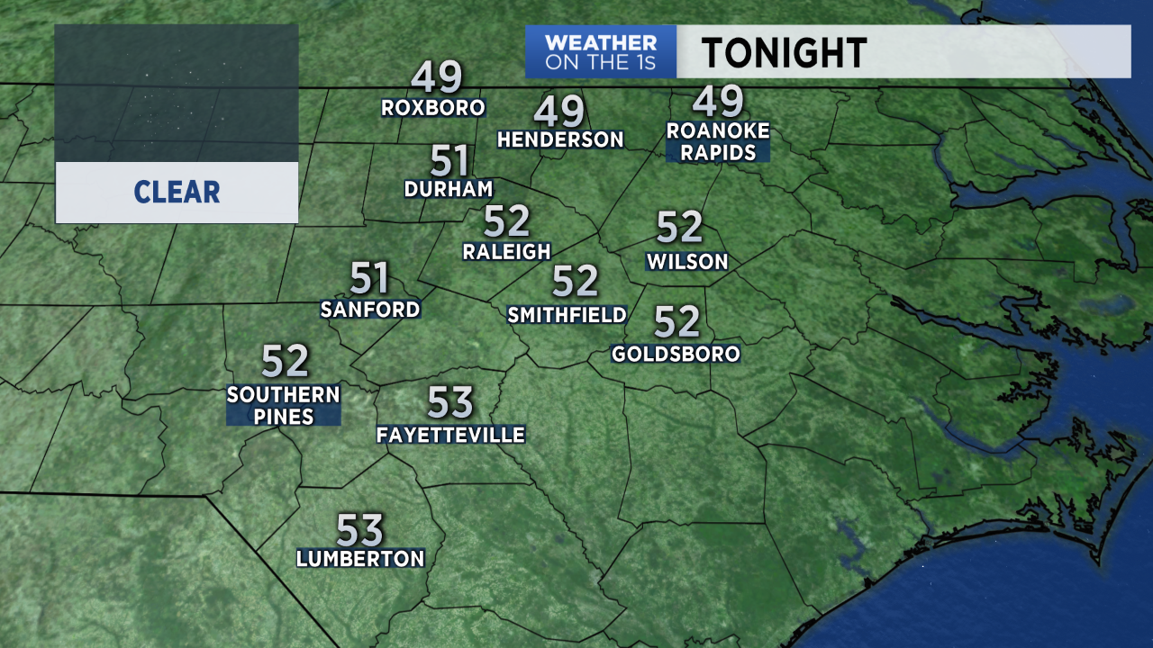
Clear skies Monday night will allow lows to drop to the low and mid 50s by early Tuesday morning. A few spots north of the Triangle could start Tuesday in the upper 40s.
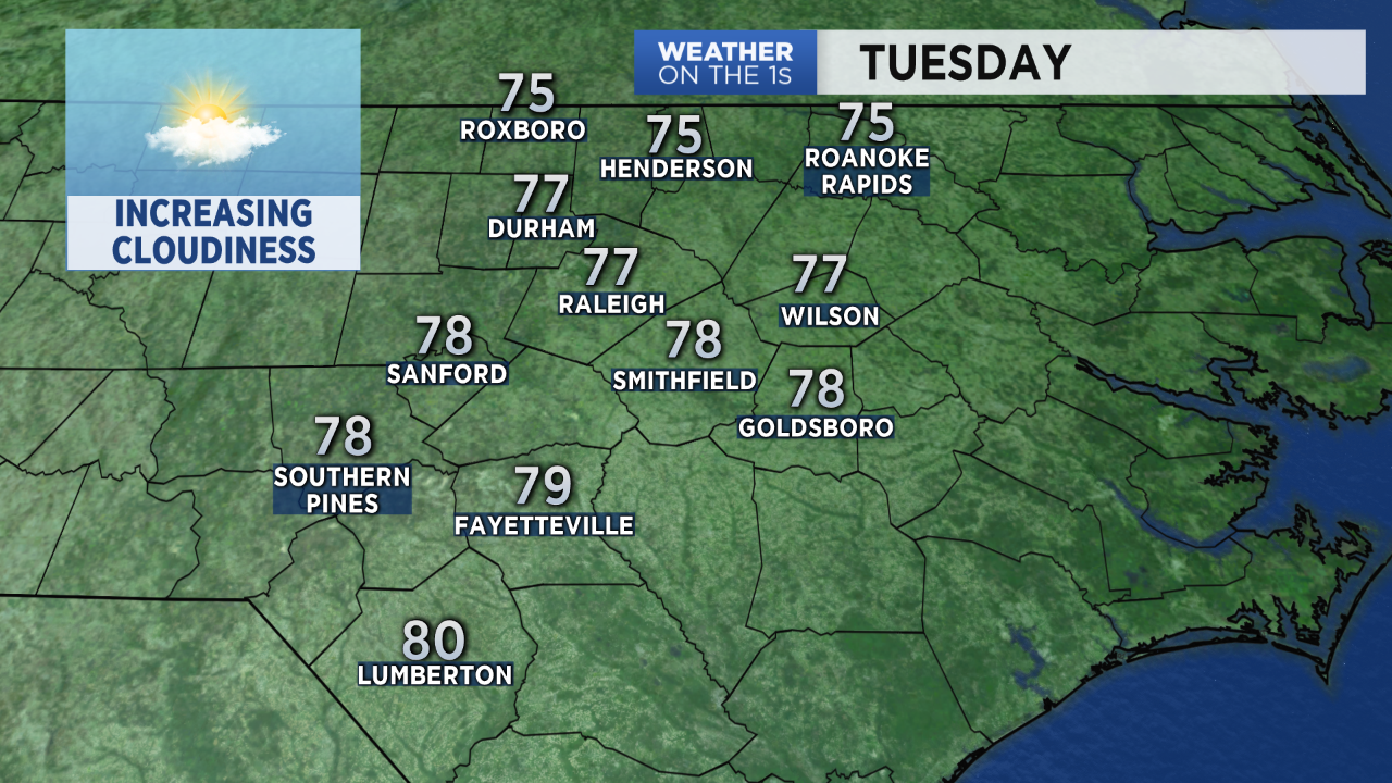
We will see increasing cloudiness and highs in the upper 70s Tuesday ahead of next rain chance.
Rain will likely spread into the region late Tuesday night into Wednesday morning.

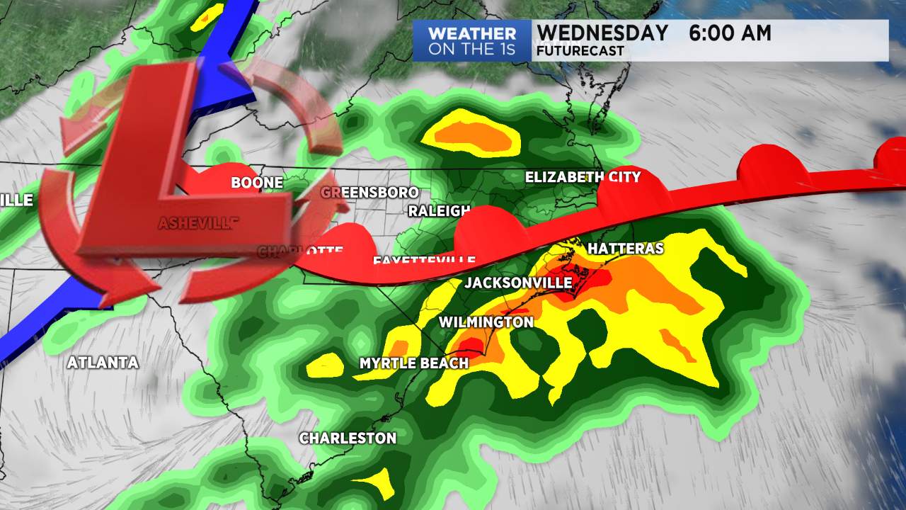
Another quarter of inch to one inch of rain is expected for most of central North Carolina.
The rain should come to an end by Wednesday afternoon. Cooler air will move into the state Wednesday night sending lows into the 40s for Thursday morning.
Thursday will bring sunny weather and highs in the 60s for opening day of the State Fair.
Follow Meteorologist Lee Ringer on Facebook, Twitter, and Instagram.