It has been a very warm September so far for central North Carolina. Through Tuesday, it has been the 9th warmest September on record for the Triangle and the 10th warmest for the Sandhills.
We will get to enjoy a break from the above average temperatures for at least the next few days as cooler and drier air filters into North Carolina.
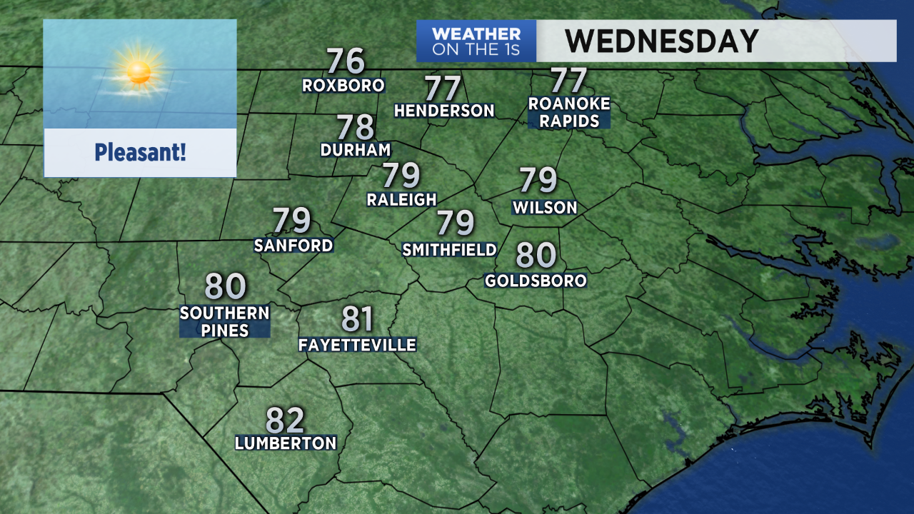
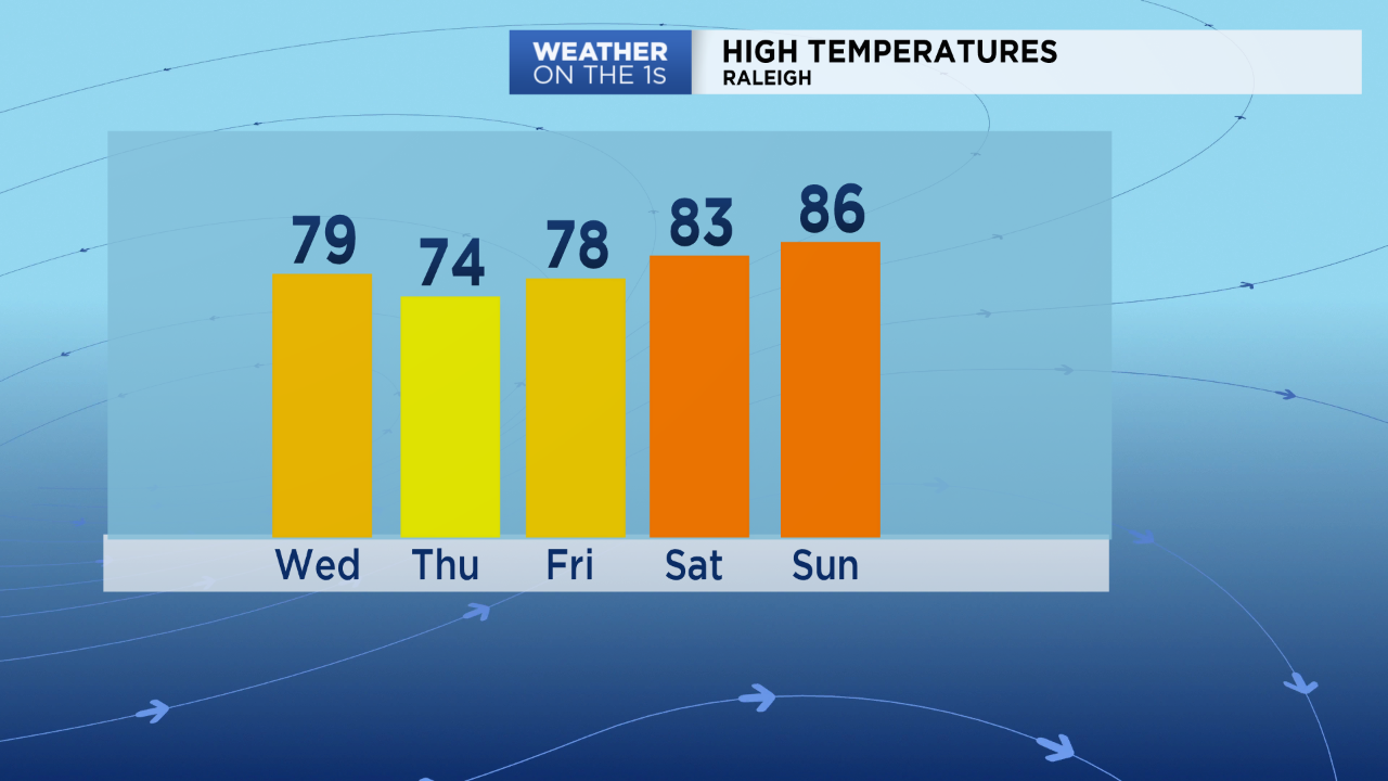
With plenty of sunshine and low humidity, Wednesday's highs will range from the upper 70s to low 80s across the region.
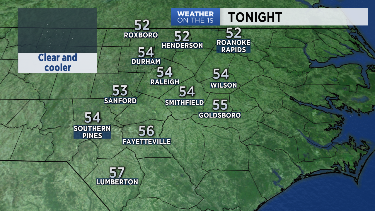
Clear skies and light winds Wednesday night will allow low temperatures to drop to the 50s by early Thursday morning.
- Check the hourly forecast on the go with our Spectrum News app
- Tweet your weather photos to @LeeRingerWx
- 7-day forecast
Sunny days with highs in the mid to upper 70s are forecast for Thursday and Friday. A warming trend will bring highs back into the 80s over the weekend.
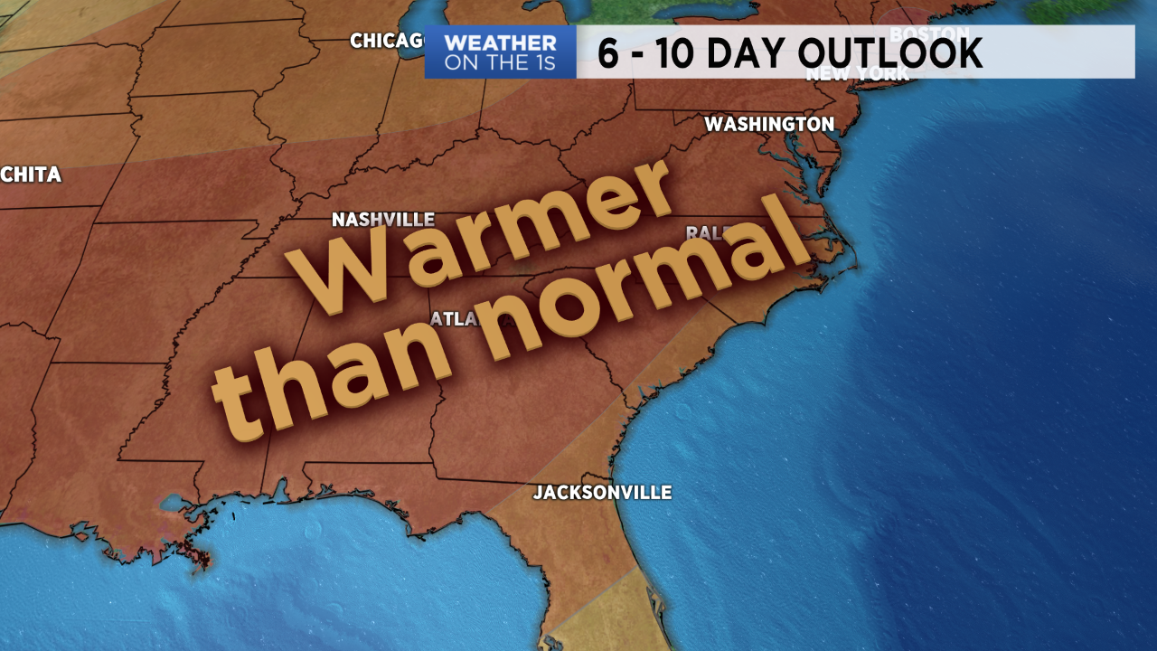
The long range outlook shows warmer than normal conditions are expected in much of the eastern United States including North Carolina next week. That should keep highs in the mid to upper 80s most of next week. A day or two with near 90 degree temperatures cannot be ruled out.