


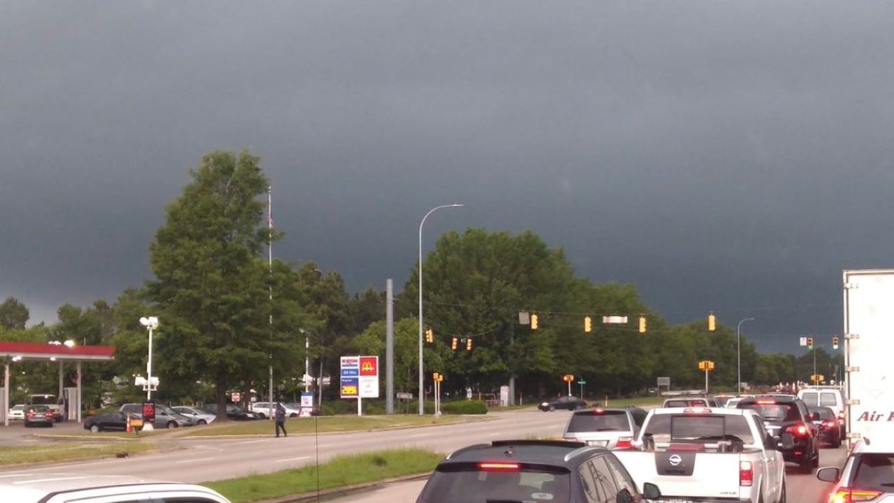
RALEIGH, N.C. -- Isolated severe storms moved through the Triangle Monday morning producing hail anywhere from the size of a pea up to the size of a golf ball across Wake County. One of the storms also produced a possible tornado causing damage near Wendell and Zebulon.
“There are trees and power lines down everywhere” according to a trooper with @NCSHP after a storm passes through the #Zebulon and #Wendell areas - this is the damage on Hwy 97 in Zebulon pic.twitter.com/DEgOD9U0Cz
— Linnie Supall (@LinnieSupall) May 13, 2019
Drone footage over Highway 97 shows many trees down between Zebulon and Rocky Mount following the strong storm that passed through this morning. Weather officials have yet to confirm if a tornado did touch down. #ncwx pic.twitter.com/GkHkj3Sqvo
— Spectrum News RDU (@SpecNewsRDU) May 13, 2019
Isolated storms remain possible through the early afternoon hours but should come to an end before the end of the day.
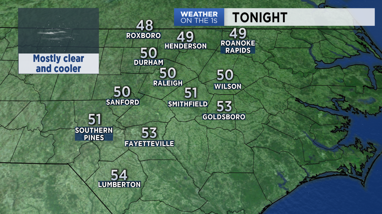
Cooler air will move into the state Monday night. That will drop low temperatures to near 50 by sunrise Tuesday.
Sunny days and dry weather is then forecast for the rest of the work week. High temperatures in the low to mid 70s Tuesday and Wednesday will be below average for mid-May. A warming trend later in the week will bring highs back to the 80s.
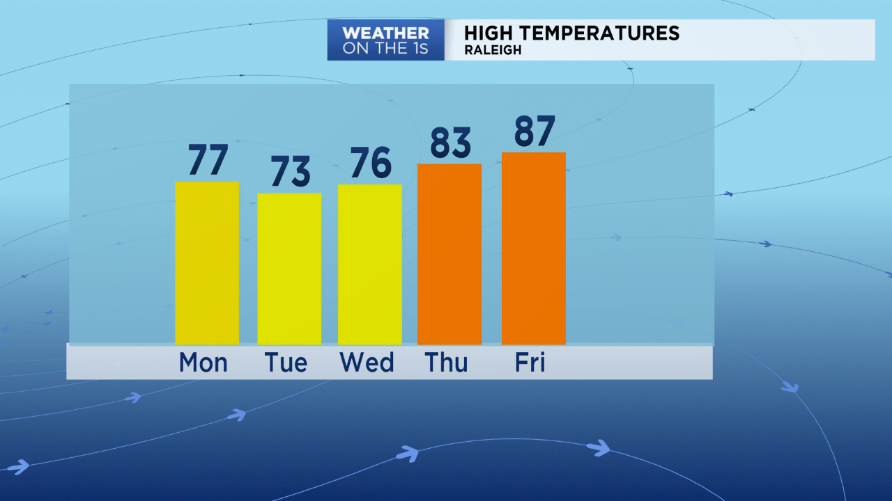
Summer-like temperatures are forecast by the weekend. Much of central North Carolina could see the first 90-degree days of the year by Saturday and Sunday.