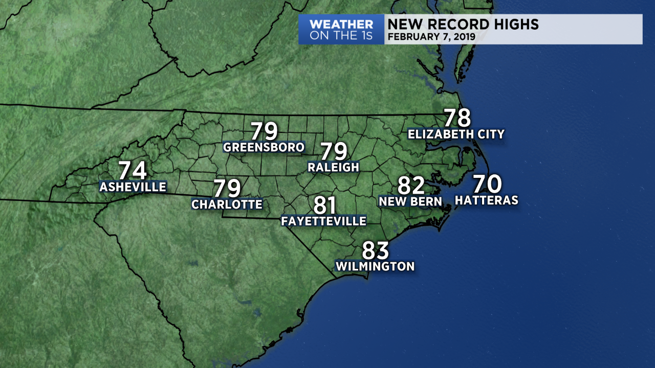
Record warmth was recorded across North Carolina on Thursday with afternoon temperatures running twenty or more degrees above average.
Every National Weather Service climate reporting station in the state set new record highs.
Those warmer temperatures are about to come to an end.
But before they do, we'll see another warm night across the region with overnight lows staying well above what our normal highs are for the early part of February.
On Friday, a cold front will cross the state. This front will bring a few clouds but no chance of precipitation. With the passage of the front, colder air will build in across the area beginning Friday night.
Temperatures will be below average through much of the weekend with daytime highs on Saturday potentially not making it out of the 40s and morning lows on Sunday in the 20s.
Beyond the weekend, we are expecting our next chance for showers by Sunday night into early next week, as we look for an unsettled weather pattern that may last a few days.
Temperatures are forecast to run slightly above average by next week.
Watch Spectrum News for your latest local forecast.