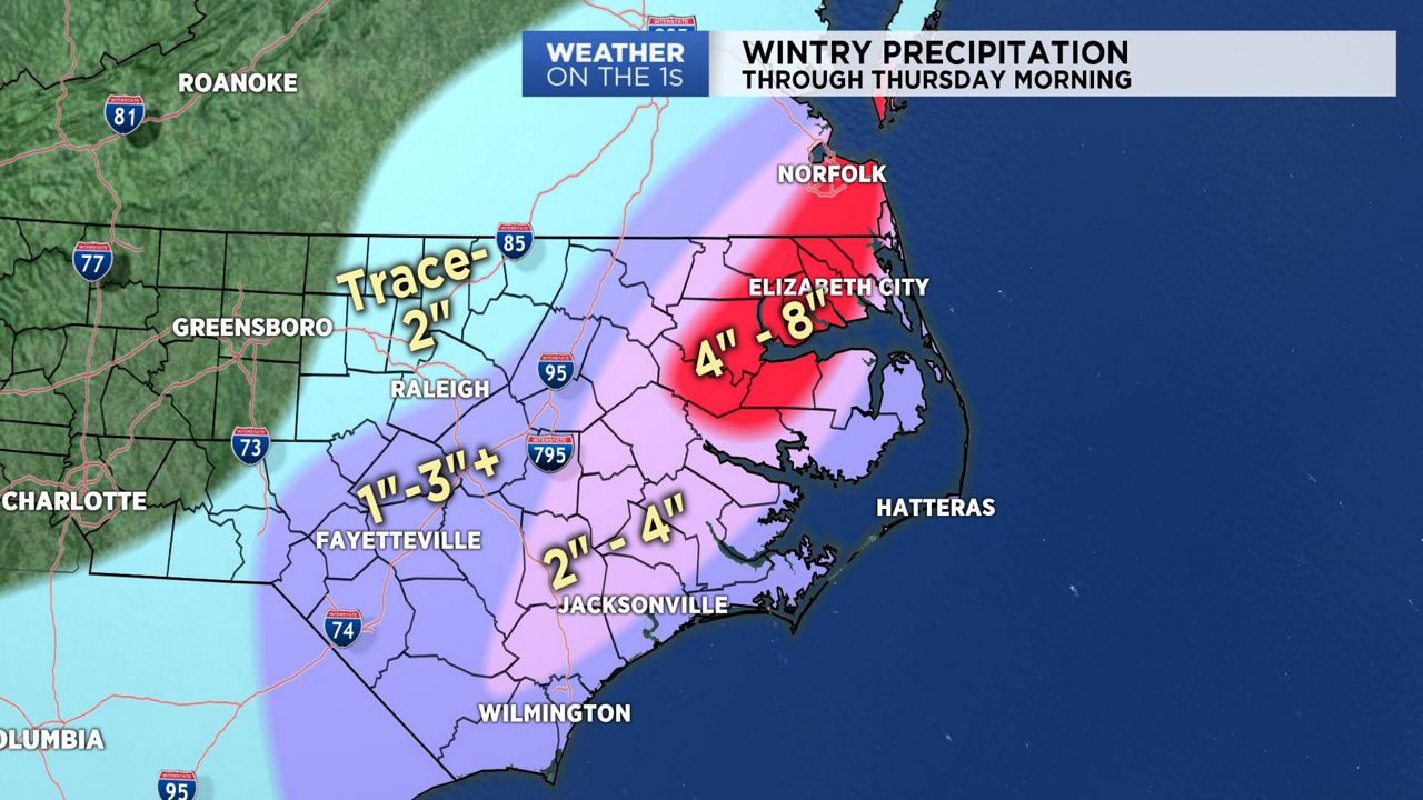
An area of low pressure moving up and long the Carolina coast brought wintry precipitation to central and eastern North Carolina on Wednesday evening and into Thursday morning.
The greatest snowfall potential fell from the Sandhills across the Coastal Plain.
Travel conditions will be hazardous in those areas that saw wintry precipitation. Those tricky travel conditions will continue this morning, and even into Thursday afternoon in areas that saw multiple inches of snow and sleet.
Cold air will dive into North Carolina in the wake of this winter storm. Daytime highs will be main in the 30s through the end of the week and into the upcoming weekend. Meaning that anything frozen on the ground may remain their for the next two or three days.
We're looking at a milder weather pattern to develop by early next week.


