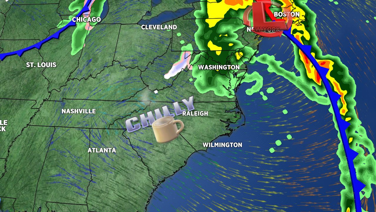
The system that brought unsettled weather across the state for Sunday will usher in a chilly start to the work week.
An intensifying area of low pressure along a cold front will lift up the eastern seaboard taking the wet weather with it. In its wake gusty west to northwest winds will bring the cold dry air in across central and eastern North Carolina. Monday morning lows will range through the 30s so some scattered frost is possible if the winds die down by sunrise.
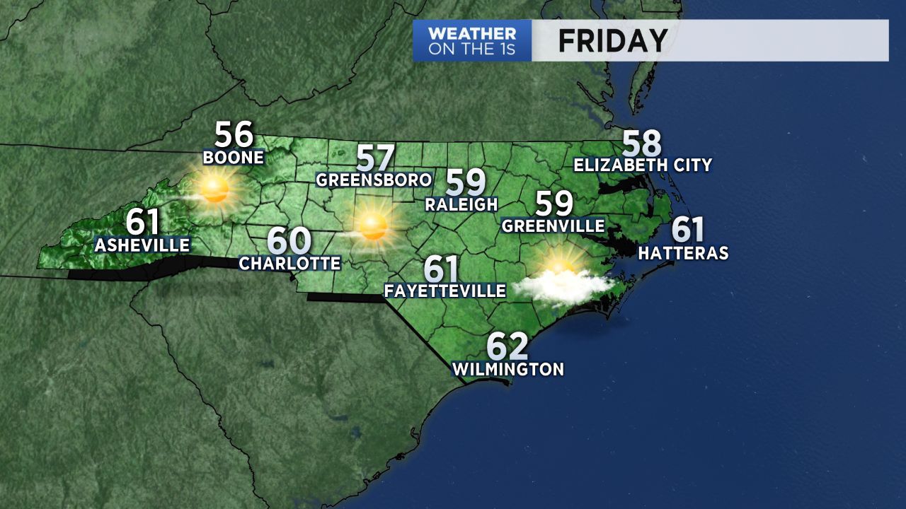
Monday will be sunny and cool for everybody with afternoon highs running about ten degrees below normal. You can expect temperatures back to normal by mid-week.
This storm system will absorb what is left of the tropical system Philippe before it impacts the northeast states brining strong winds and heavy rainfall overnight and early Monday.