


The National Weather Service is calling the rain that fell in parts of southeastern North Carolina Monday "historic."
Along with the rain, tornado warnings were issued for counties near the coast and several school districts closed Tuesday because of flooding from the storm.
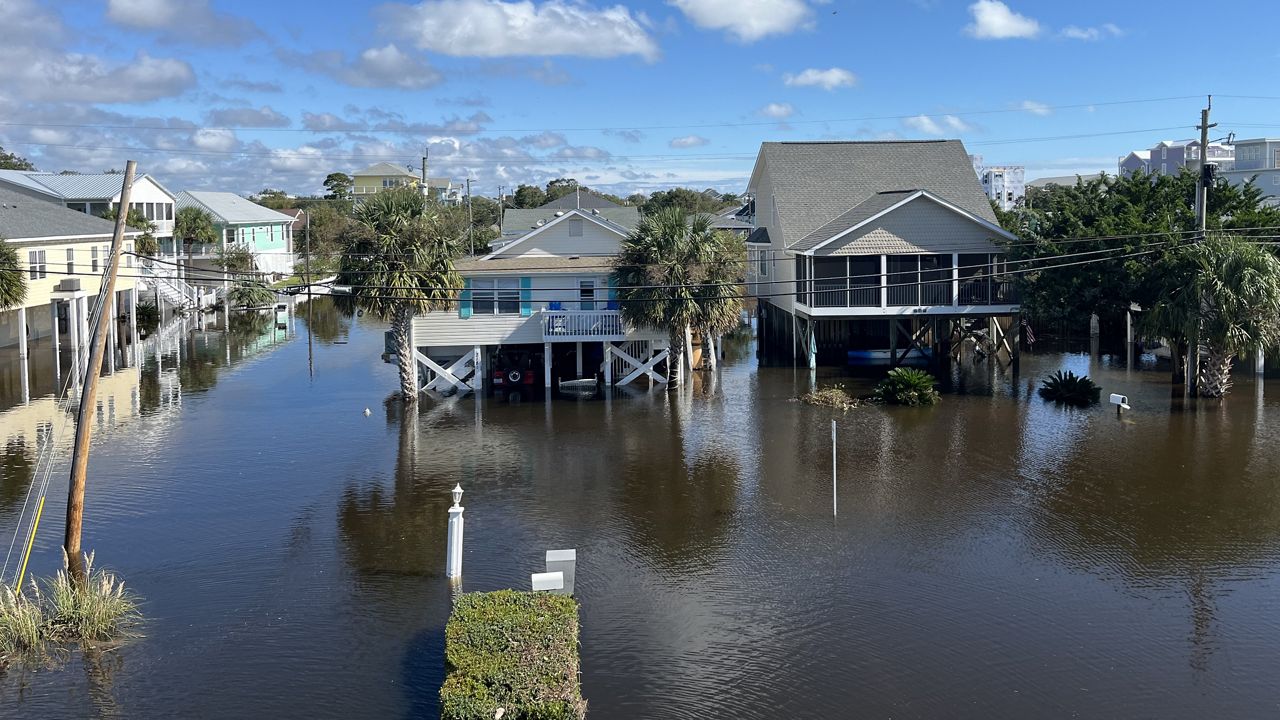
A disorganized area of low pressure that formed off the Carolina coast never officially became a tropical storm, but it still produced well over a foot of rain in southern New Hanover County and the eastern half of Brunswick County.
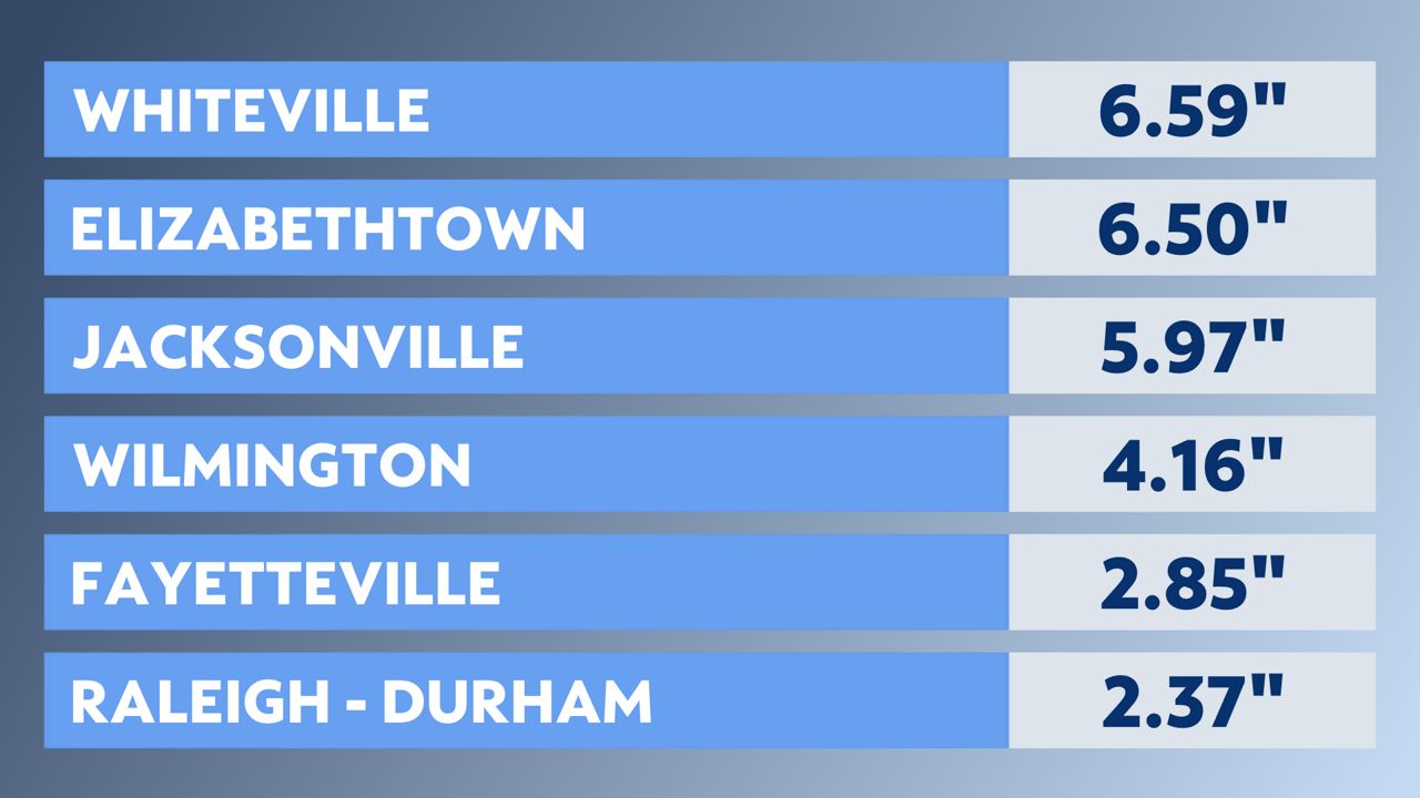
The incredible amounts of rain were focused on those areas while other parts of southeastern North Carolina did not see nearly as much.
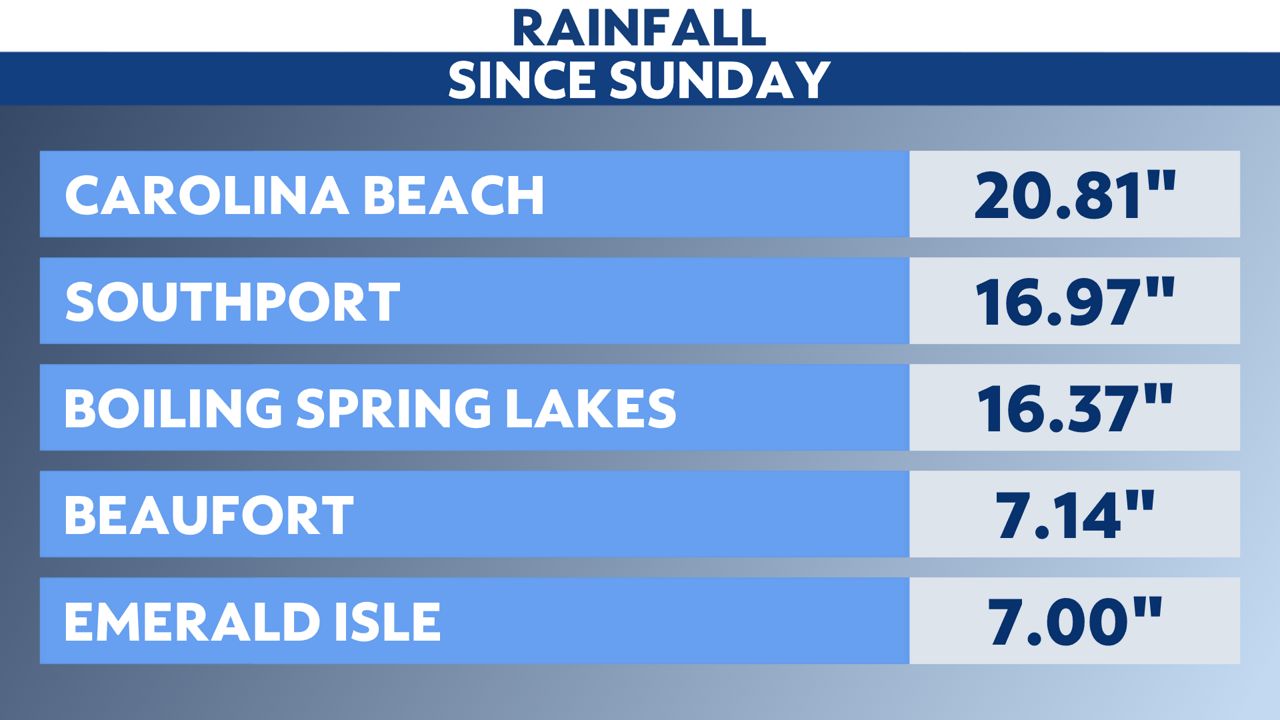
According to the National Weather Service, at least 18 inches of Carolina Beach's storm total rain fell in around 12 hours. They say that has a probability of happening once in about a 1000 years.
Extensive flooding damaged roads across Brunswick County.
In New Hanover County, a high water vehicle made its way through flooded roads to take children home from school.
Buses at Carolina Beach Elementary School were unable to get through flooded roads. "So we fired up the big trucks and got the kids home," the New Hanover County Sheriff's Office posted.
New Hanover County Schools opted for a remote day Tuesday.
Other school districts were closed Tuesday, including Brunswick County Schools, Anson County Schools and Pender County Schools. Craven County Schools, Cumberland County Schools, Stanly County Schools and Union County Schools operated on a two-hour delay.
The National Hurricane Center only names a system once it becomes a tropical storm.
For that to happen, the storm must have sustained winds of 40 mph or greater and a warm core center of circulation.
The low off the coast Monday did produce winds strong enough to be classified as a tropical storm, but hurricane hunter aircraft flying into the storm never found a well defined center of circulation.
Regardless, the system still produced conditions much like a tropical storm.
Fortunately, for areas that saw the extensive flooding, Tuesday will be mostly dry.
The low is now inland and producing scattered downpours around portions of northeastern and western North Carolina.

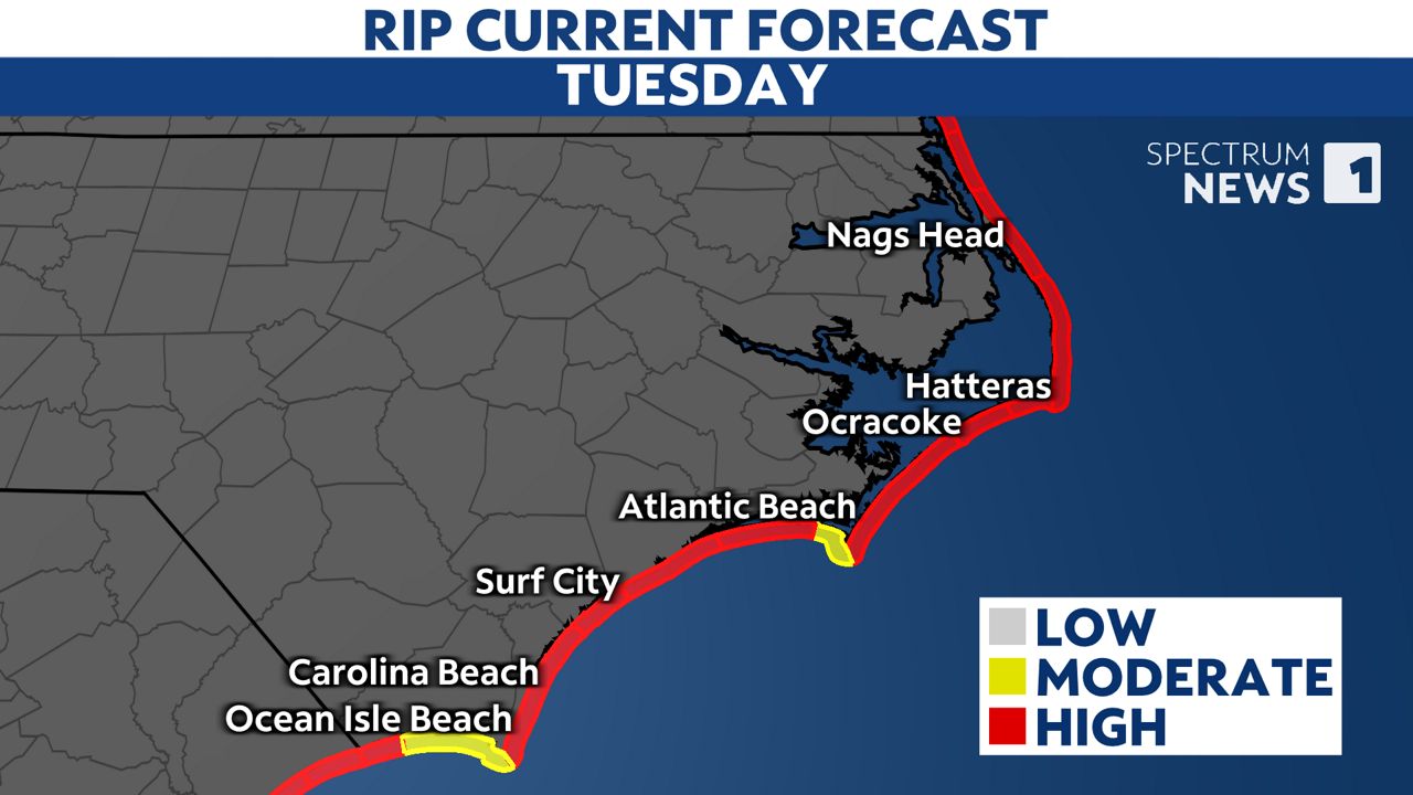
Ocean overwash along with the rain could cause sections of Highway 12 along the Outer Banks to close.
The entire coast also continues to see rough surf and a high danger of rip currents.
Stay tuned to Spectrum News 1 and the Spectrum News app for updates.