Sunday's storm system has now moved well north of North Carolina, but it's still having some lingering impacts on the state.
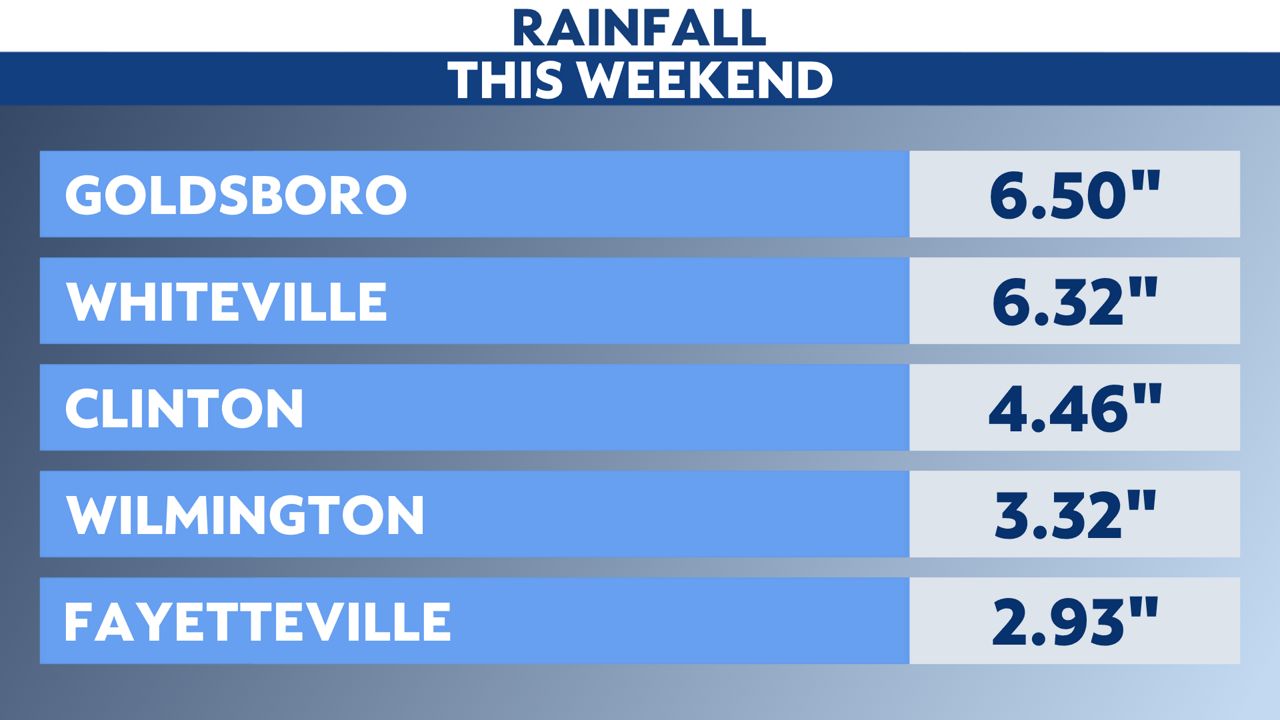
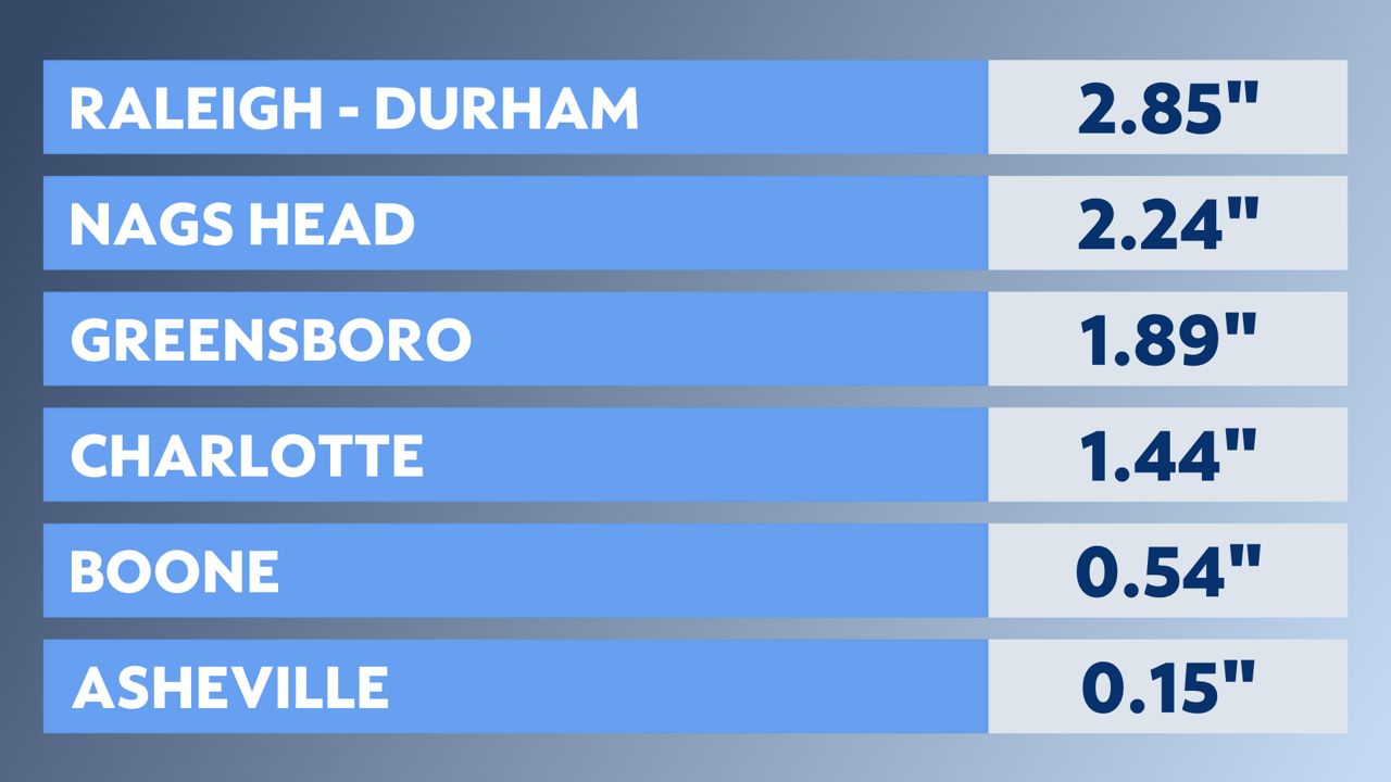
As expected, the heaviest rain with the system in North Carolina was felt in eastern parts of the state, with lower amounts around the mountains.
The heavy rain led to flooding in some areas. Near Raleigh, the Town of Apex Police Department reported having to rescue a stranded driver who drove through flood waters.
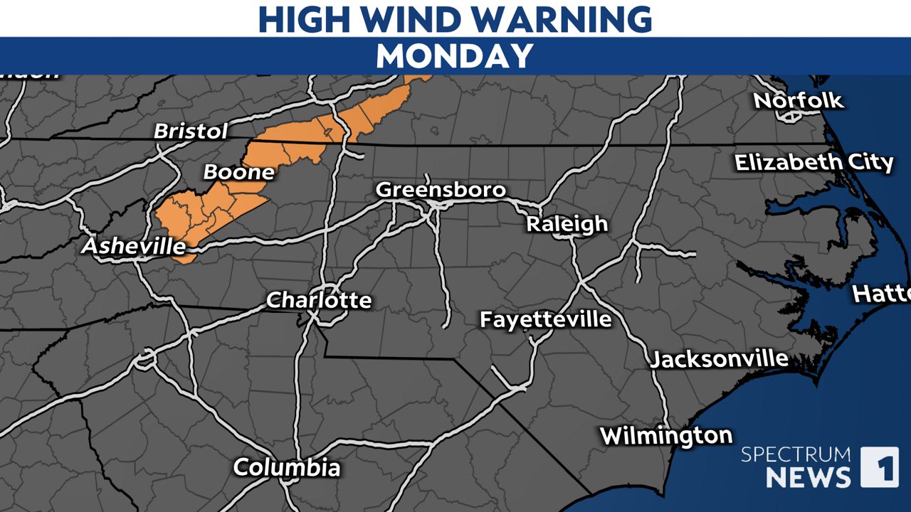
Even though the rain has come to an end, windy conditions continue in much of the state Monday with gusts in many areas up to 30 mph. The gusts will be even stronger in western North Carolina where gusts up to 50 or 60 mph are forecast through the afternoon in the mountains.
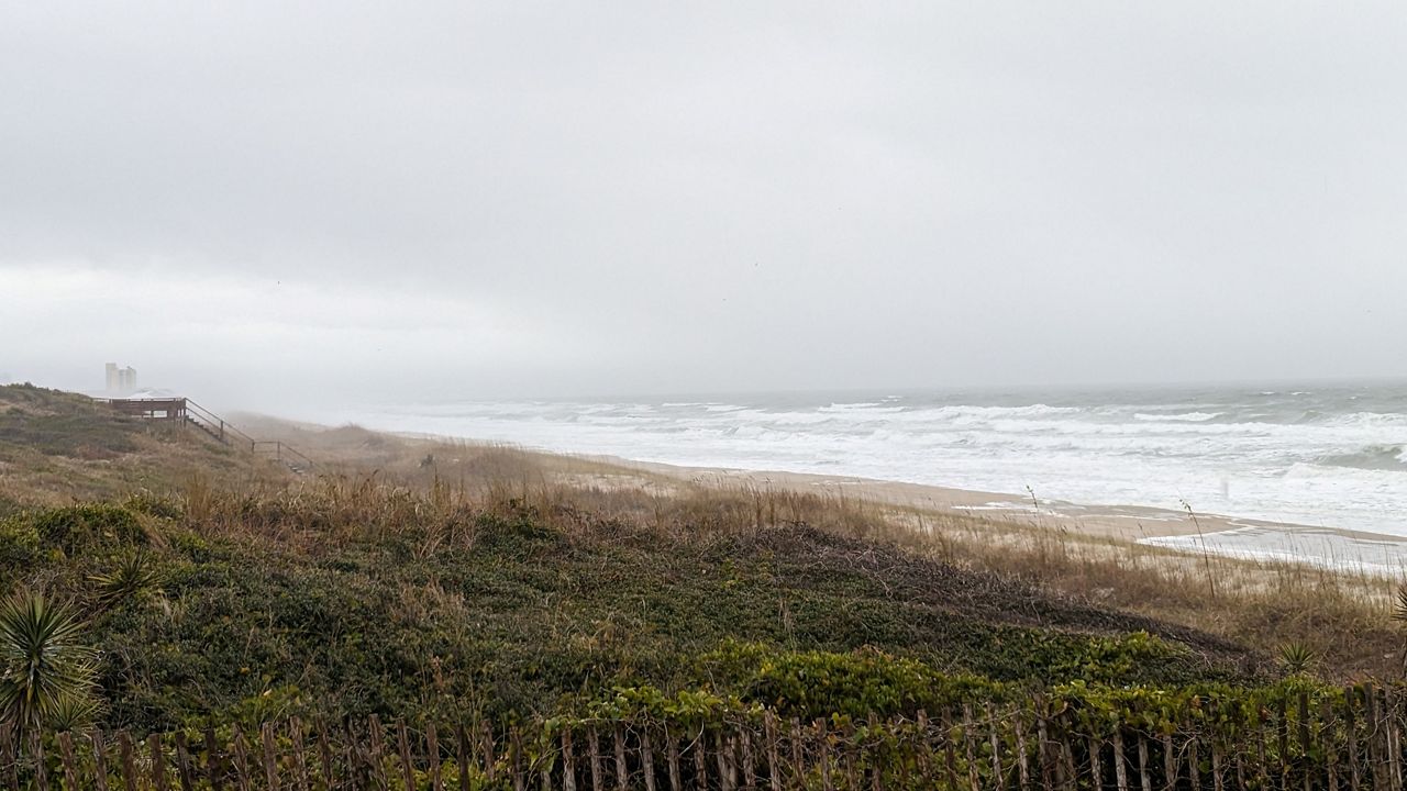
Along the coast, coastal flooding remains a concern, especially for the Outer Banks.
Sections of N.C. Highway 12 near Hatteras Village have been impassable since early Monday morning due to the flooding.
Most ferry services along the coast remain suspended due to the windy conditions.
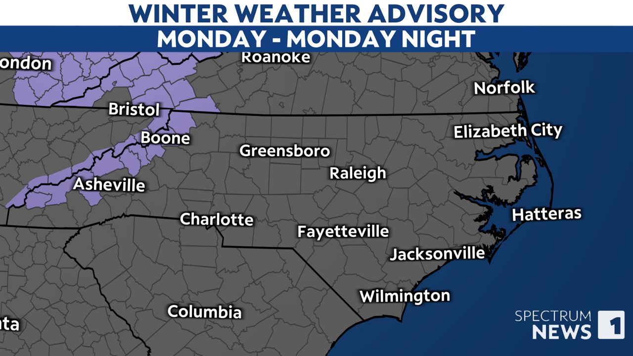
Colder air is set to arrive in the state tonight. As the cold arrives, snow showers are expected late today and tonight around the highest elevations of the mountains.
Our team of meteorologists dives deep into the science of weather and breaks down timely weather data and information. To view more weather and climate stories, check out our weather blogs section.