We're watching Tropical Storm Ophelia for strengthening as it drifts up the Southeast coast.
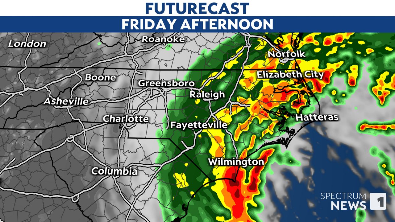
Low pressure is moving north, off the coast of Florida and Georgia and has developed into Tropical Storm Ophelia. As the storm moves north, rain should spread farther over coastal and central North Carolina on Friday afternoon.

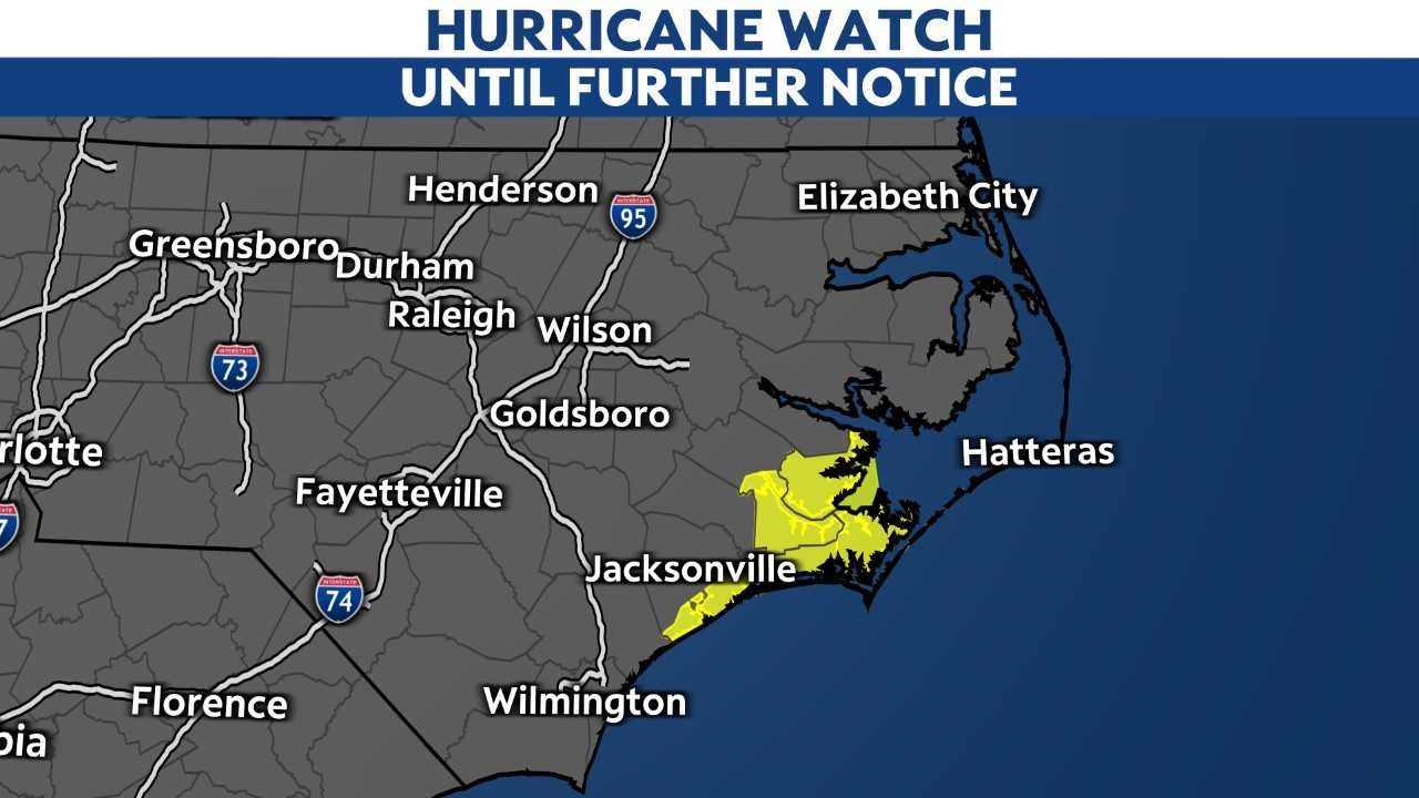
A Hurricane Watch is in effect for the coast of North Carolina from north of Surf City to Ocracoke Inlet.
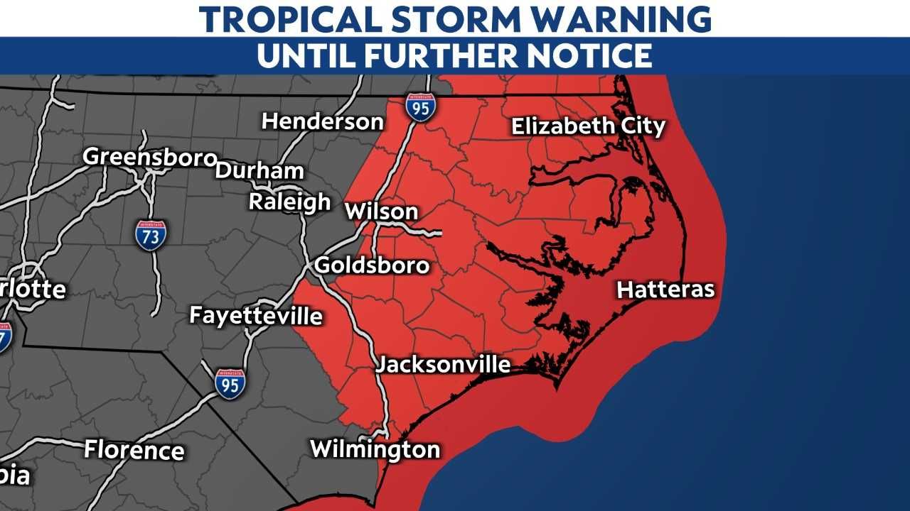
Tropical Storm Warnings are in effect along and near the coast.
The rain will likely reach the Raleigh and Triangle area by the afternoon. Some areas near Charlotte and Greensboro may eventually see some of the rain as well.
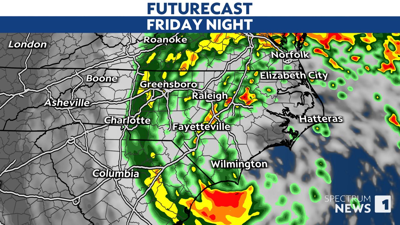
Off-and-on rain is likely through Saturday morning.
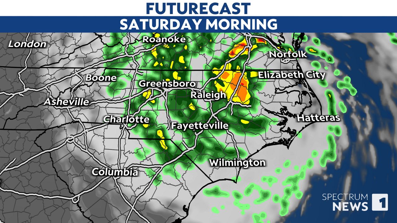
Most of the rain should come to an end by late Saturday afternoon or evening.
Some parts of western North Carolina will see very little rain, if any, for the start of the weekend.
Locations between Interstate 95 and the coast will be the wettest, with at least 1 to 4 inches of rain. Some spots in Carteret and Dare counties could see up to 4 or 5 inches.
Along with the rain, it will also be breezy on Friday and Saturday. Wind gusts up to 40 mph will be possible near the coast. In central North Carolina, gusts up to 35 mph will be possible.
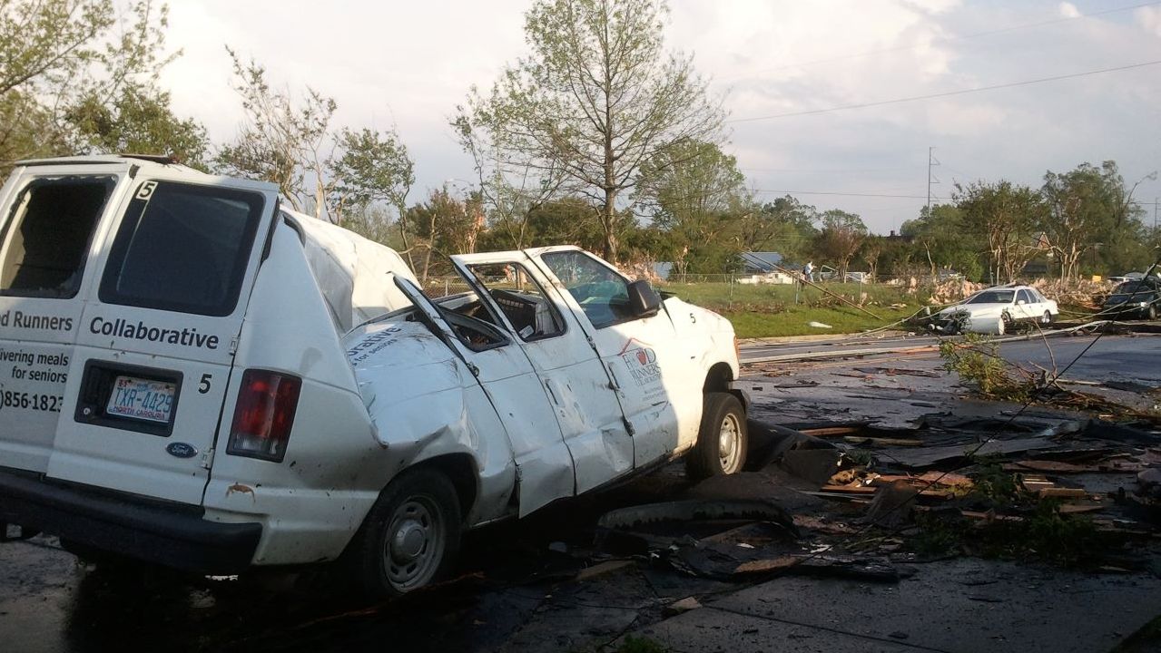
Eastern North Carolina may have a few tornadoes with this storm as it nears the coast between sunset Friday and the middle of the day Saturday.
In the outlook released by the Storm Prediction Center, parts of North Carolina east of I-95 are the main area we're watching for tornado potential.
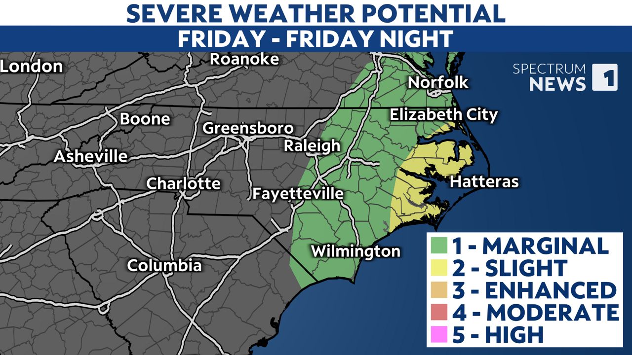
There is a marginal to slight risk for tornadoes in those places, which equates to a level one to two out of five.
Tropical tornadoes are typically brief but are notoriously difficult to visualize on Doppler radar. Lead time in warnings for tornadoes may be shorter than usual, so be prepared and have a plan in place before a warning is issued.
Dangerous storm surge will also be possible with this storm.
Potential inundation is expected to range from 1 to 4 feet from Wilmington through the Outer Banks.
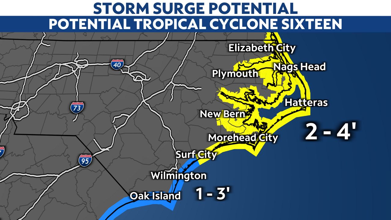
The greatest storm surge potential exists north of Surf City.
A Storm Surge Warning extends from Duck, N.C., up to Virginia. That includes the Neuse and Pamlico rivers and parts of Pamlico and Albemarle sounds.
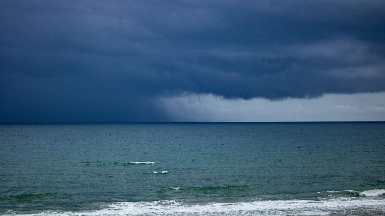
The coastal low is already generating rough surf along the coast.
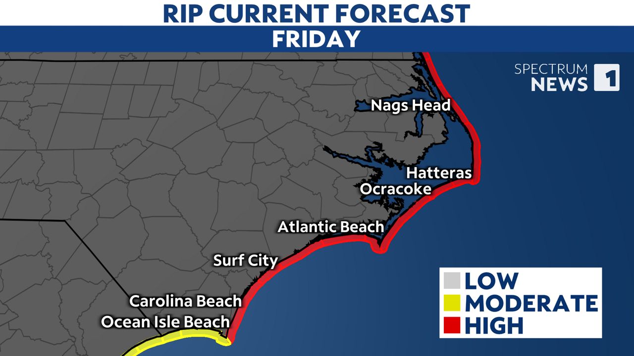
The threat for rip currents will continue into the weekend.
Beachgoers should stay out of the water, as rip currents are powerful channels of water than can pull even experienced swimmers away from shore.
Our team of meteorologists dives deep into the science of weather and breaks down timely weather data and information. To view more weather and climate stories, check out our weather blogs section.