


A cold front will push eastward across our area today. After a few spot showers this morning, we’ll see a lull through late morning. With some sunshine breaking out, temperatures will climb close to 80 degrees.
The front will cross the region this afternoon. Storms could break out ahead and along the front, but are not expected to be widespread.
However, if a storm develops, it could become strong to severe with gusty winds, hail and even a tornado. Even with a lower threat today, it’s a good idea to have a plan in place and have your notifications enabled. The higher likelihood for storms will be east of the Mississippi River, metro east locations.
Any wet weather will diminish by early evening, and skies will begin to clear this evening. Under clear to partly cloudy skies, temperatures will drop into the mid-50s.
We dry out midweek but cool way down. Highs on Wednesday will only manage the upper 60s to near 70 degrees as sunshine returns. Thursday will see temperatures only reach the low to mid-60s.
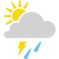 |
Sun and clouds, afternoon storms High: Near 80; Winds: Becoming West at 10 to 15 mph, gusts to 20mph Low: Mid-50s; Winds: West at 10 to 15 mph, gusts to 25mph
Hour-by-hour forecast | Share your weather photos | Turn on weather notifications | Radar |