WILMINGTON, N.C. -- Rain will be widespread Monday across the state.
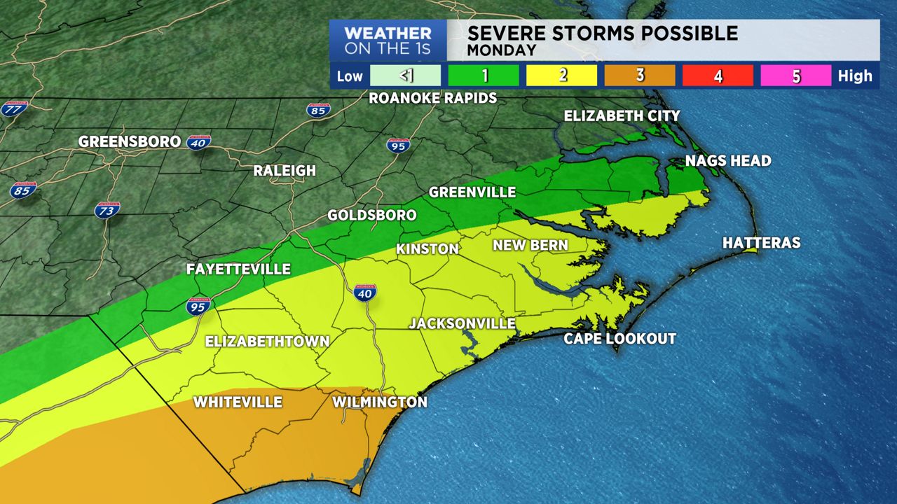
Thunderstorms will be embedded within the rain shield and it's possible a few of those storms will be strong to severe. The Storm Prediction Center decreased the coverage of the slight (level 2) risk for severe storms today.
Elizabeth City and much of extreme northeastern counties are not included in the risk area. From New Bern to Fayetteville and points south, a slight risk for severe storms is in place. Wilmington has a slightly higher, enhanced (level 3) risk.
Timing on the more impactful cluster of storms has been moved up. Beginning early this morning storms will move in from the Sandhills and South Carolina and move northeast across the Coastal Plains and eventually the Outer Banks.
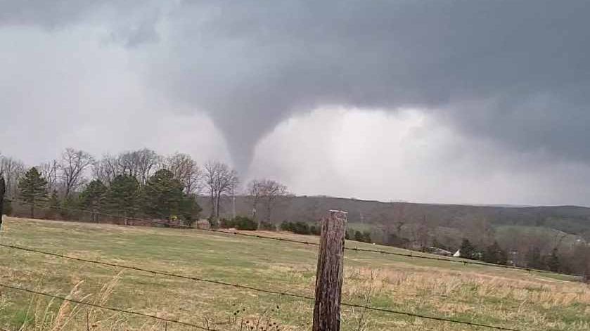
The greatest threat for severe storms exists across coastal areas, where scattered thunderstorms could bring damaging wind gusts, hail and isolated tornadoes.
- Interactive Radar
- 7-Day Forecast
- Connect with Meteorologist Vernon Turner on Facebook
- Follow Meteorologist Vernon Turner on Twitter
Due to the threat of damaging wind gusts and tornadoes, there could be a few power outages due to storm damage. This would be a good time to make sure any needed electronics are fully charged before you potentially lose power. Make sure you have a reliable way to receive weather updates when the power goes out. A NOAA Weather Radio and the Spectrum News App are great resources. The Spectrum News App is free for Android and Apple devices.
After our morning and midday storms, winds will still be breezy. Expect strong sustained winds through the day. These winds could blow around any light/unsecured items you may have outside of your home Monday afternoon.
)