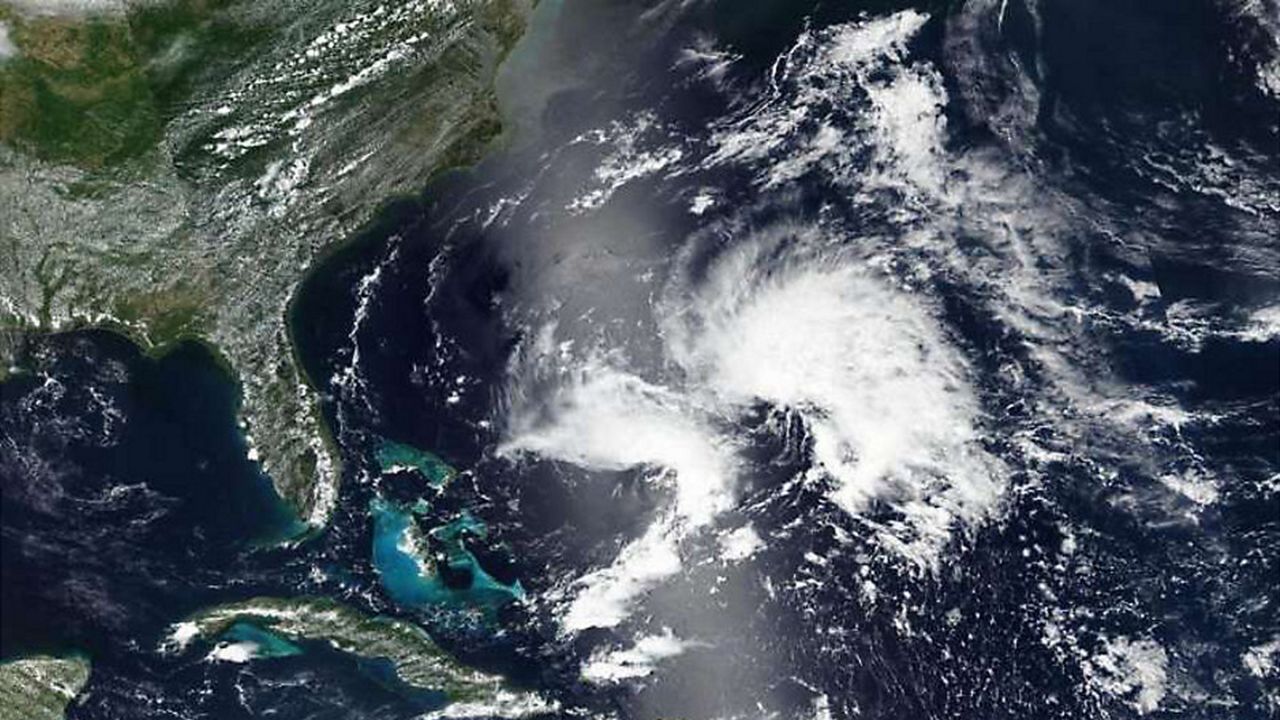
On Monday, May 20, Subtropical Storm Andrea became the first named storm of the 2019 Atlantic hurricane season. But why the prefix “sub” in front of the name? Well, there is, indeed, a difference between a subtropical and a tropical storm. And it all starts with how these storms were formed.
A truly tropical storm needs ocean waters to be at least 80°. The warm water provides the “fuel” for the storm to form. As the warm, moist air over the ocean rises then condenses to form clouds, it creates an area of low pressure near the surface . Once that occurs, air in an area of higher air pressure tries to fill into the low pressure center, warms up, then rises as well. This cyclical rising and condensing process over the warm water continues and the system of clouds and winds begins to spin faster in a counter-clockwise fashion, eventually creating an “eye” at the center of the storm. This creates for a compact, symmetrical area of rain, storms, clouds and very strong winds all wrapped around a tight center.
While still forming in the tropics, subtropical storms, on the other hand, need help from cooler, drier air in the upper levels of the atmosphere to form. Because of this, they can form over cooler waters, allowing them to develop earlier than the normal dates for hurricane season — just as Alberto did. Differences in temperature and dew point on either side of the storm along with changes in the winds aloft (called wind shear) aid in the development, which leads to a more ragged, asymmetrical system that tends to cover a broader area compared to its tropical storm counterpart, with it’s strongest winds located well on the outside of the center of the storm.