A strong cold front will cross North Carolina today. This weather system will bring the threat of strong-to-severe storms. Damaging wind is expected to be the main severe weather threat with this front.
A Tornado Watch has been issued for counties in northern parts of the state until 7 p.m. where tornadoes will be most likely to form if they form at all today.
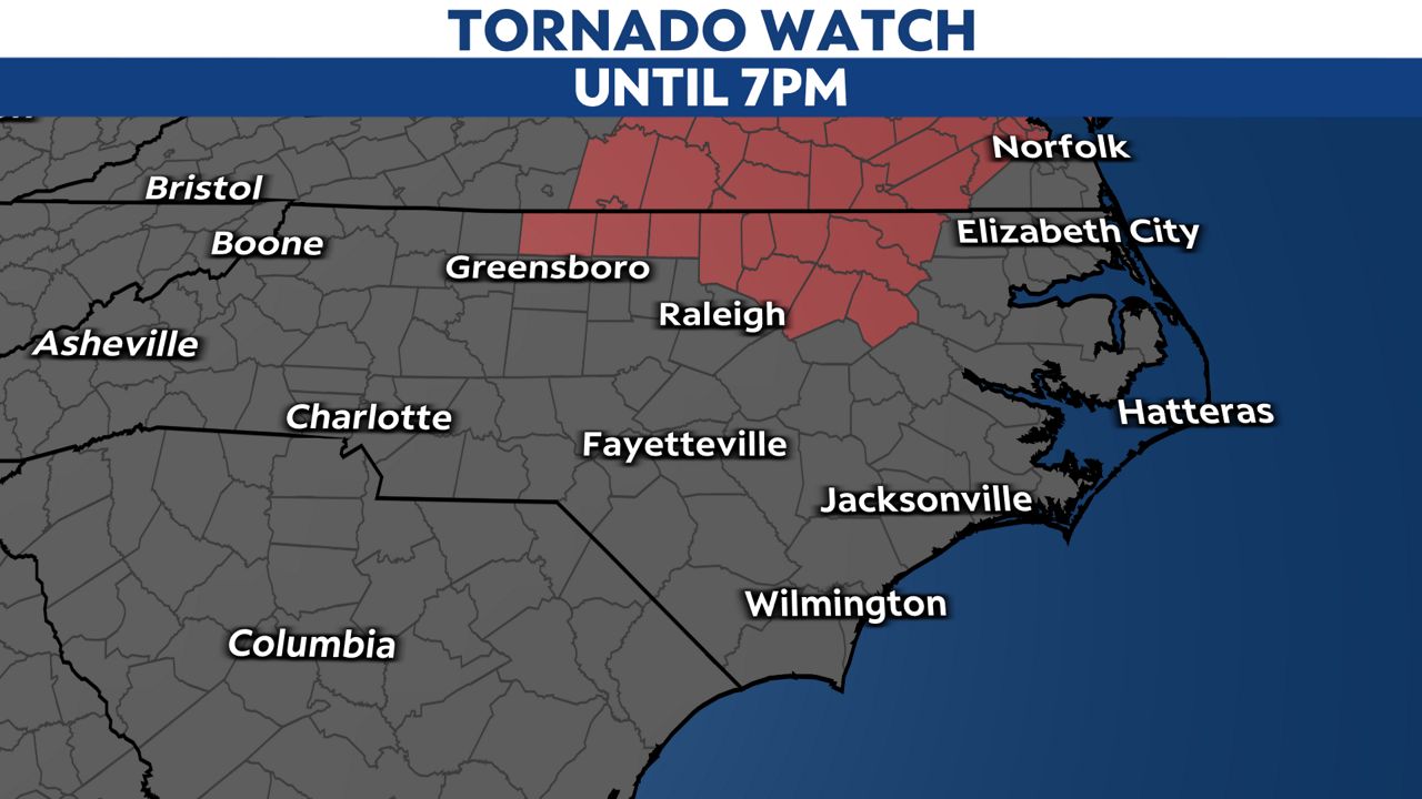
These counties include Caswell, Edgecombe, Franklin, Granville, Halifax, Nash, Northampton, Person, Rockingham, Vance and Warren counties.
A Tornado Watch means that conditions are favorable for a tornado to form, but it's a warning that alerts you to a tornado being imminent or occurring already. Have a way to receive tornado or severe thunderstorm warnings today should they be issued!
As the system moves east, parts of central and eastern North Carolina will have showers and storms during the rest of the morning hours.
With the fast pace of the front, we should see clearing from west to east through the day with the last of the precipitation clearing the coast late this afternoon or early this evening.
The Storm Prediction Center has been monitoring this system for the past few days. Much of the eastern half of the state is under a marginal (level one) to slight (level two) risk for severe weather.
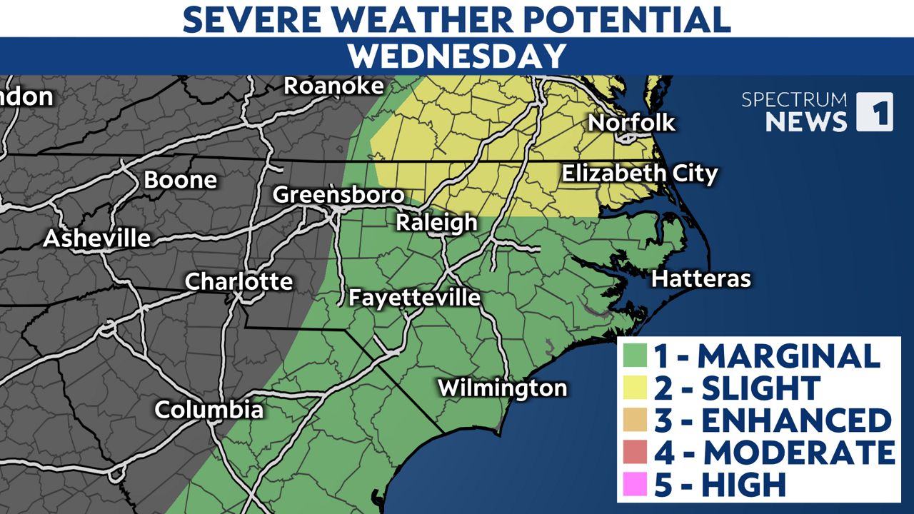
The main severe threat with this cold front will be the possibility of storms with strong, damaging winds. There is a lesser threat for hail. At this time, the chance for isolated tornadoes is low, and the chance for flooding is even lower. Storms may also trigger a good deal of cloud-to-ground lightning.
.gif)
Stay weather aware throughout the day Wednesday and watch Spectrum News 1 and Weather On The Ones for severe weather updates and your complete forecast.