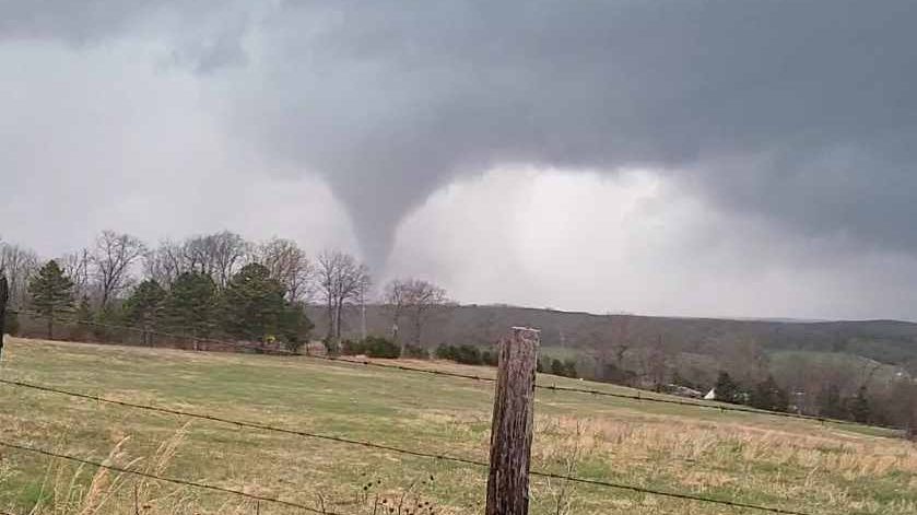
North Carolina had a stormy start to the week with powerful storms from the mountains to the coast on Monday.
Rain and storms are moving across the state today, but it's not exactly like Monday.
Much of central and eastern North Carolina has a slight, or level 2 of 5, risk for a severe storm.
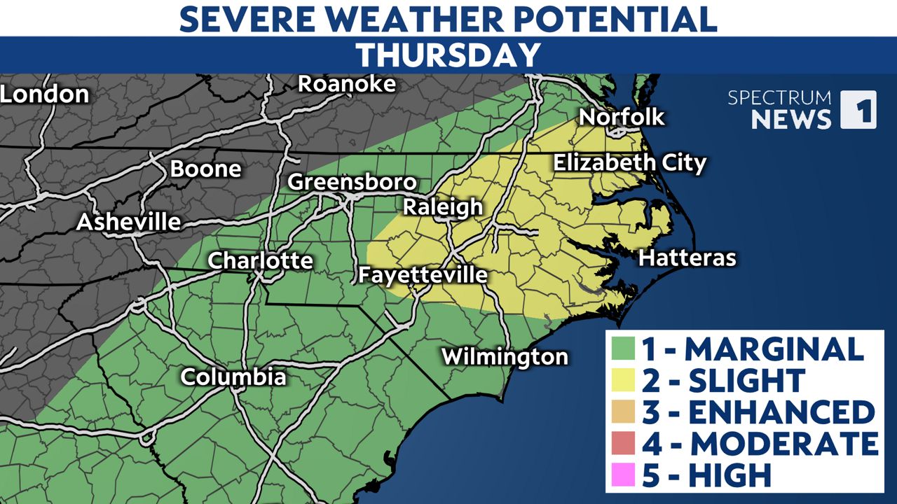
Much of the state was under a level 3 risk on Monday, and parts of the mountains were even under a level 4 risk.
While Thursday will not be exactly like Monday, the main threat from the storms will still be damaging straight-line winds in excess of 60 mph. That could lead to downed trees and power outages in some areas. There's also a low risk for a brief tornado.
Any of the storms could also produce downpours and frequent lightning. Hail up to the size of quarters is possible with a few of the storms.
The first round of storms has been moving across the mountains and Piedmont this morning. It will move into the Coastal Plain through midday.
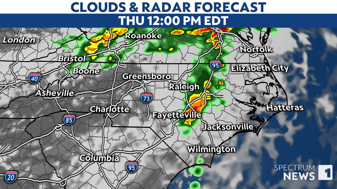
Some locations will quickly break out in sunshine just after the first round of storms passes.
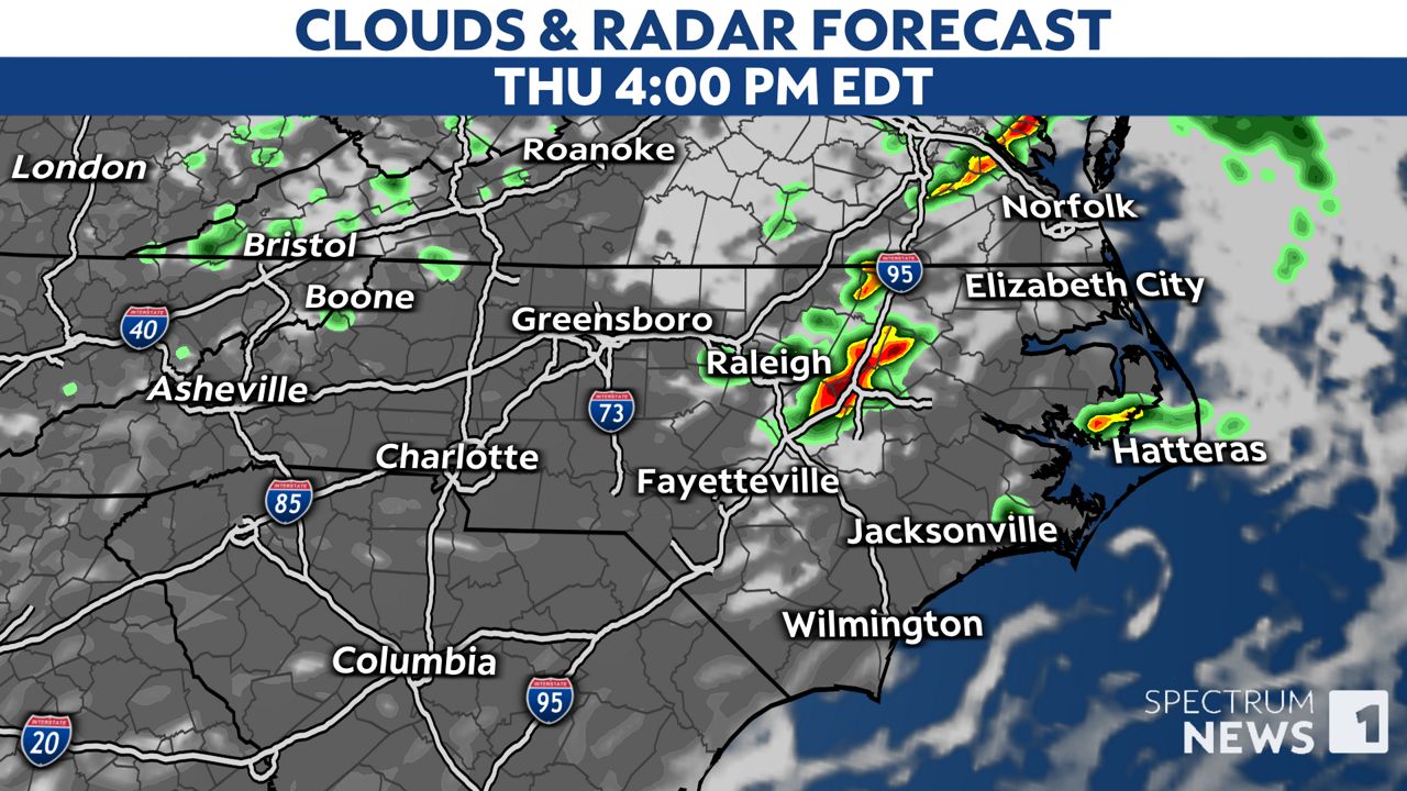
That should fuel a few more scattered storms in central and eastern North Carolina after 2 or 3 p.m. through just before sunset. Those storms are expected to be stronger and may bring the greatest threat for severe weather today.
For now, make sure you have a way to receive weather alerts. If a warning is issued for your location, be ready to seek shelter in an interior room on the lowest floor of a sturdy building. Basements, hallways, closets and windowless bathrooms usually provide the best protection during severe storms.
Stay tuned to Weather on the 1s on Spectrum News 1 and the Spectrum News app for updates.
Our team of meteorologists dives deep into the science of weather and breaks down timely weather data and information. To view more weather and climate stories, check out our weather blogs section.


)
