Stay weather aware this afternoon and evening. A line of severe storms will likely move across North Carolina.
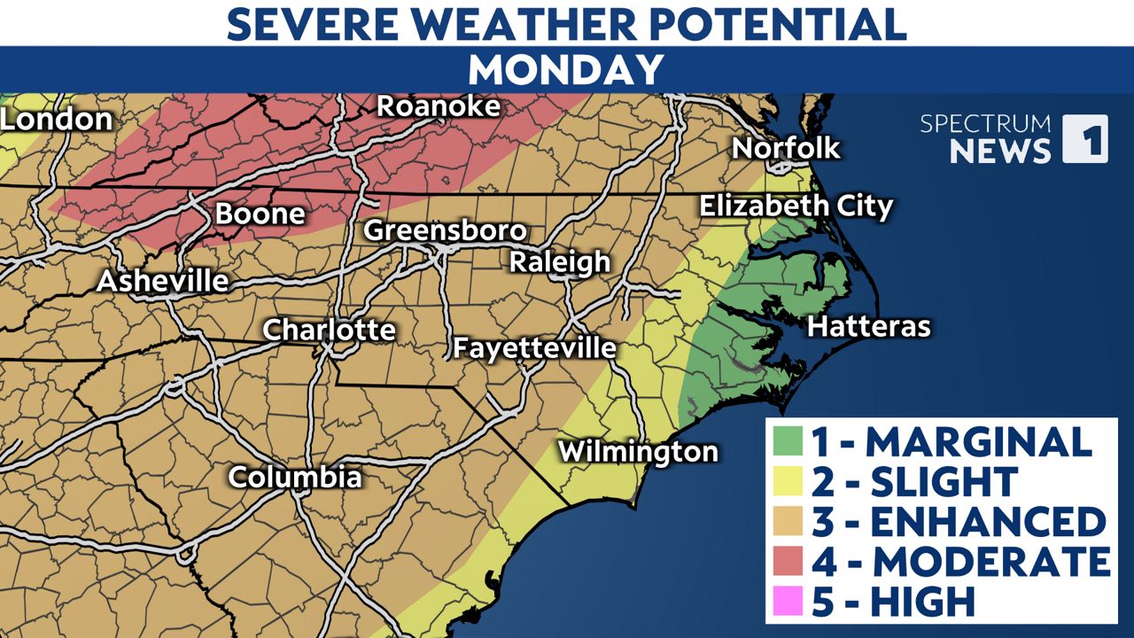
Some sections of the northern mountains are now under a rare level 4 risk for severe weather. Much of the rest of the state has an enhanced, or level 3, threat for severe storms. The risk is a bit lower closer to the coast.
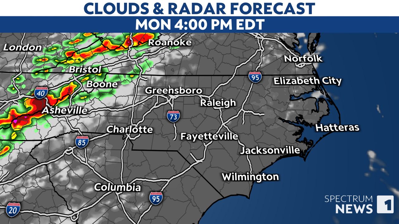
Fueled by very hot and humid conditions, a line of storms is expected to develop across the mountains and foothills of western North Carolina around mid-afternoon.
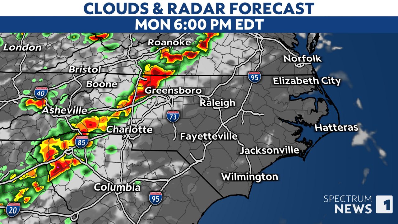
The line of storms will then quickly race to the east.
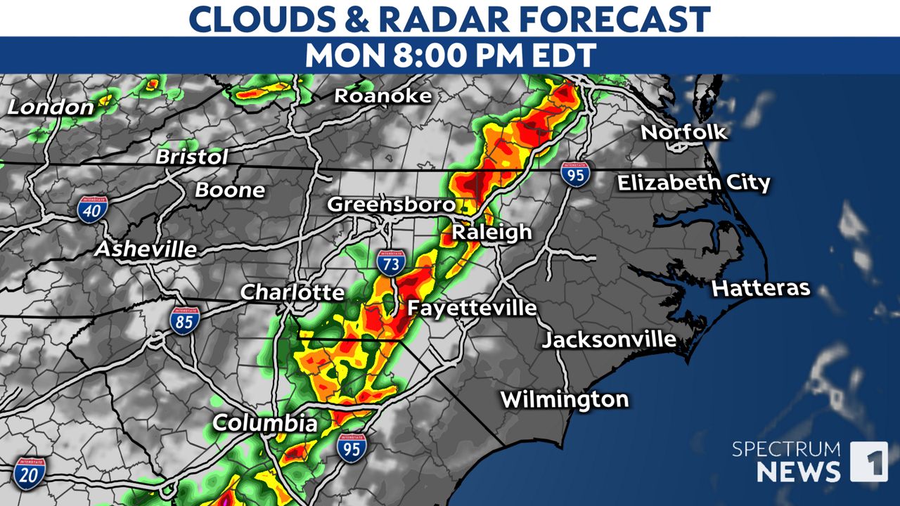
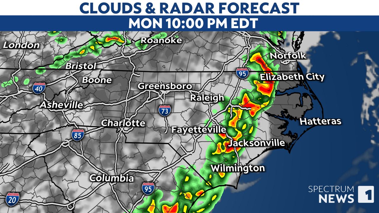
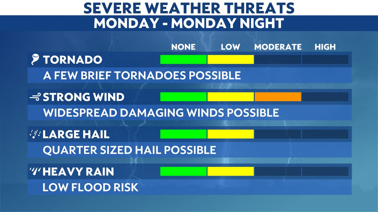
Damaging straight-line winds in excess of 60 mph will be the greatest threat from these storms. However, we'll also have to watch out for hail and the low risk of a tornado.
Make sure you have a way to receive weather alerts today and stay tuned to Weather on the 1s on Spectrum News 1 and the Spectrum News app for updates.
Our team of meteorologists dives deep into the science of weather and breaks down timely weather data and information. To view more weather and climate stories, check out our weather blogs section.


